After our pottery mudslide and olive press visit, we made our way to Demnate, where we wanted to explore the Mellah, the historical Jewish section of the town.
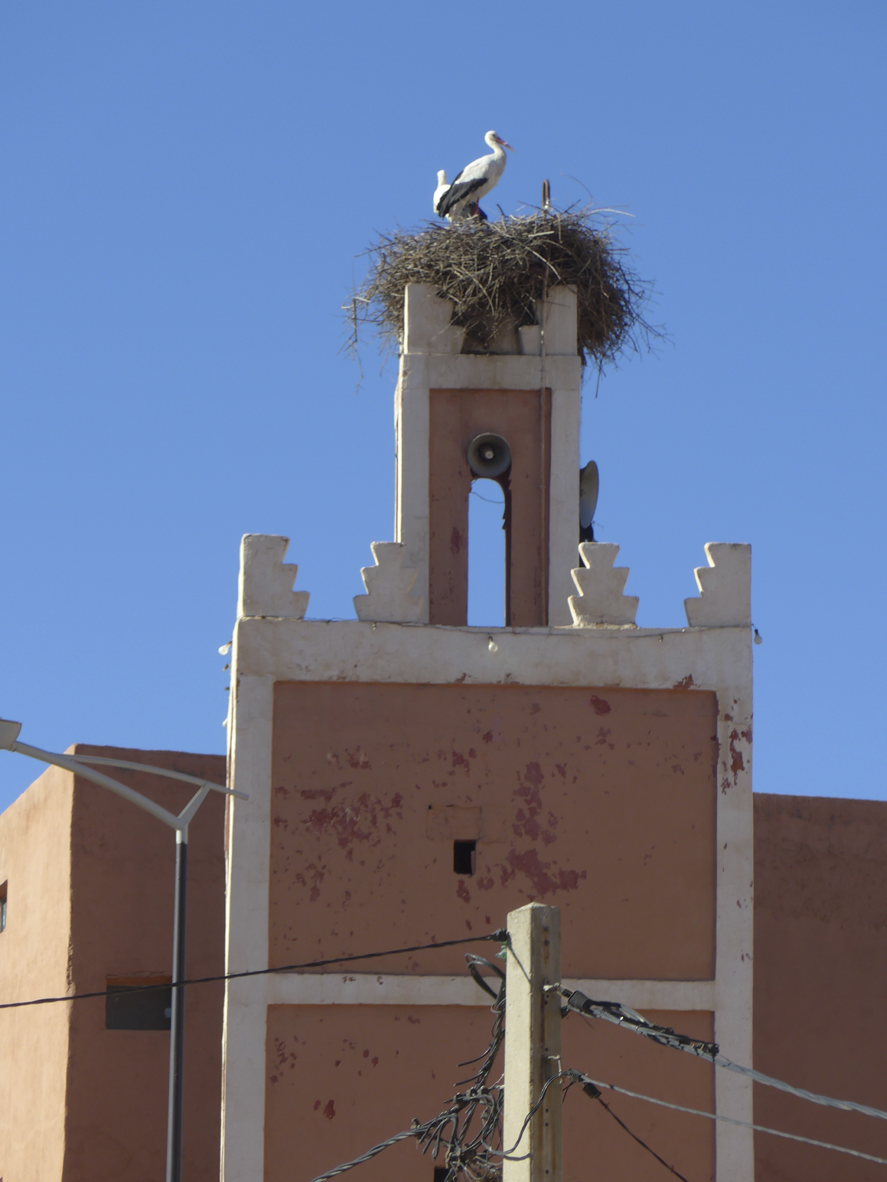
Storks on top of the minaret at the central mosque in Demnate
The first Mellah to be established was in Fez, when a Marinid sultan persuaded the Jews living scattered through the old medina to move close to the royal palace. (Many a Moroccan sultan saw himself as a protector of the Jews, those handy artisans and financiers.) The word Mellah evidently came from the word for salt, milha: the Mellah was the place of salt, the place where salt-traders gathered, the place where the salt-trade was financed and organized and run.
Demnate historically had a large Jewish population; we had hoped to take a tour of the Mellah with a guide specializing in this history, but he was in Agadir for the few days of our visit. We stopped by the veteran’s center, on the edge of the Mellah, to see if anyone there would talk to us a little about history, but everyone was deep into a game of backgammon or cards, so we wandered off on our own, dropping into a courtyard near the entrance.
This was something like a tailor’s souq, with many small shops braiding djellaba trim and sewing it onto djellabas.
One older man here knew a little about the Jewish community. There was only one well-known Jew remaining–a cantor. (Nancy was delighted to recognize the Arabic word by its resemblance to Hebrew.) Everyone else had left for Israel, as Jews across Morocco had emigrated en masse within a brief span of time.
While James and Nancy chatted with the men surrounding this djellaba shop, Jeremy was making friends. One man in the center of the courtyard let him run the braiding machine for a moment–
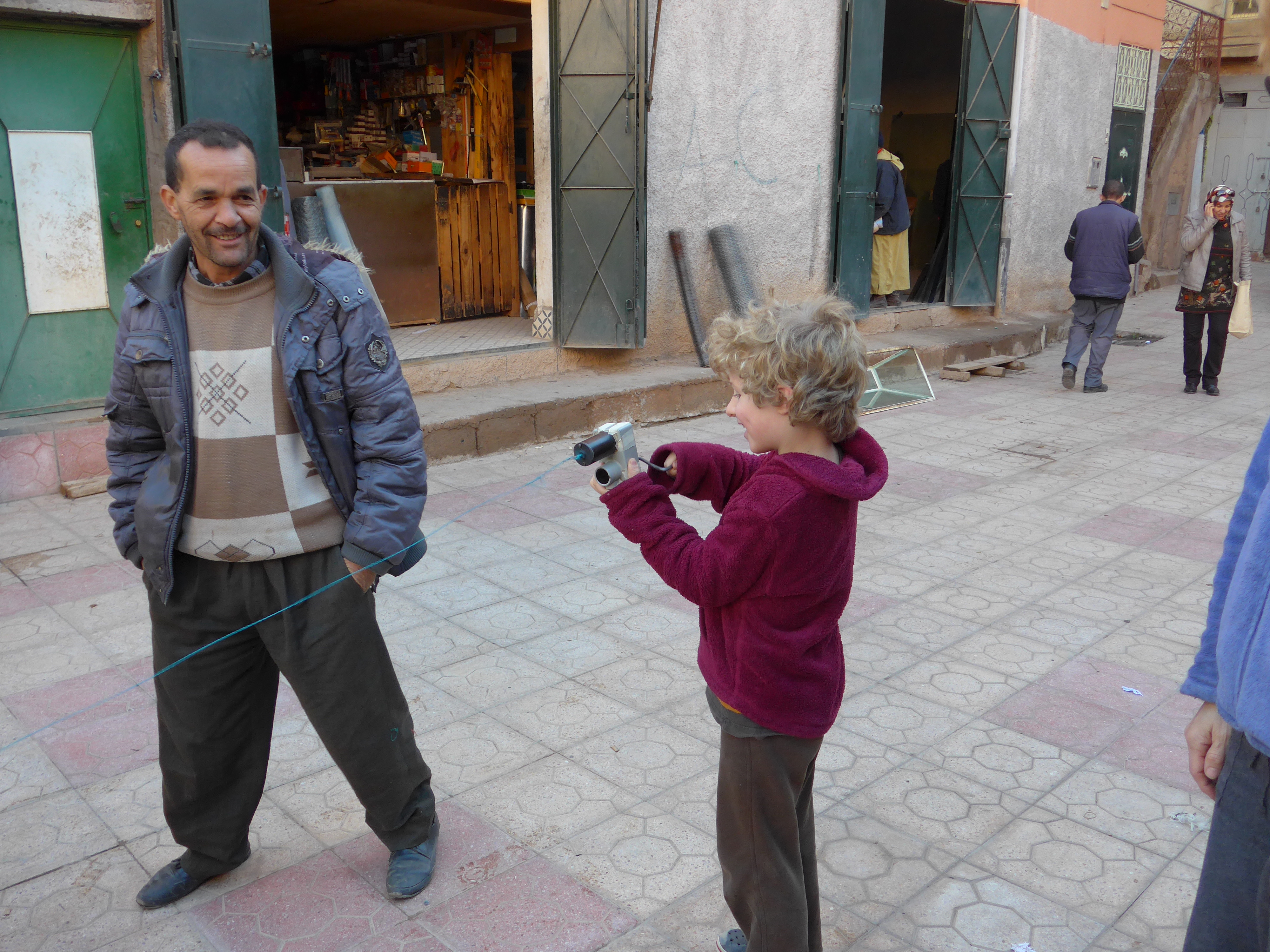
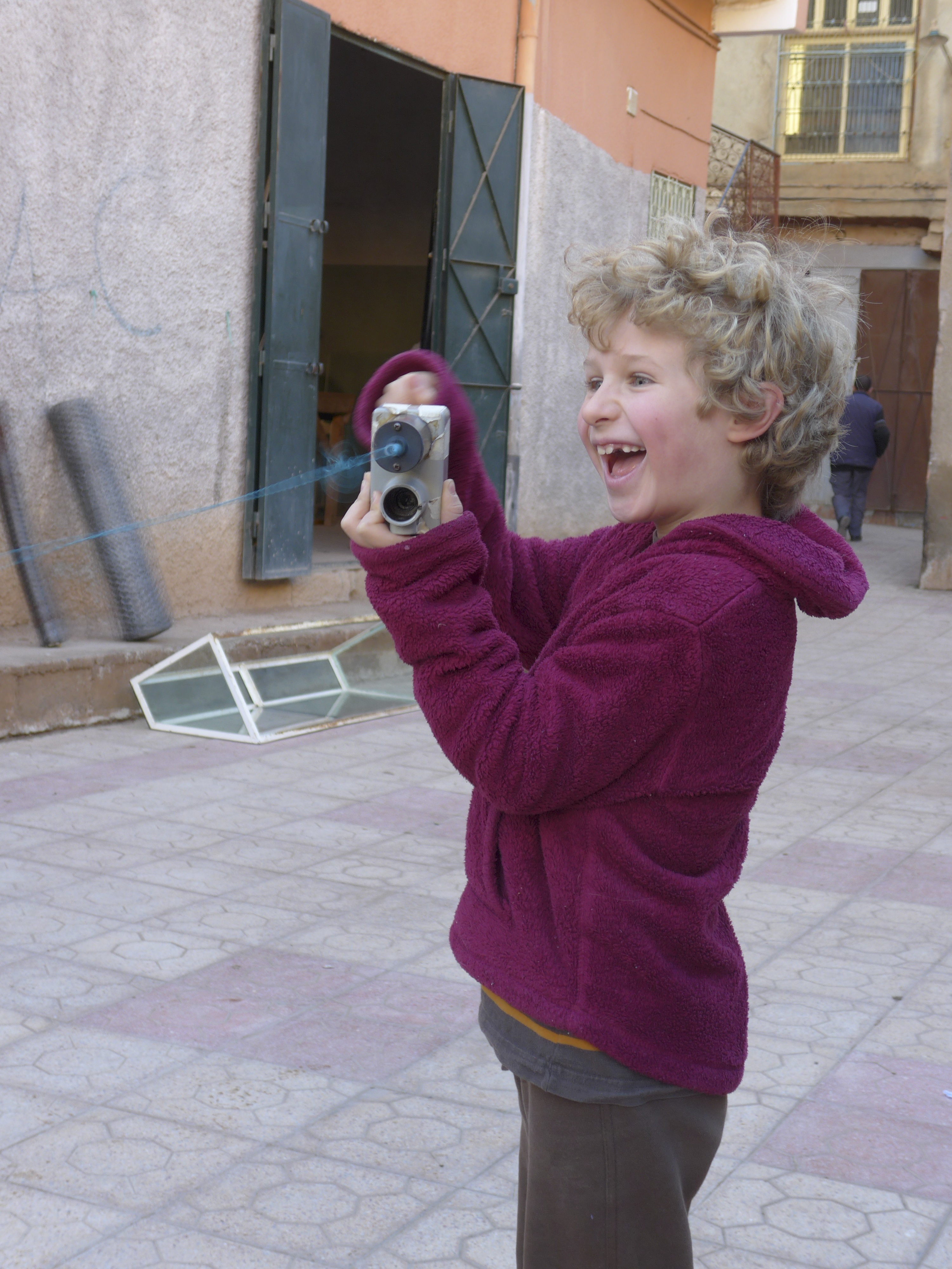
–he didn’t even mind when Jeremy ran it backward by accident. Another man hunted around in his shop for a present for our boy, finally emerging with an onion!
After a wander around the town, ducking in and out of bright sun, and dodging through dark and chilly corridors, we headed out of town again, looking for the Imni n’Ifri cave or bridge or geological formation. We didn’t really know what we were looking for, but the guidebook said it was worth a stop.
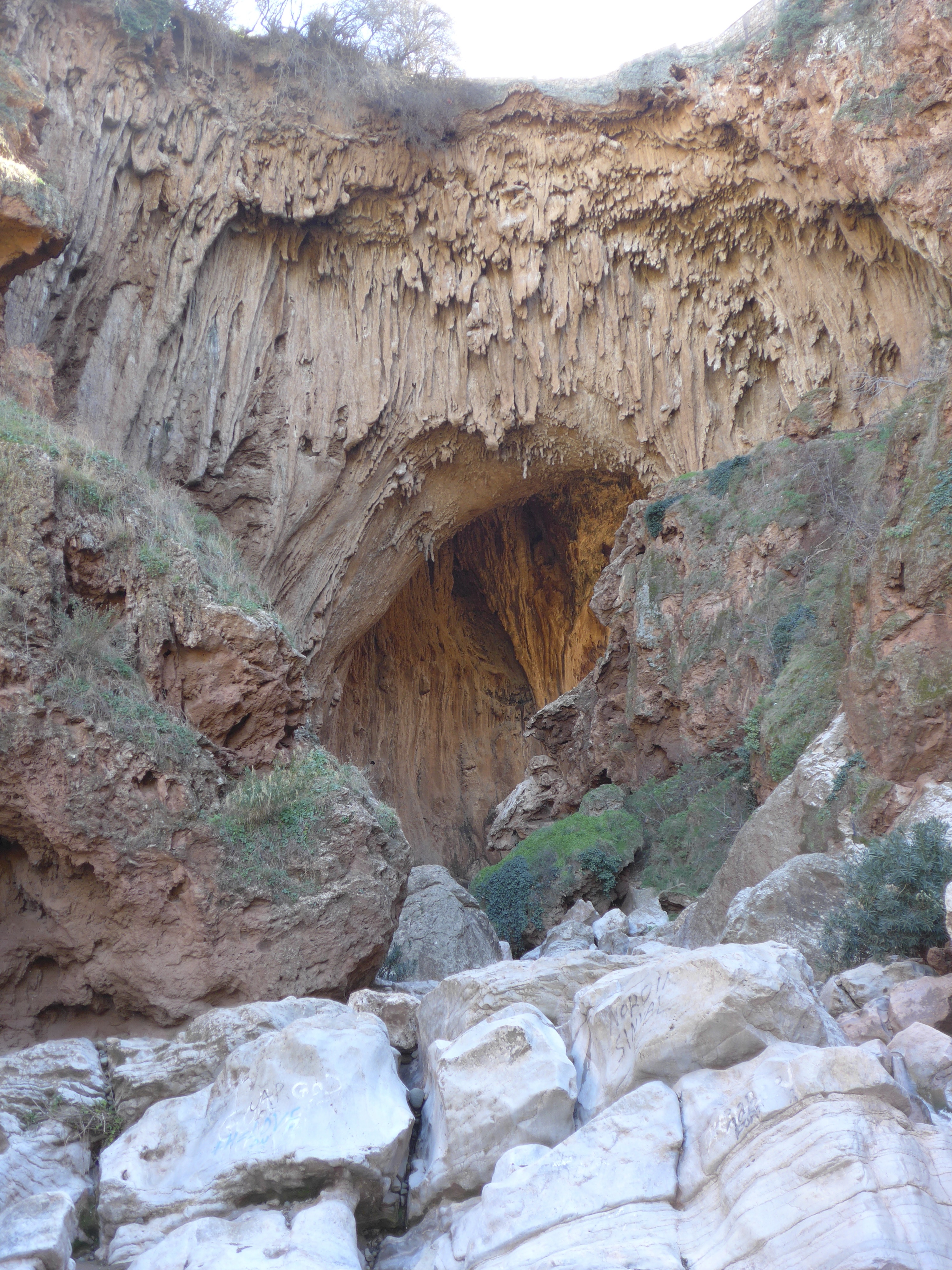
In the end, it was both a cave and a bridge, with an interesting geological formation taking shape under the natural bridge. Guides wanted to be paid to lead us through, so (as at the Cascades), they showed us the least appealing, apparently most difficult approach first. We declined their help, thinking we might just walk down the easy steps on the other side, and look at the passage from the bottom. One of the guides followed us down and again offered his help. “We’d rather do it ourselves, thank you.”
In fact, James and I were the ones who really wanted to keep going, so Nancy volunteered to stay behind with the children. At which point, Zoe, with a maturity beyond her years, noted that while she didn’t want to go, she would be mad at herself later for missing something interesting. Of course then Jeremy was unwilling to be left behind. So we all girded our metaphoric loins–prepared for wet feet–and kept going.
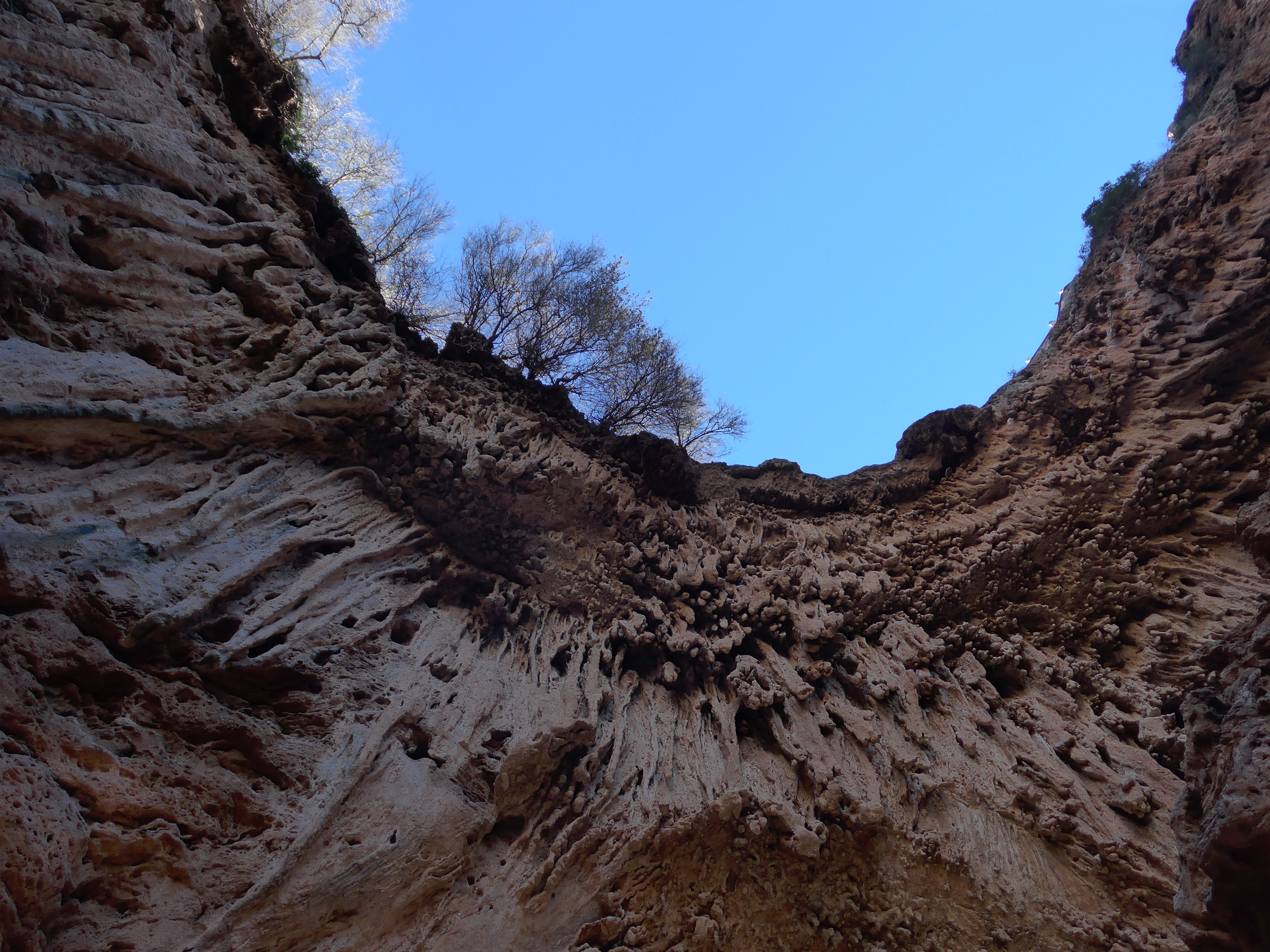 We were so glad we did! The “map of Africa” is the formation’s claim to fame,
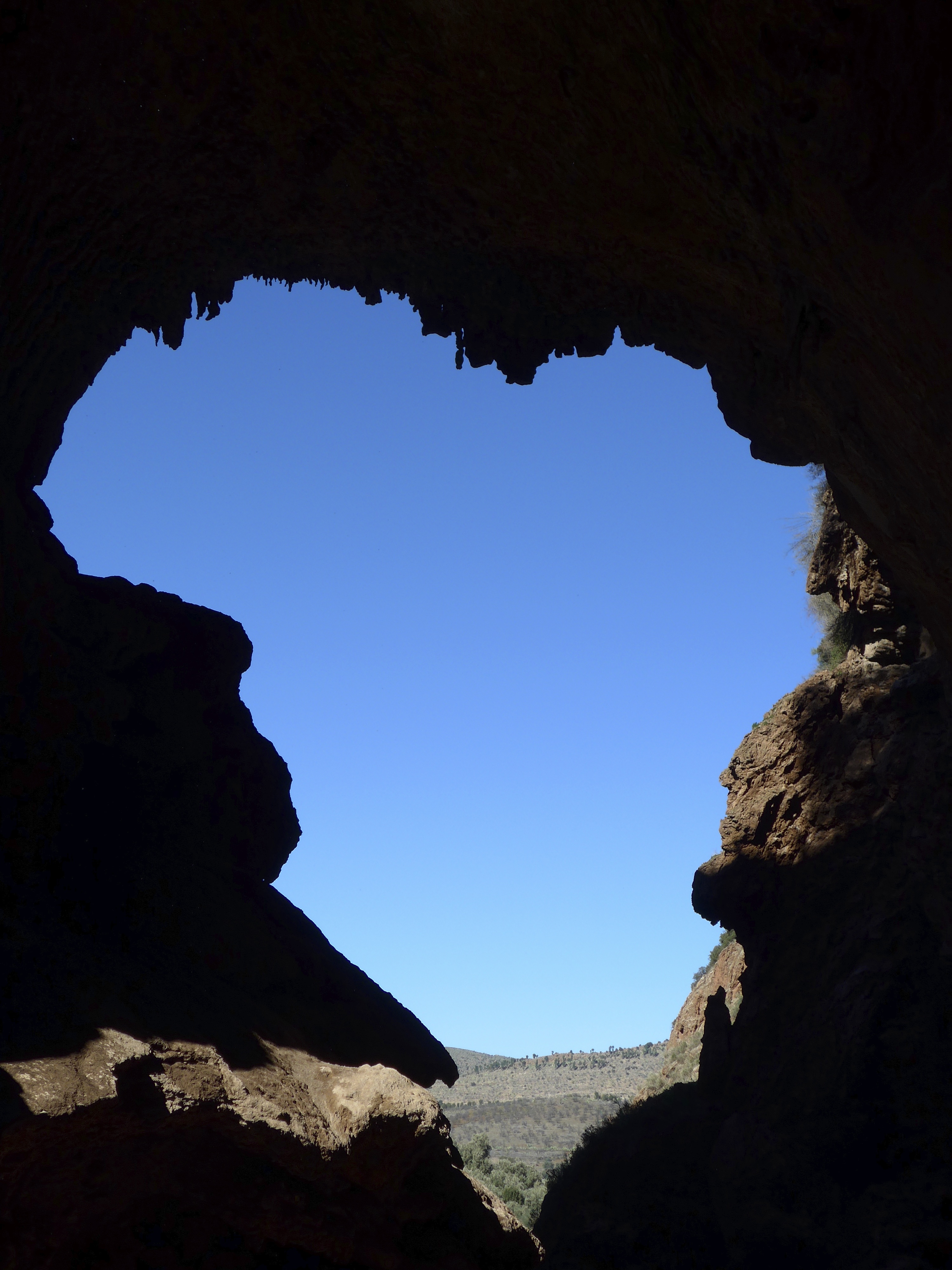
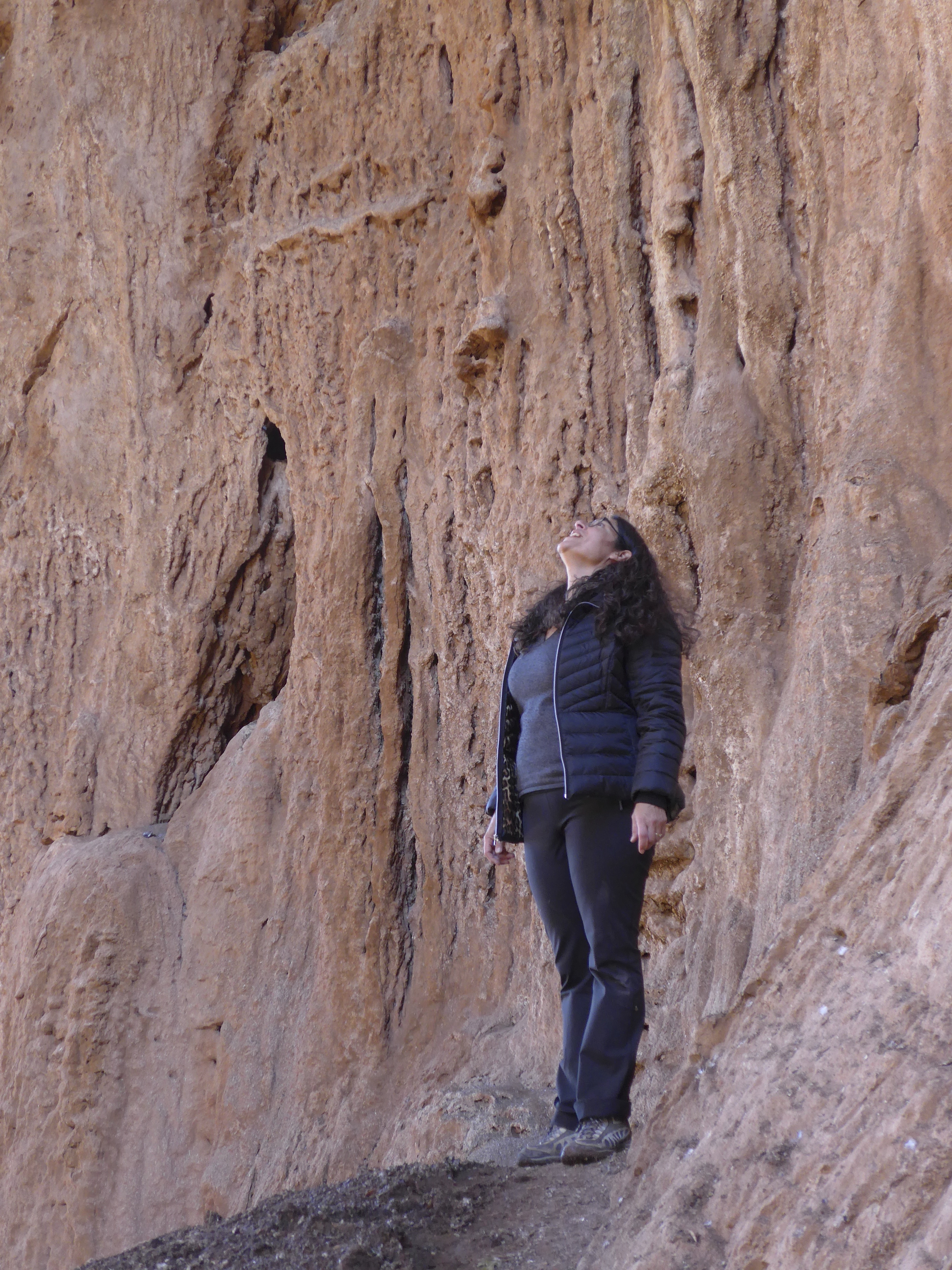
but we were most taken with the structure of the walls,
the water misting down in a beading curtain, capturing the light.

It was a magical space–these photos don’t really do it justice.