Driving south from Ifrane, through Azrou and Midelt, you see a lot of barren landscape.
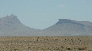
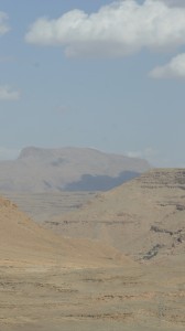
The first time I made this drive (on the way to Ouarzazate), I gasped when I saw the blue waters of the Hassan Addakhil dam. It felt as if those waters were easing an intense visual or mental thirst:
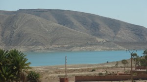
But even in a sideways glance (or in a small photo), you can see the high-water mark on the hillside, defining the drastic loss of water to evaporation. (Note the small buildings in the foreground, constructed by the US Army Corps of Engineers, who helped build the dam in 1971.)
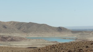
And as you come closer to the dam, certain angles of vision let you see how little water it actually holds:
Let’s remember that in southern Morocco, irrigation is everything:
In the Sahara the oasis–which is to say, the forest of date palms–is primarily a man-made affair and can continue its existence only if the work of irrigating its terrain is kept up unrelentingly…. It was never the practice or the intention of the sons of God to live there. They have a saying which goes, “No one lives in the Sahara if he is able to live elsewhere.” …. The oases, those magnificent palm groves, are the blood and bone of the desert: life in the Sahara would be unthinkable without them….
(Paul Bowles, Their Heads are Green and their Hands are Blue: Scenes from the Non-Christian World, 1957)
The most obvious forms of irrigation in the Tafilalt are the rivers, the canals, and the khettara. Archeological reconstruction, for instance, shows that the builders of Sijilmassa diverted the Oued Ziz into a channel that ran along the side of the city. [Lightfoot & Miller]
But traditional irrigation also relied upon periodic flooding, and on a series of low-lying, traditional dams across the Ziz, to divert waters when in flow. Here’s a photo of Rasif dam, one of these traditional dams:
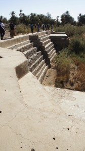
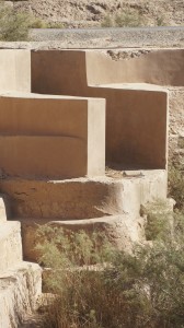
And here’s what that dam looks like from the air:
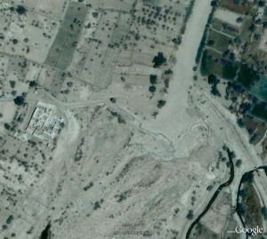
Eric Ross notes of this satellite image (on his blog): “The masonry structure zigzags across the dry valley of the Ziz River. The dam’s reservoir (light grey area north of the masonry) is completely silted up. Occasionally, after heavy rains, water will still rush down the Ziz and flow over the dam.”
The Hassan Addakhil dam was built in 1971 after a catastrophic flood in 1965. The dam was designed both to stop such massive floods, and to hold water for farmers. It has been only partially successful. On the plus side, the dam moderated the severe flooding of 1989 (greater flow than the 1965 flood that prompted dam construction), and it provides clean drinking water throughout the Tafilalt, with water piped from the reservoir directly to community fountains outside each qsar.
(Blurry night photo of large blue buckets being filled at a community fountain and mounted on mules and donkeys.)
On the downside of the equation…
the dam stops most of the periodic floods that used to recharge the water table, so the water table is sinking dangerously low;
not all flooding is contained by the dam;
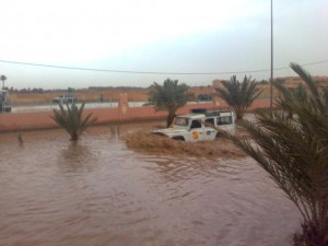 (photo Tachfine Baida, Eric Ross’s blog)
farmers complain that the cold water sent downstream with each timed dam release “burns” their plants;
fertilizer use and irrigation have both increased dramatically since the dam’s construction, with accompanying soil depletion;
cement irrigation channels increase evaporation dramatically over the khettara or traditional mud channels;
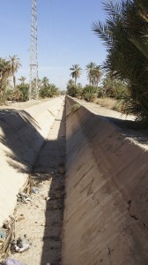
community fountains are placed outside the qsars, making it more laborious to gather water (and contributing to the local tendency to keep girls out of school). 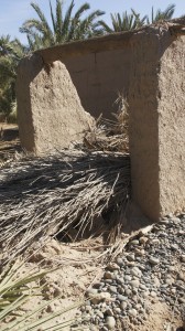
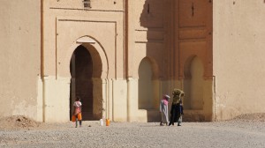
An old community well, now dried up and useless; girls and women preparing to carry water.
John Shoup reports that one of the engineers overseeing the dam told him the best thing to do with the dam would be to blow it up. Hsain Ilahiane suggests there may be political benefits to the dam’s introduction of “a bureaucratic structure of water management, a social welfare institution whose motives coincide with anchoring the state’s presence in a border area not far from a defiant Algeria.” (Dissertation, 1998)
Water is wealth; water is power.