Category Archives: History

Recent history or the distant past, from post-colonialism back to 8th century refugees from Iraq, or further…

Meknes and monuments: the (other) Bou Inania

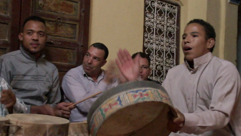
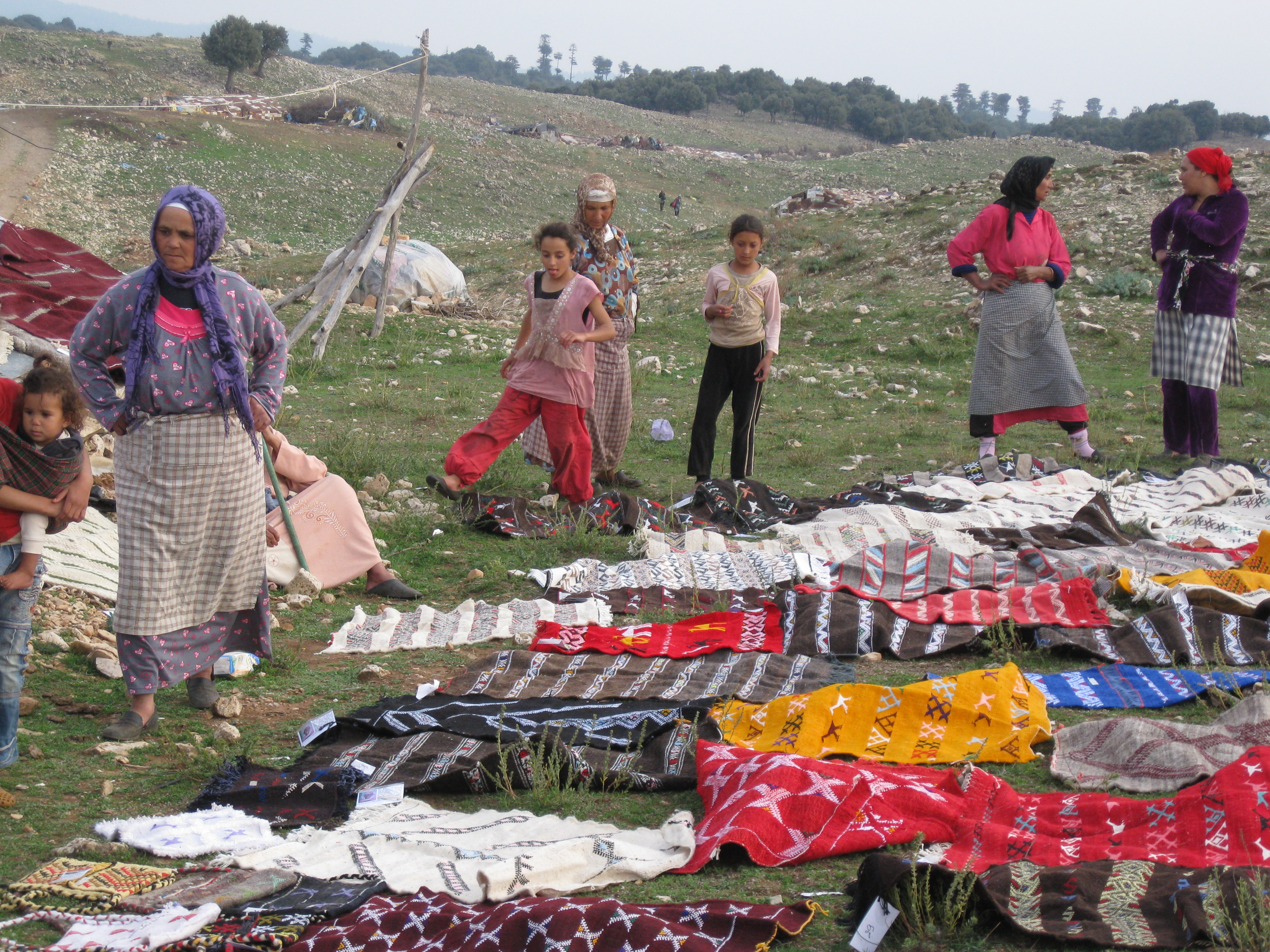
It feels as if we’ve only just returned from the Tafilalt, but John Shoup is taking a group of students to do field exercises in Meknes, and he’s agreed to let us tag along again: he’ll show us some of the monuments in Meknes while the students are busy with their exercises.

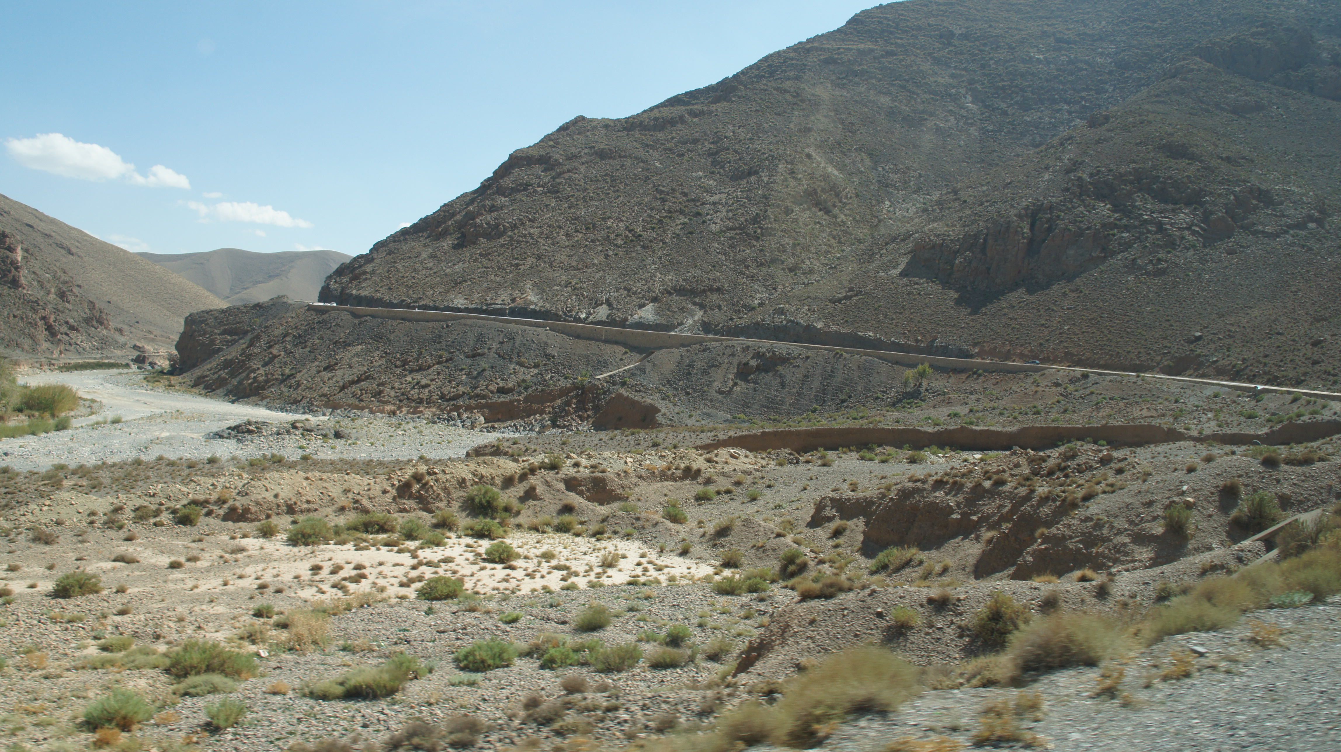
It’s a drizzly day, and the hour-long bus ride seems a little subdued.  We pass fields with these odd-looking structures.

SONY DSC

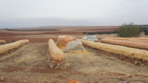
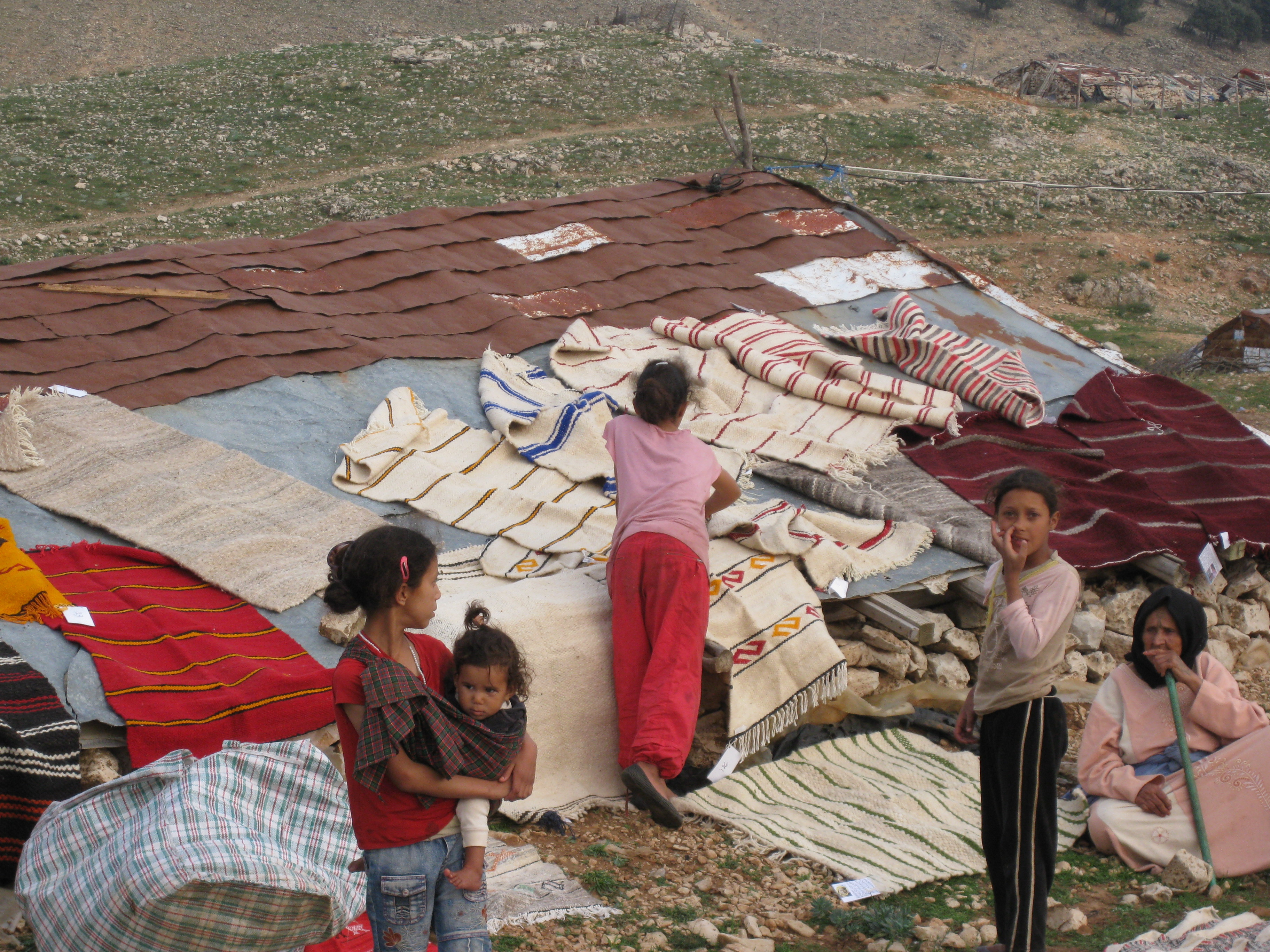
When we first arrived, I asked someone about the long strips of piled stone: were these stone farms, I wondered?  Did construction companies come and gather a strip of stones at a time for building purposes?    No, no!  It’s busla! (Onions.)  The area between Ifrane and Meknes is a big onion-growing area, and these strips are a storage technology.  The stones keep the onions off the ground and away from (at least some) moisture.    Within the curve of the stone, you place a layer of straw, then a pile of onions, then more straw, and finally plastic to keep the rain off.  Insh’allah, the onions will keep through the winter, to furnish the souqs and the hungry people around Morocco.

The students are being sent out in groups of 3-5 people (with at least one good Arabic speaker in the group) to try to identify which parts of Meknes are successful neighborhoods.  At lunch, one group shows us their photos: a friendly woman invited them into her house (hugs all around) and introduced them to some of her neighbors.  The students are thrilled with their experience.  This is one of the reasons John likes Meknes: the town is both smaller and friendlier than Fez, and people welcome his students and their endeavors.

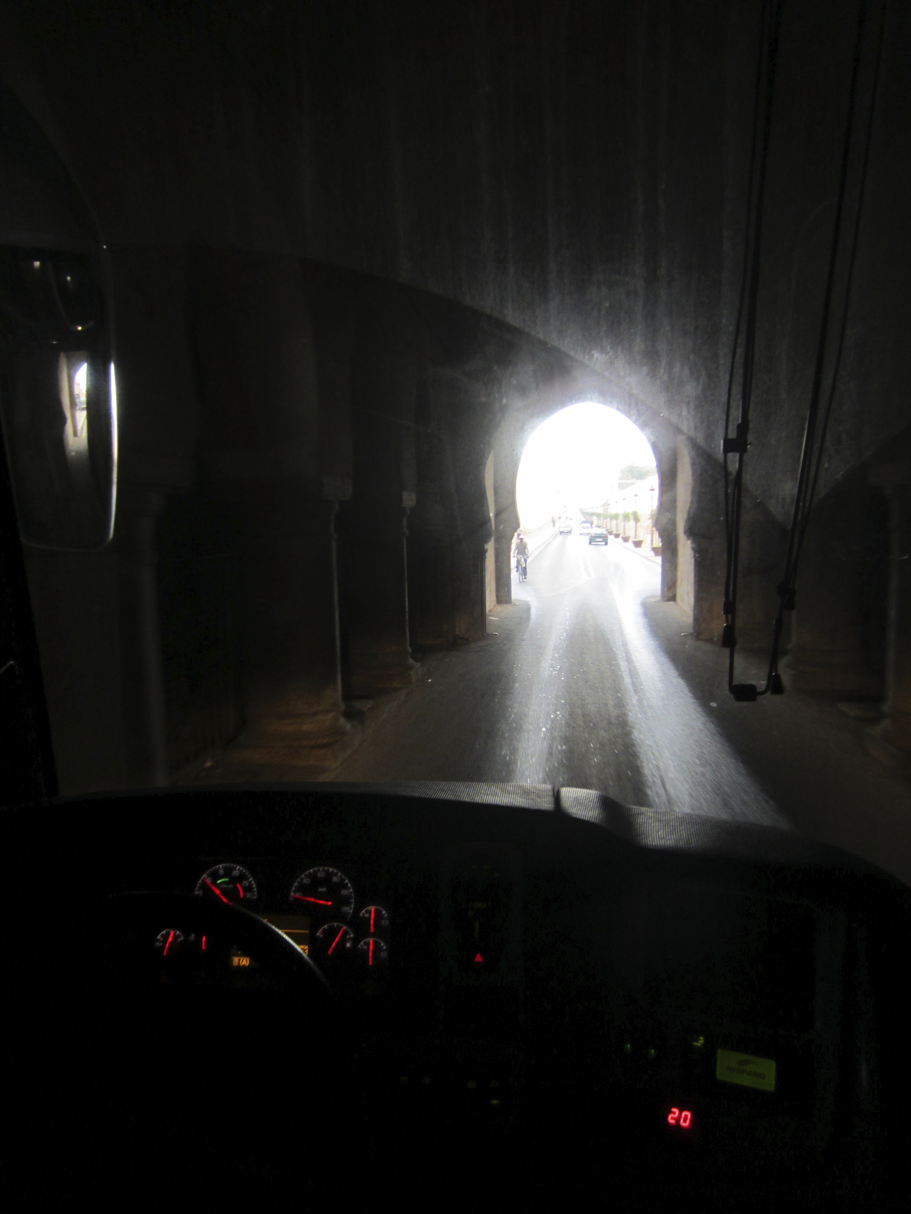
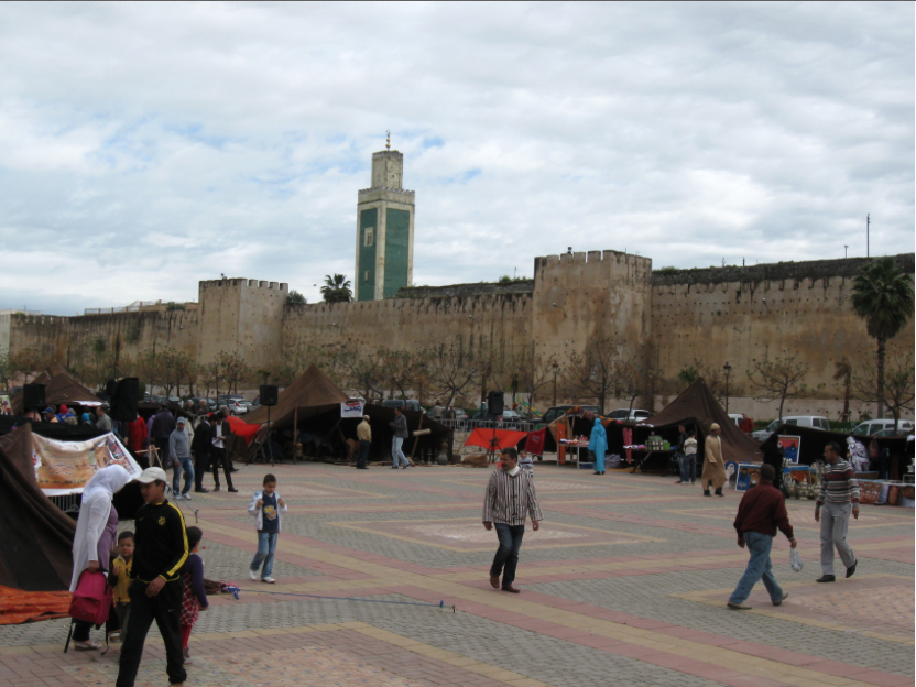
The entry into Meknes does not give that impression, however: Moulay Ismail (1672–1727), who made Meknes his capital city in order to snub the uppity Fassis, invested heavily in stone as a demonstration of state power.  Driving into the center of the city, we took the path diplomats would have followed, along two kilometers of a walled corridor that would have been lined with thousands of soldiers.  Passing through a tunnel, we arrive at the mashwar or the fore-court of Moulay Ismail’s (second) Dar el Makhzen palace, where those diplomats would have been received.

IMG_1519 SONY DSC

The courtyard may seem large, but the “Pavilion of Diplomats” in the upper left corner is small enough to administer a snub: you’re not worth my full attention.  In fact, John tells us that Lalla Aouda, wife to Moulay Ismail, was an unusually active member of her husband’s government, and often met visiting dignitaries in her husband’s place.  In the macho culture of early modern Europe and Morocco, that too might have seemed a snub to foreign diplomats.

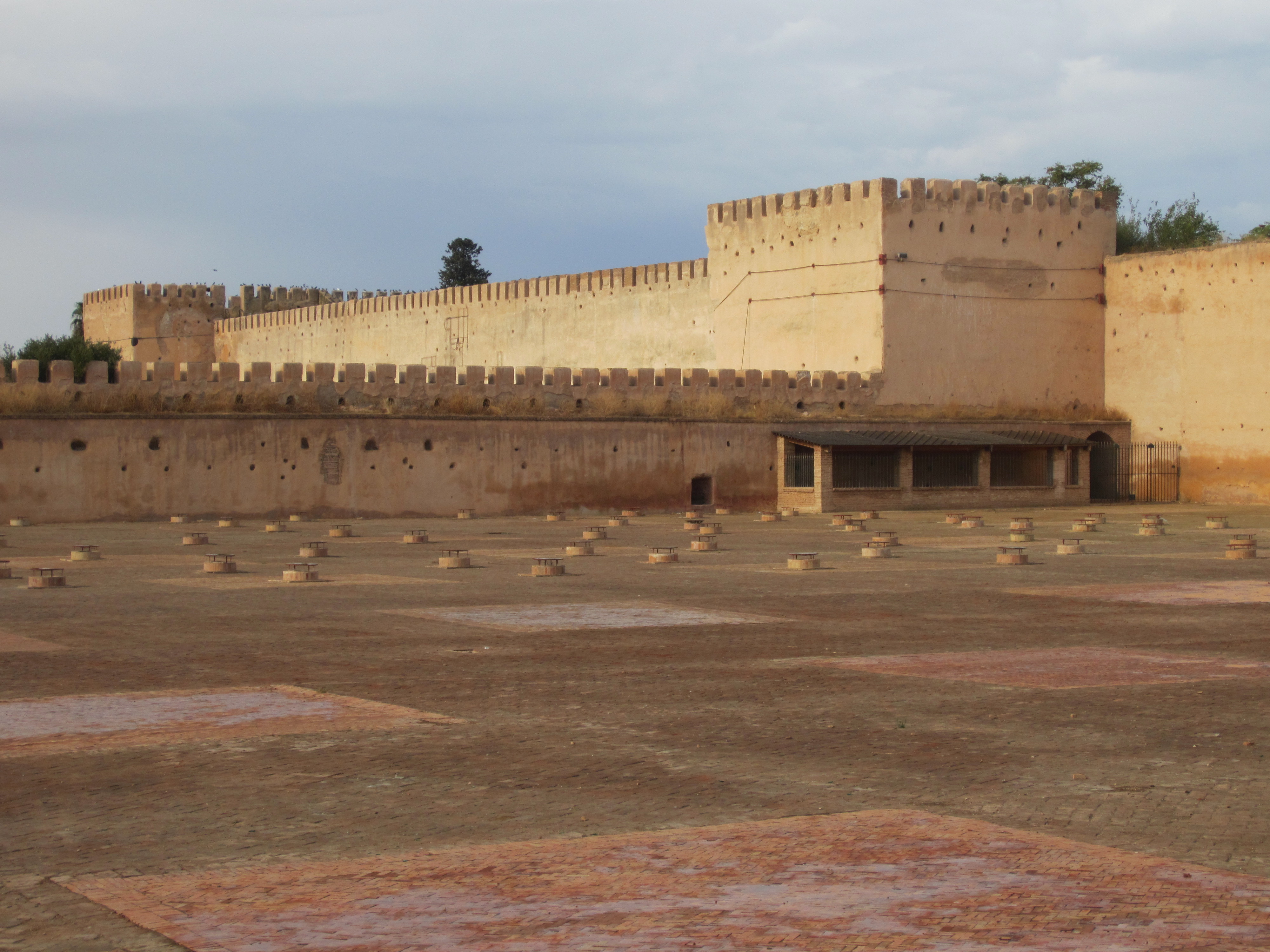
The small structures emerging from the courtyard provide ventilation for the vast storage chambers underneath.  These were used to store grain and other food.  Two years ago, John was present when workmen were installing chains to go along with the more intriguing story that these chambers were a dungeon.  “No truth in that story,” notes John.  “The chains are only two years old.”

IMG_1512

We cross Lalla Aouda square, with the minaret of the Lalla Aouda mosque in the background (photo Eric Ross).

Screen Shot 2014-01-16 at 11.44.37 AM
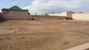
This is the forecourt of what was once Dar Lakbira (the Big House), Moulay Ismail’s first palace–of the three he built.  As Eric notes on his blog,

“Over the course of his reign [Moulay Ismail] built three successive palaces, and surrounded these with multiple ramparts that enclosed an area more than ten times larger than the pre-existing city of Meknes, still largely confined within the Almohad walls. The palace-city included neighborhoods for civil servants and the army (largely slaves), vast storage facilities, stables, reservoirs, flocks, fields and gardens. So large was Moulay Ismail’s imperial city that within its walls, today, we find: the current Royal Palace (the second to be built by Moulay Ismail), dense urban neighborhoods (some old, others new), a military academy, a horticultural institute, a track for horse races and other outdoor sports facilities, a golf course, a university campus, as well as monuments open to the public.”

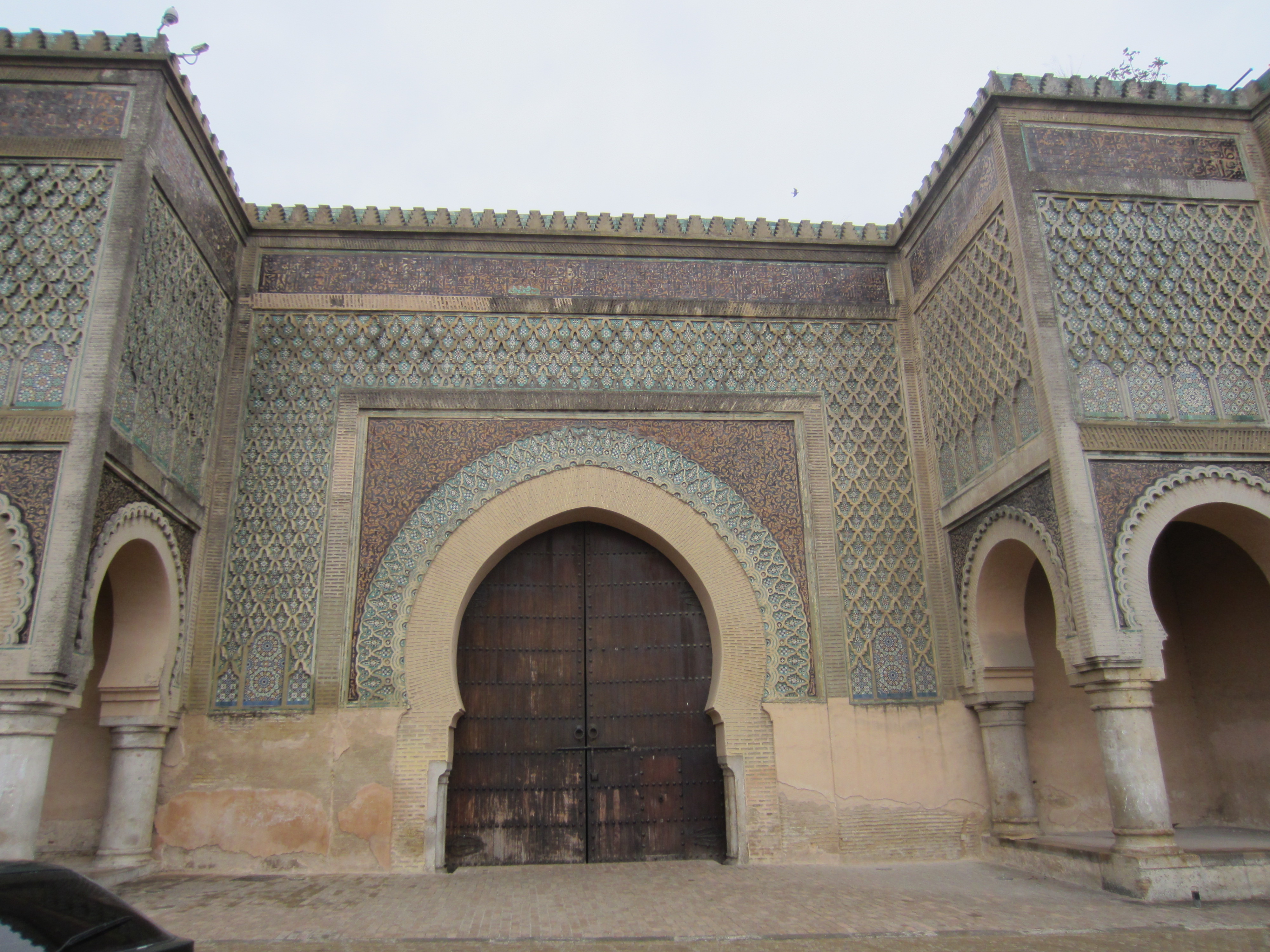
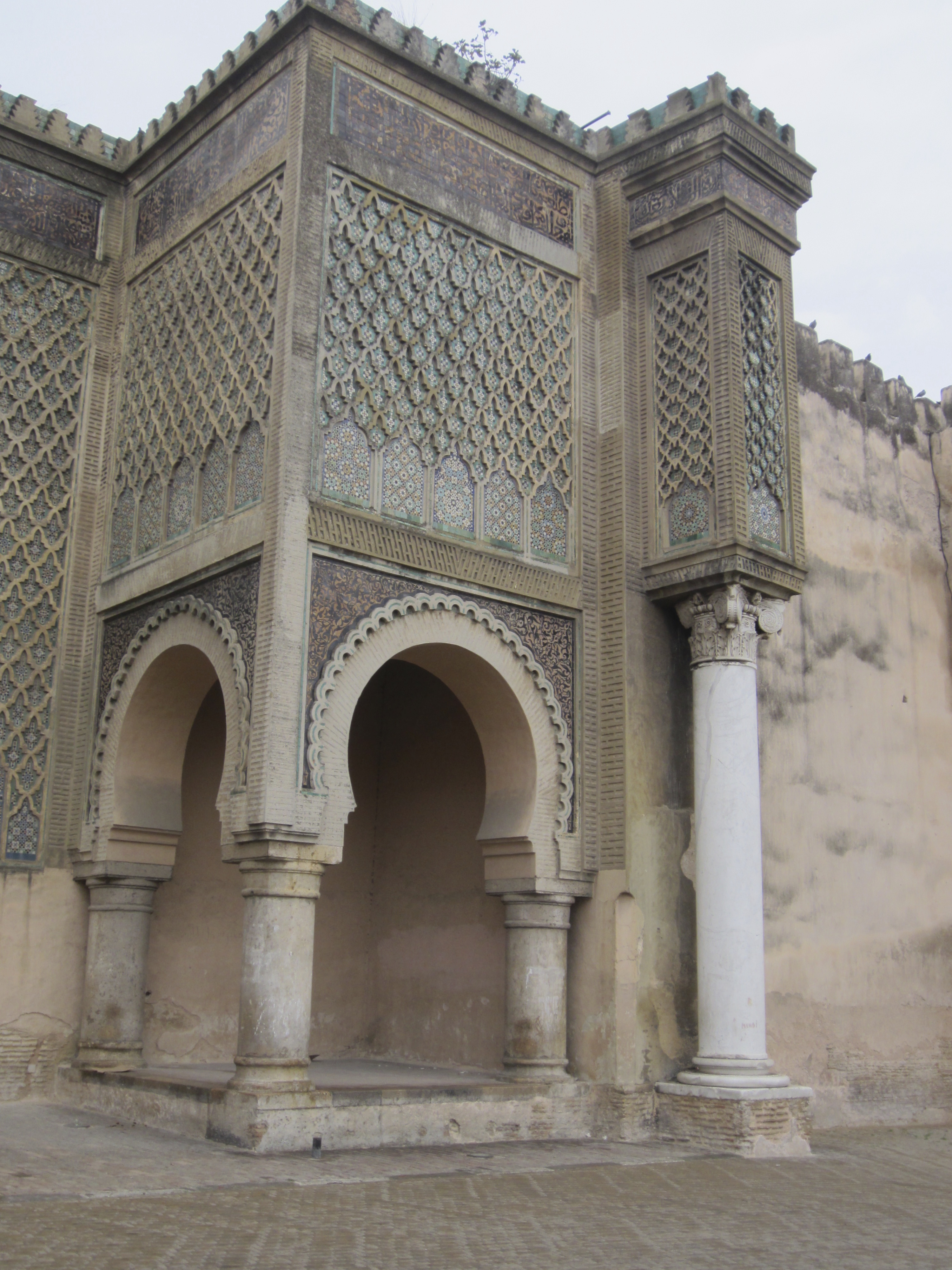
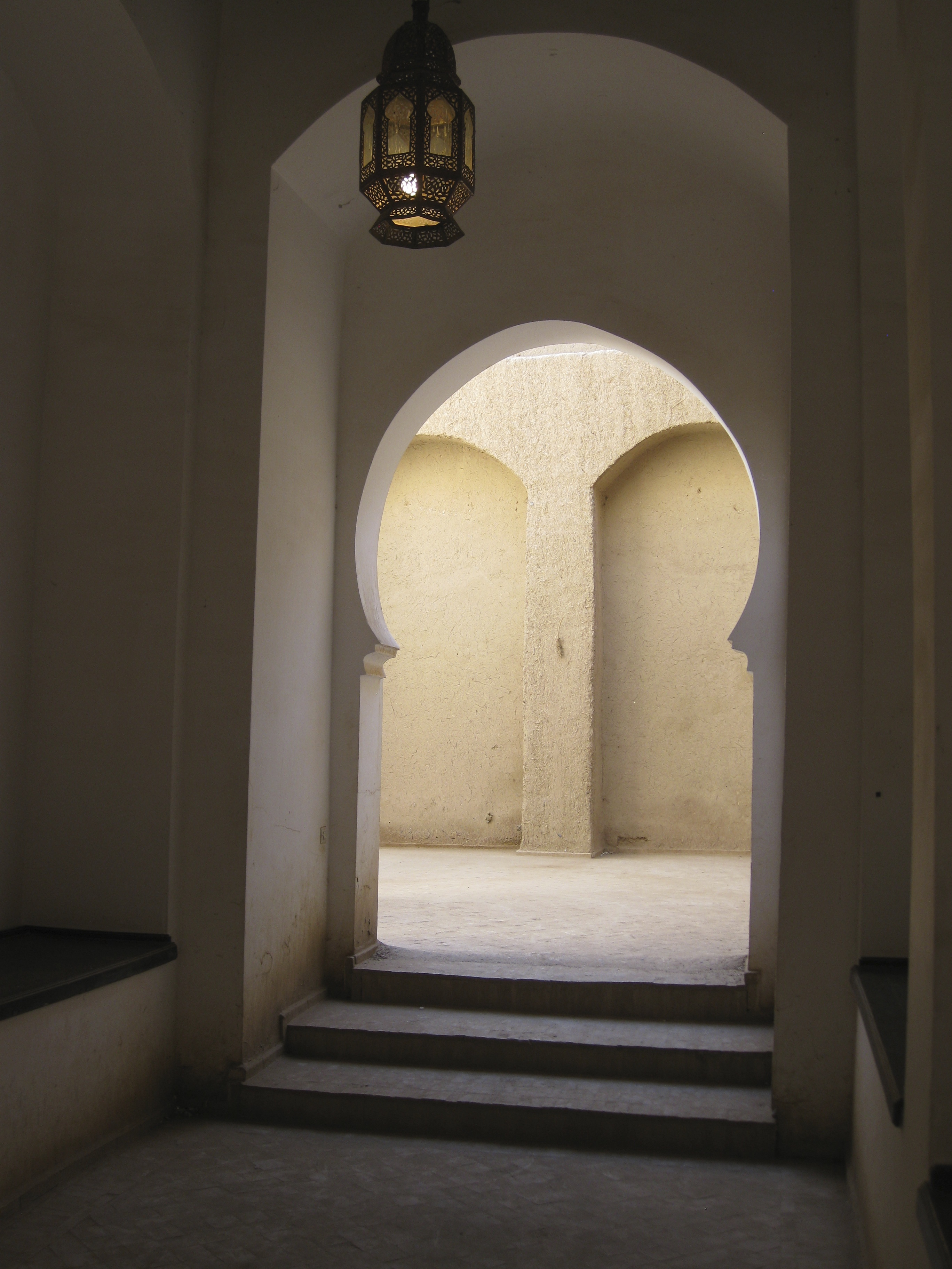
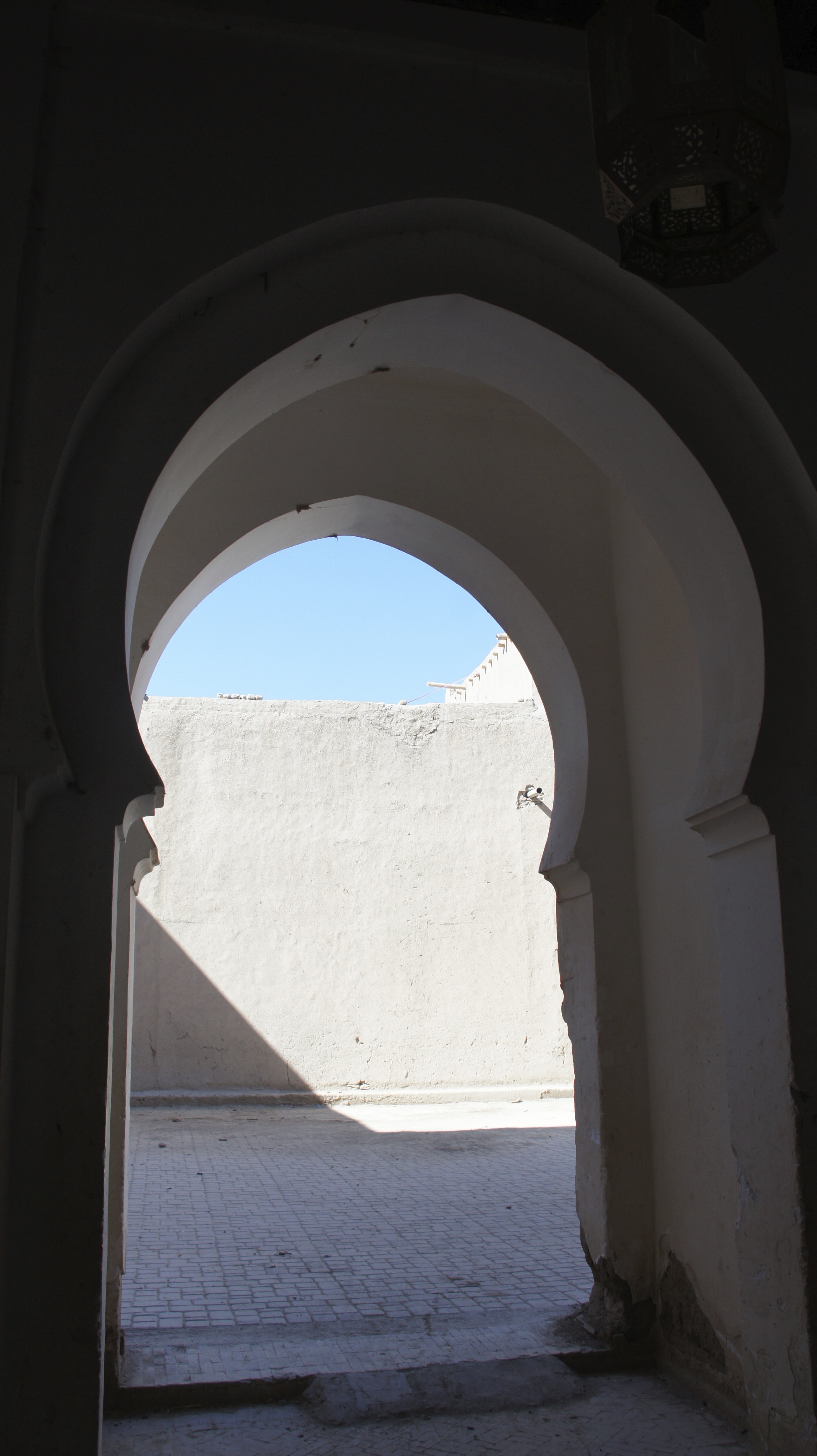
The Bab Mansour (also known as the Victorious Gate) connects the old medina to the palace-city of Moulay Ismail.  The gate is named for its architect, El-Mansour, who played on Almohad design patterns and used marble columns from the Roman ruins of Volubilis (Oualilia or Walïlï).  Moulay Ismail supposedly inspected the gate upon its completion and asked El-Mansour if he could have done better.  El-Mansour felt obliged to answer yes–and in frustration, Moulay Ismail chopped off his head.  The only problem with this story is that the gate was apparently completed five years after Moulay Ismail’s death.  In any case, the glory of its architecture is addressed not to foreigners entering the city, but to the inhabitants of the city itself, when they turn toward their king.  The gate is now a gallery which one enters through a side door, creating an uncanny tension between grandeur and indirection.

IMG_1468  IMG_1470

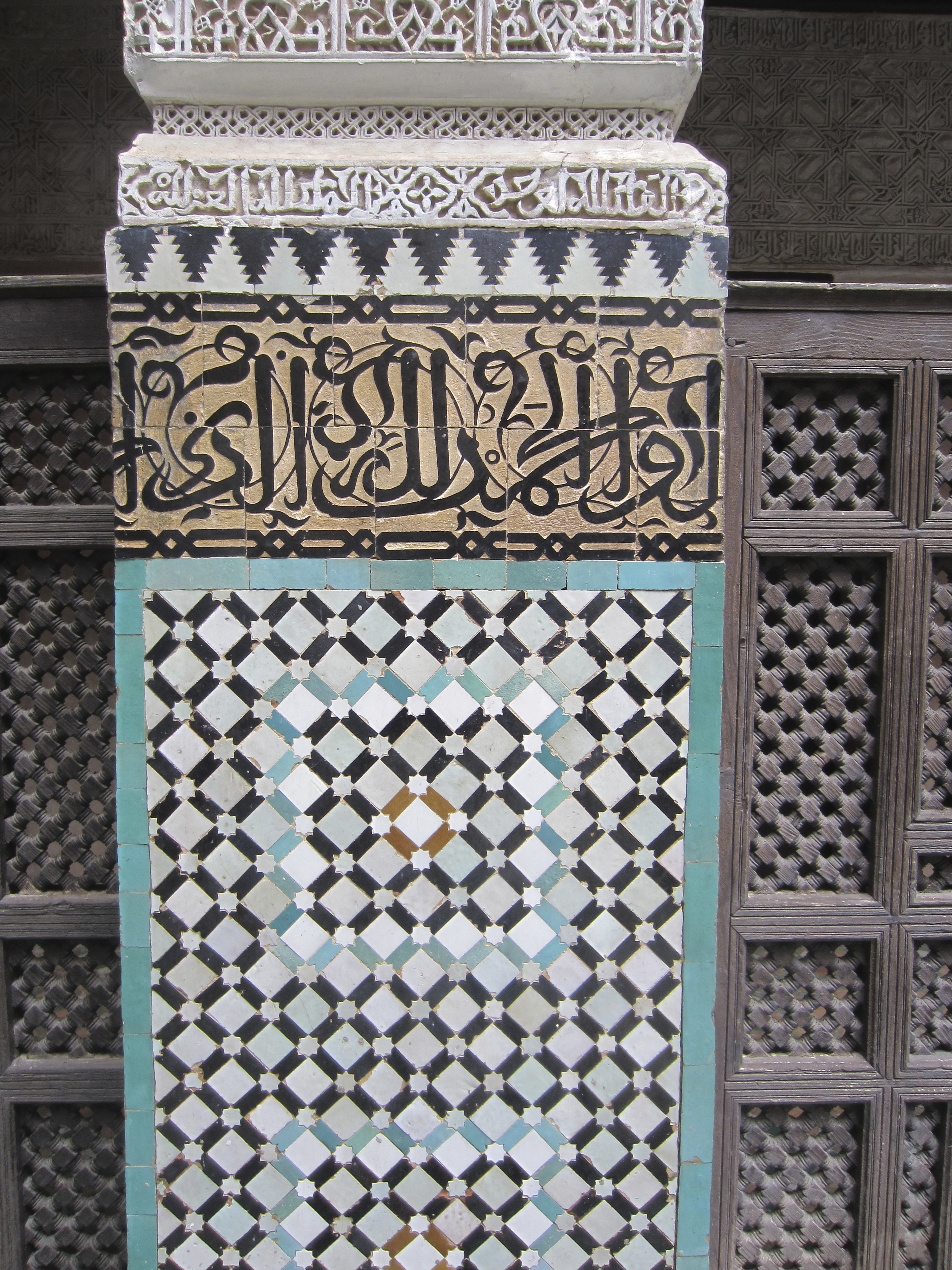
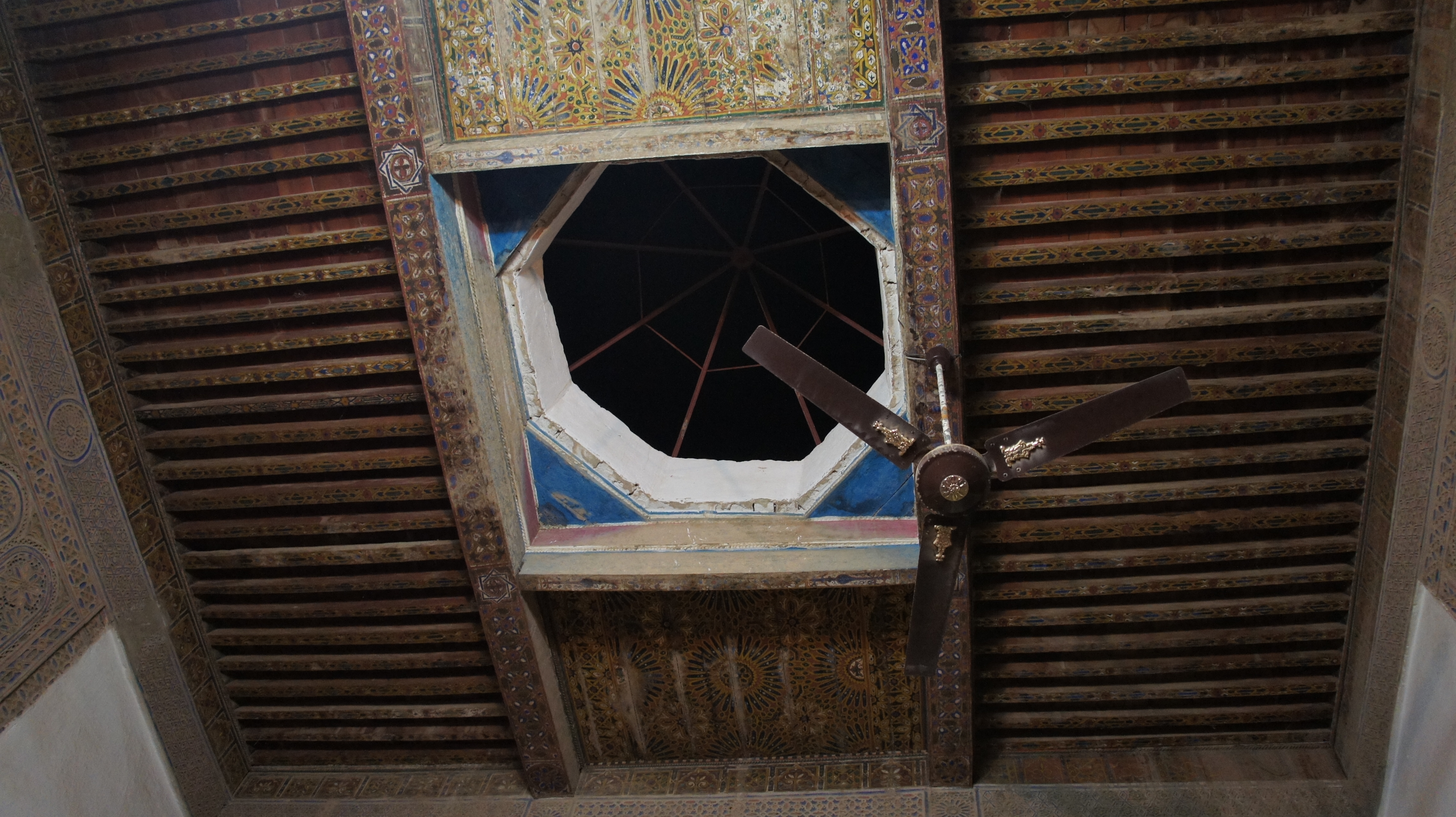
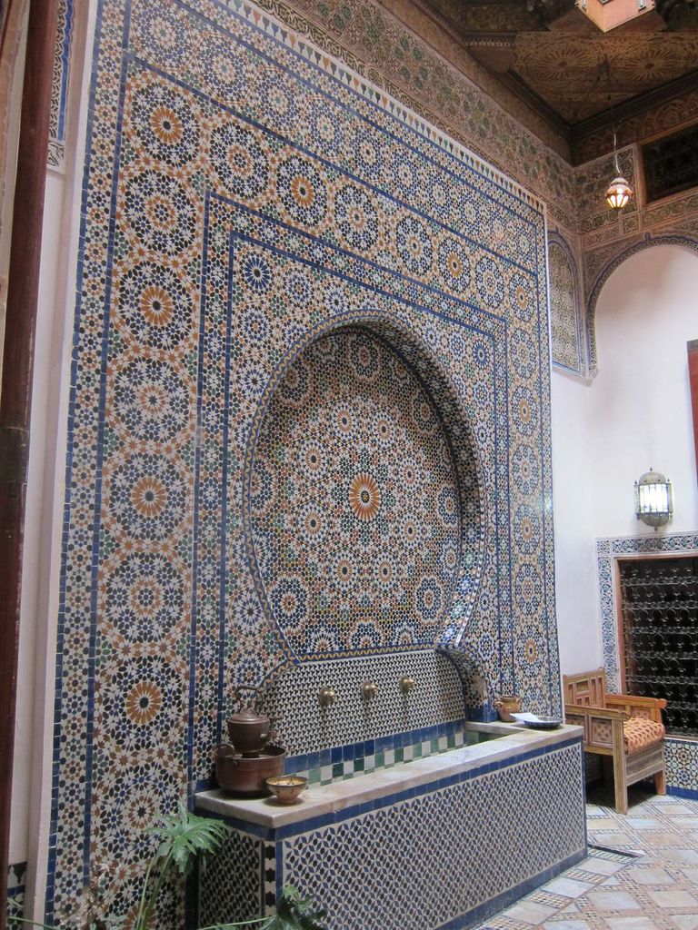
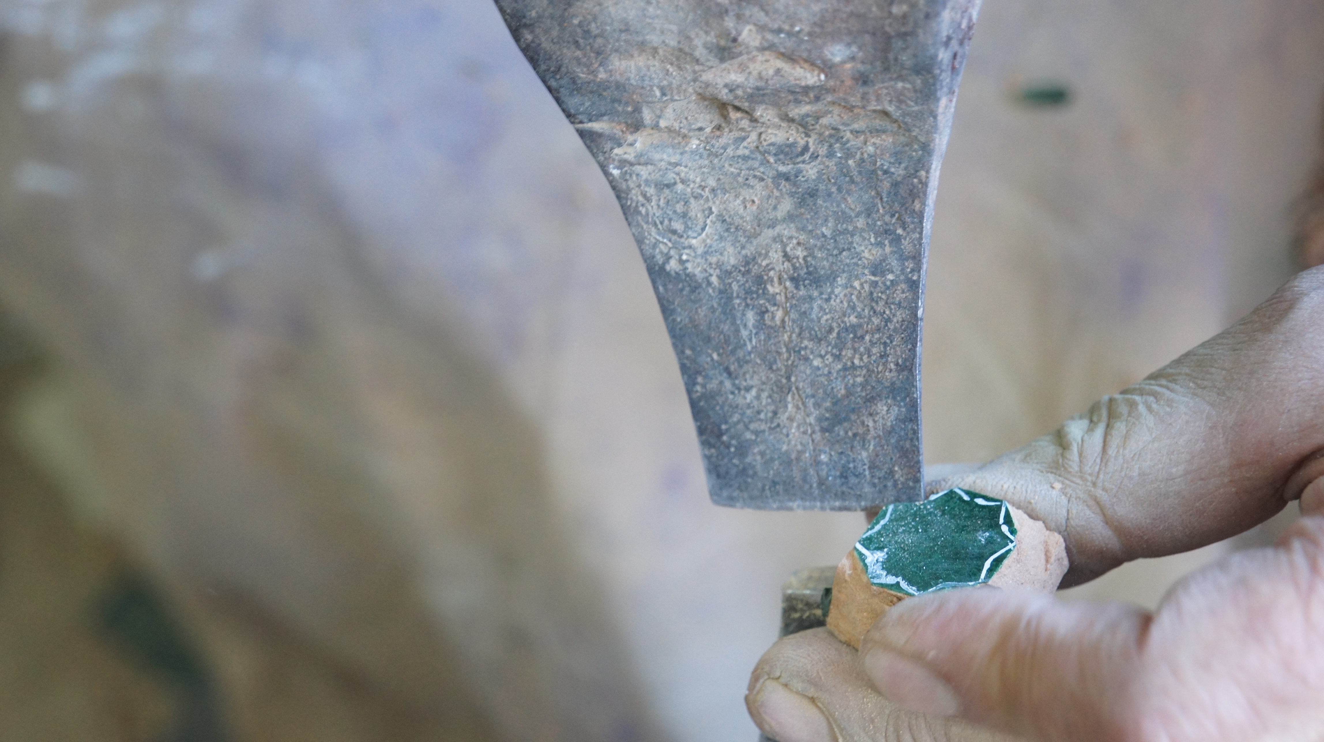
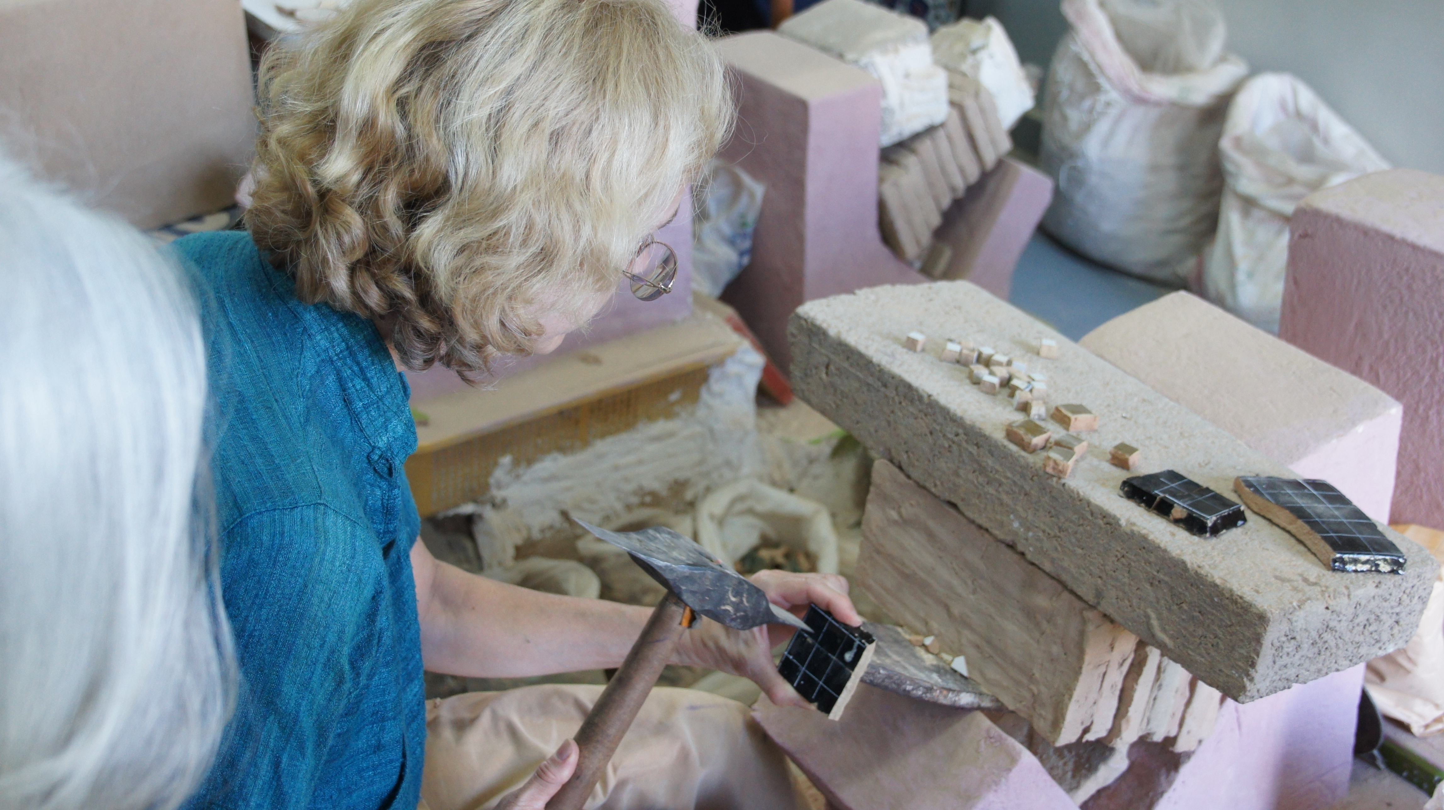
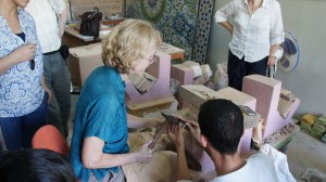
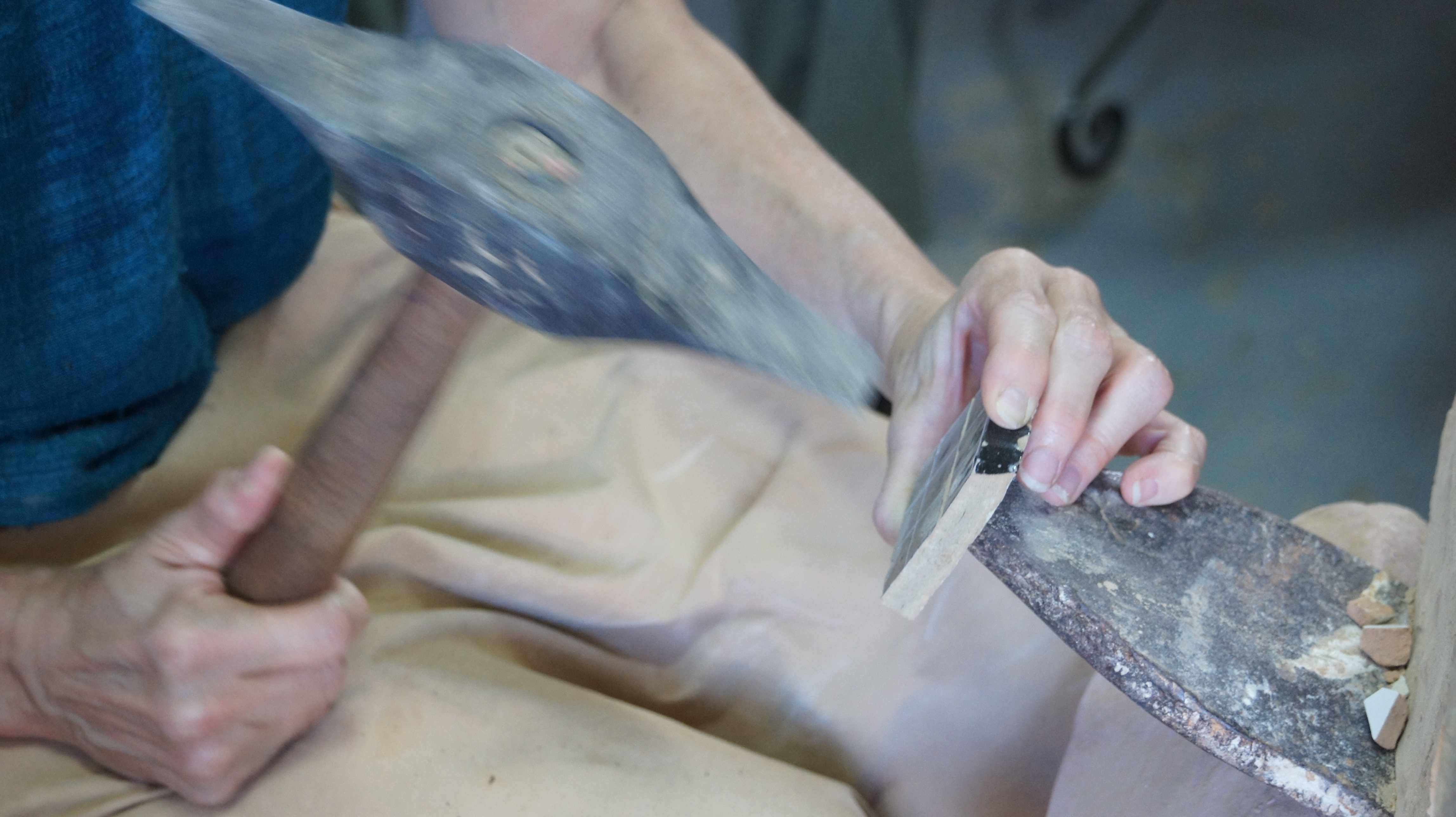
John leads us first to the Bou Inania medersa.  This, like its larger namesake in Fez, was built under the Marinid dynasty (built 1331-1351).  I’m struck by the way the lower level of the building, lined with zellij and cedar screens, gives the effect of being underwater, or a watery reflection, as if the main level of the building started half a story above ground.

IMG_1483

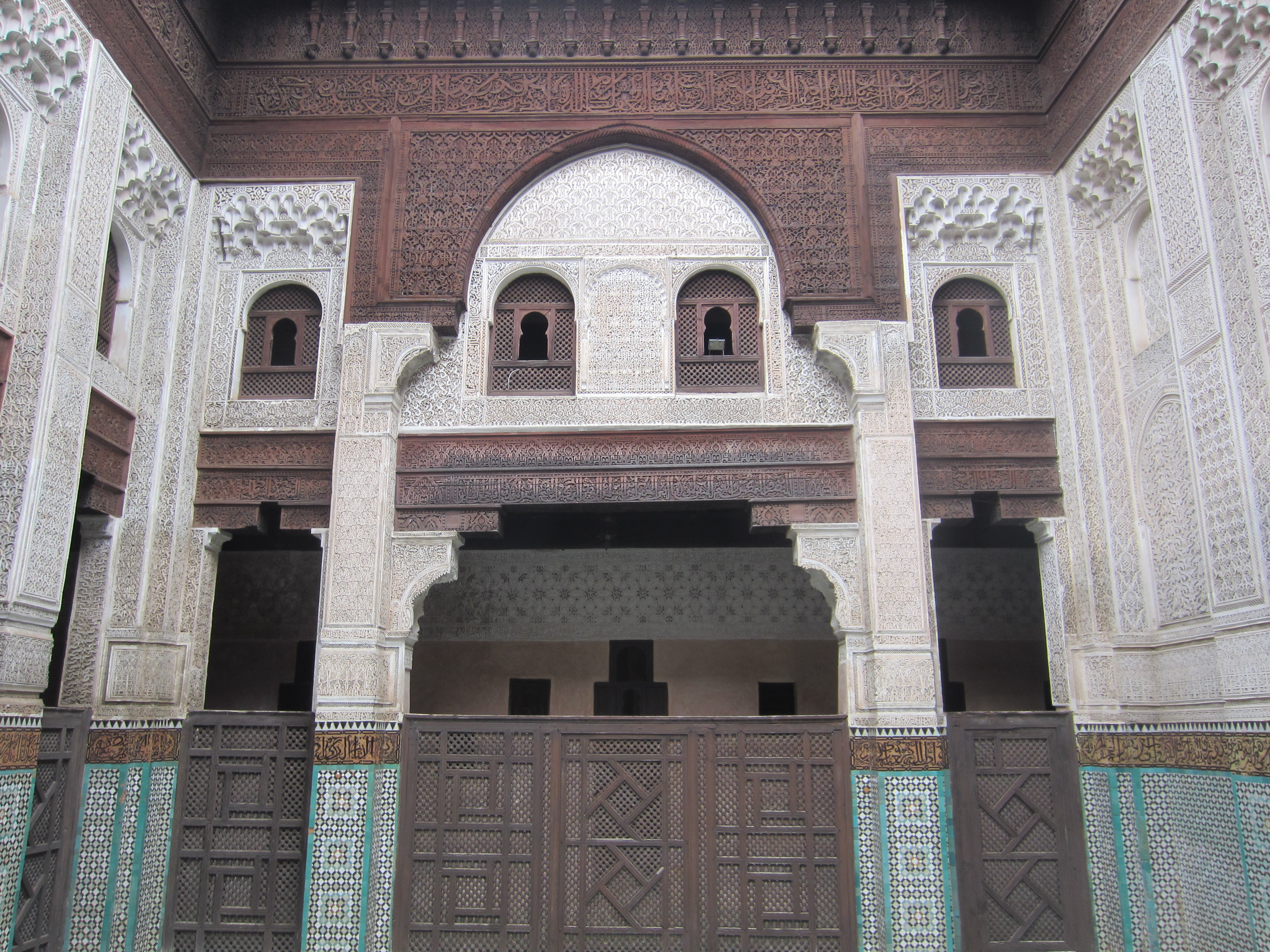
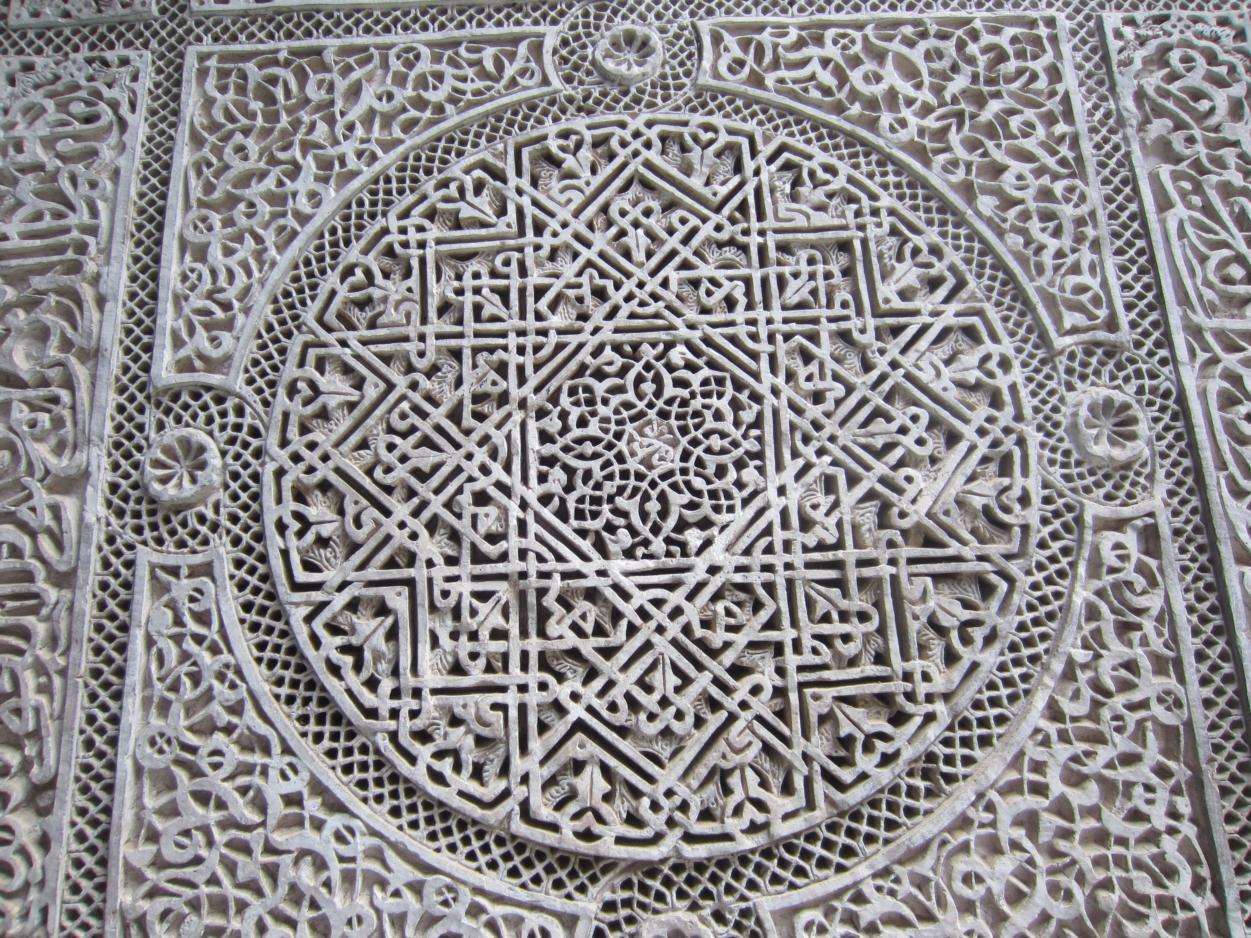
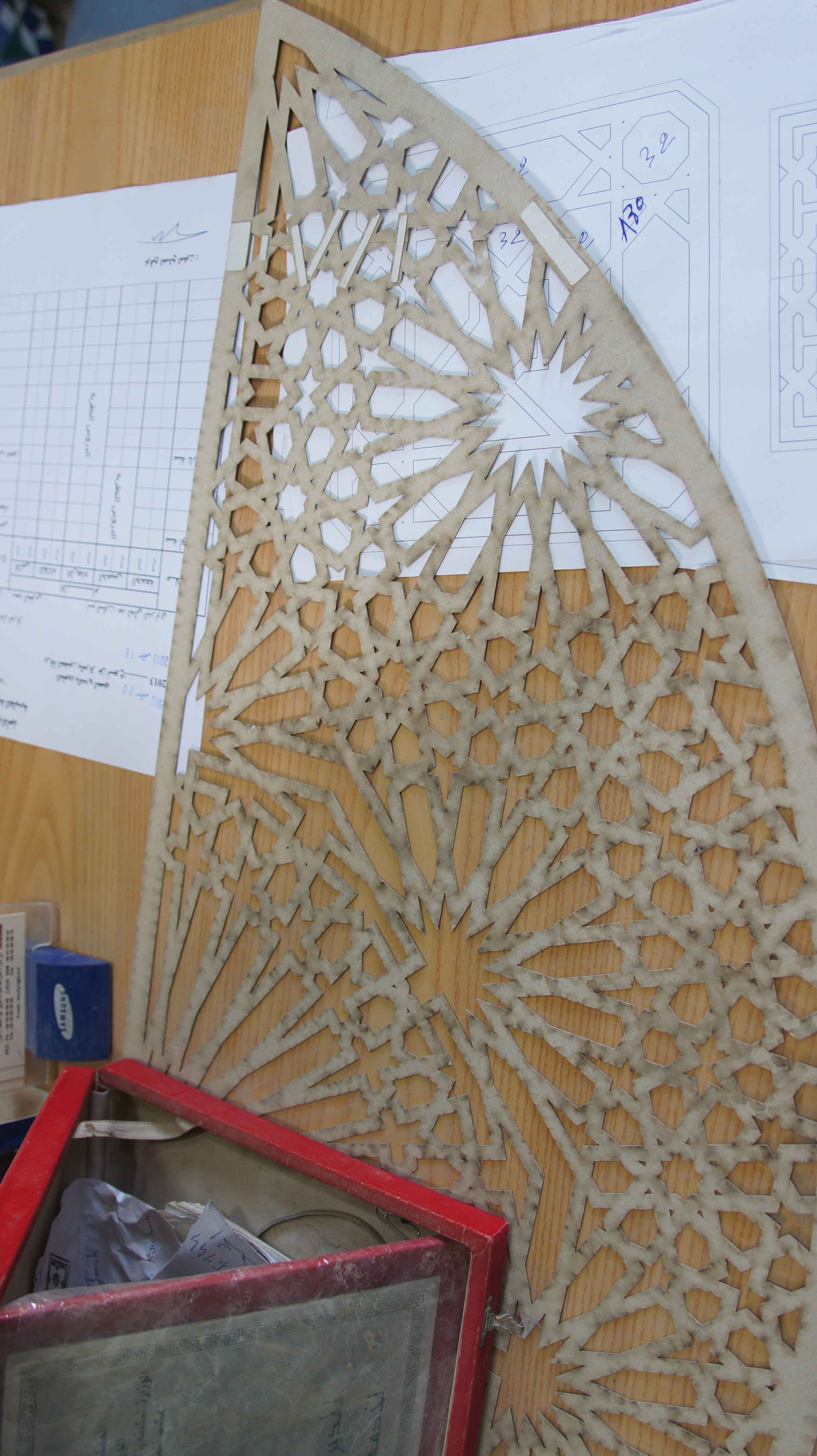
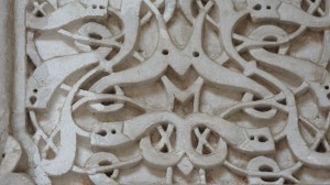
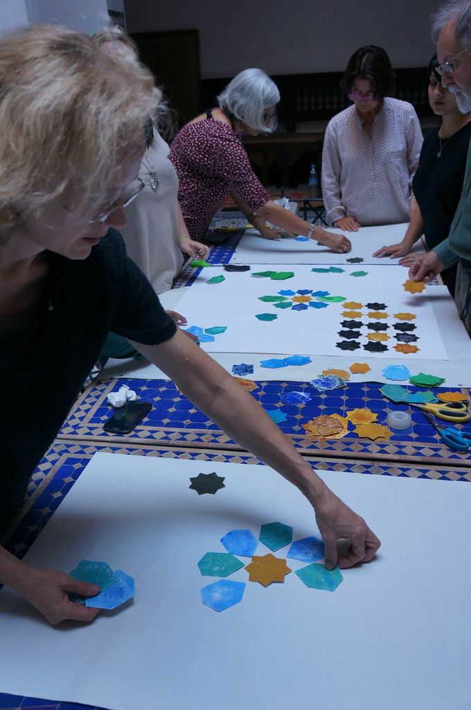
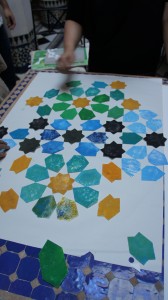
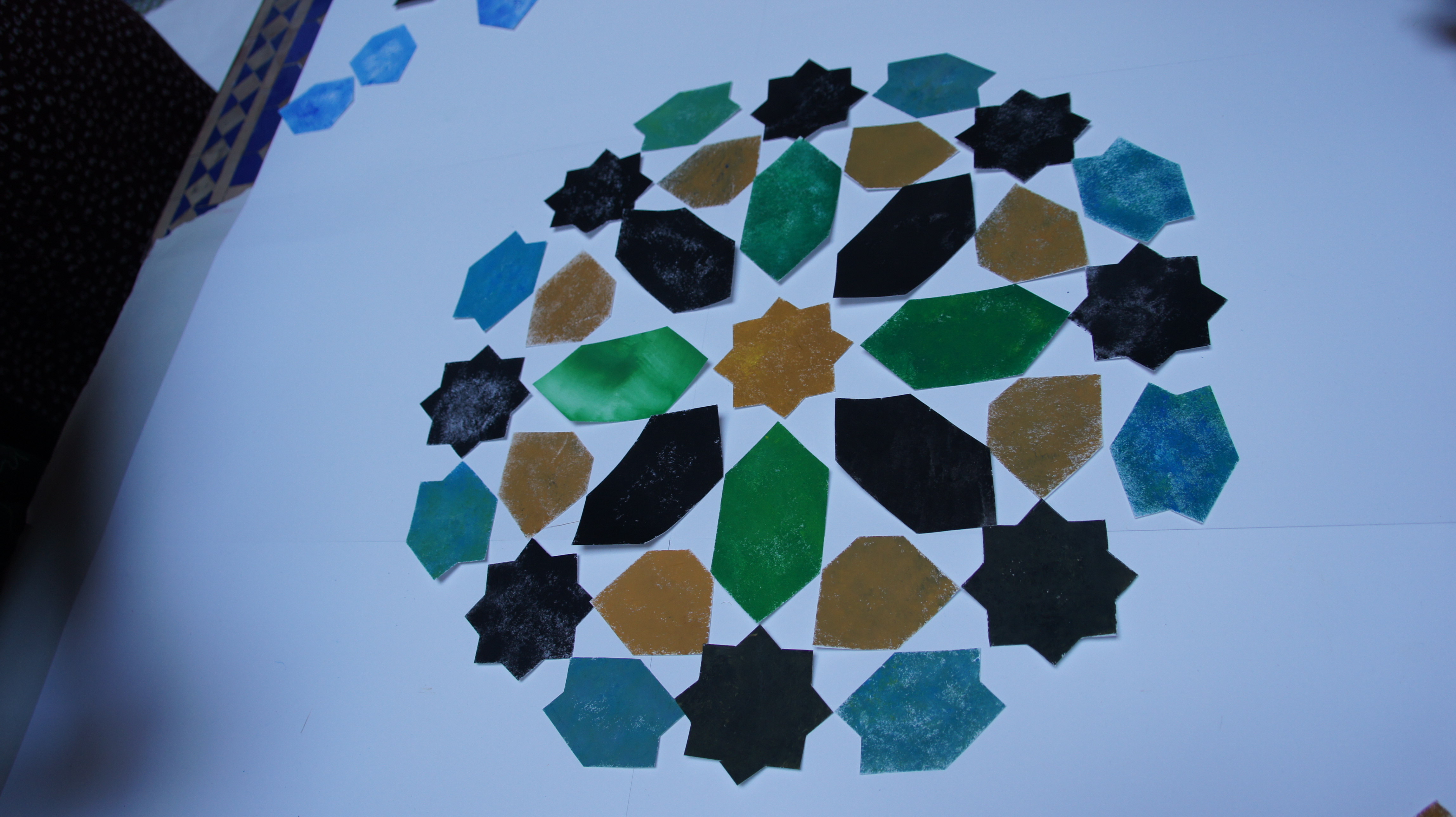
The zellij here is truly remarkable, with all the sophisticated complexity of the Andalusian style:
SONY DSC

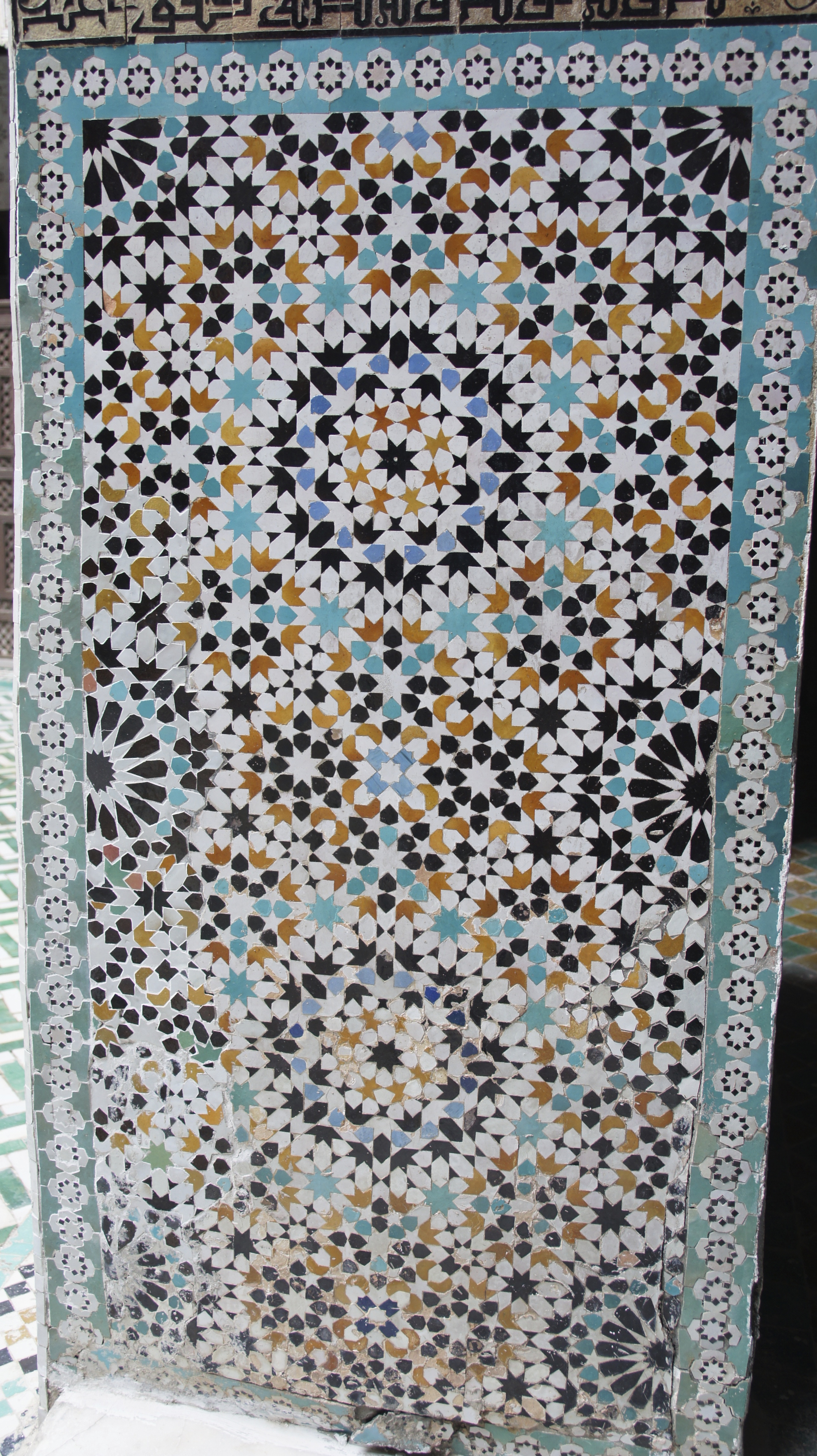
John tells us to find the center of the pattern (here, the black eight-pointed star) and count the number of layers of decoration radiating out from that center.  I count nine layers out to the light blue stars, for what it’s worth.  But notice too the excruciatingly small black and white tiled circles around the outside of the pattern.  I’m very taken with the multitude of shapes and play of colors here.

In other places, the zellij is quieter, more subtle, in a way that seems sophisticated to me:
IMG_1480
Shadow patterns within patterns.

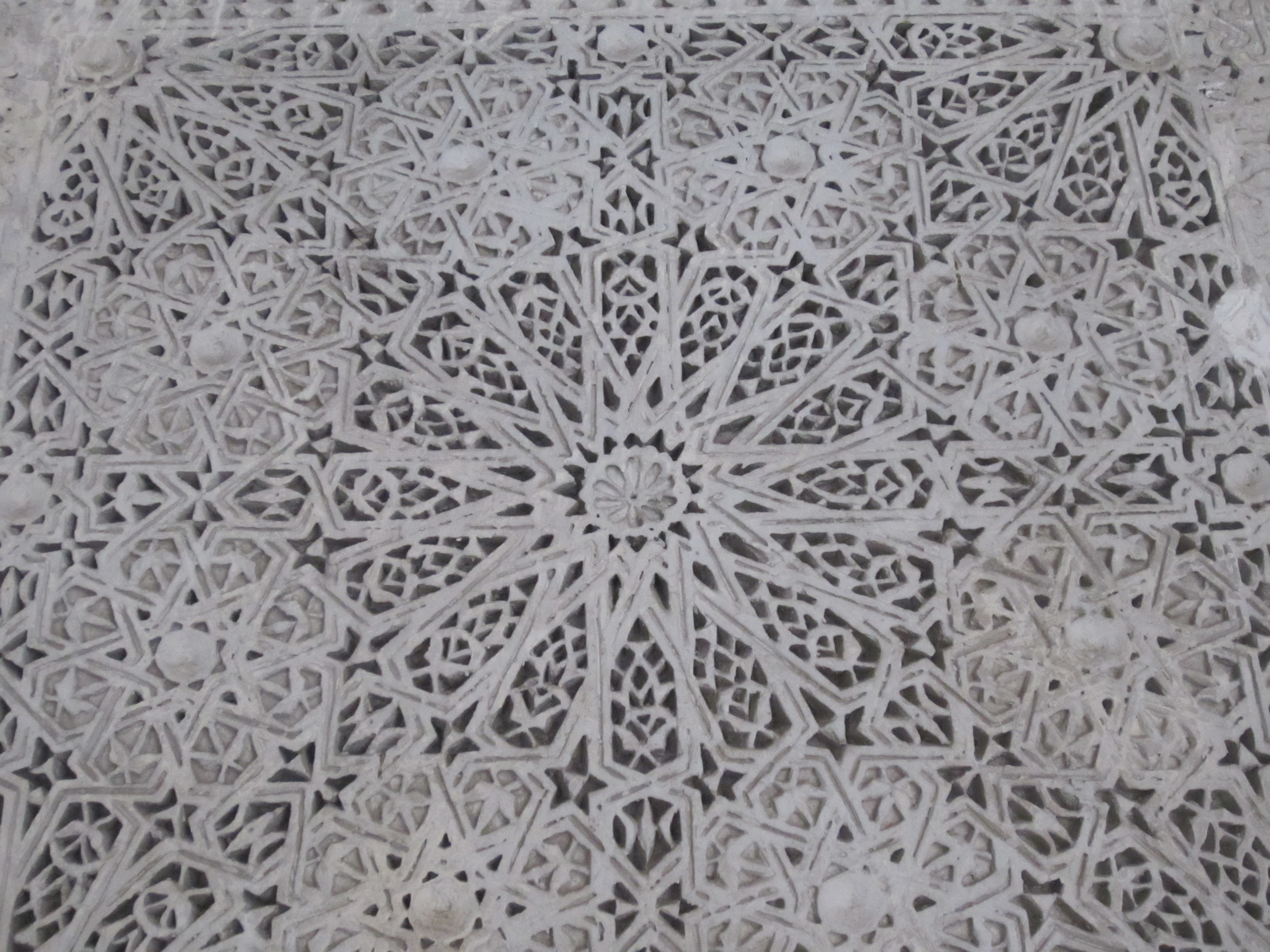
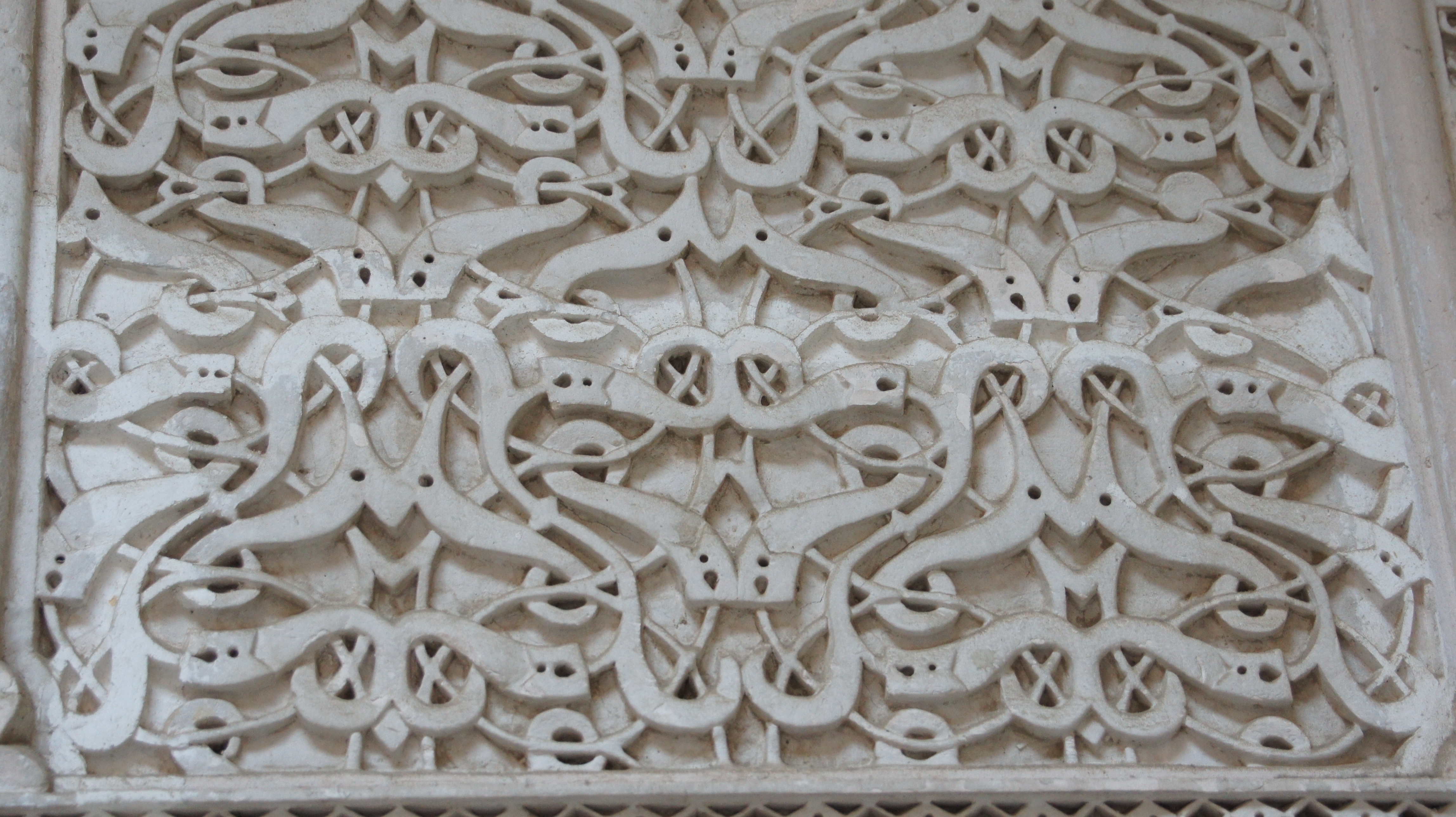
The plaster work also strikes me as quite phenomenal.  Is it easier to follow, or am I getting better at seeing the grid?
IMG_1477

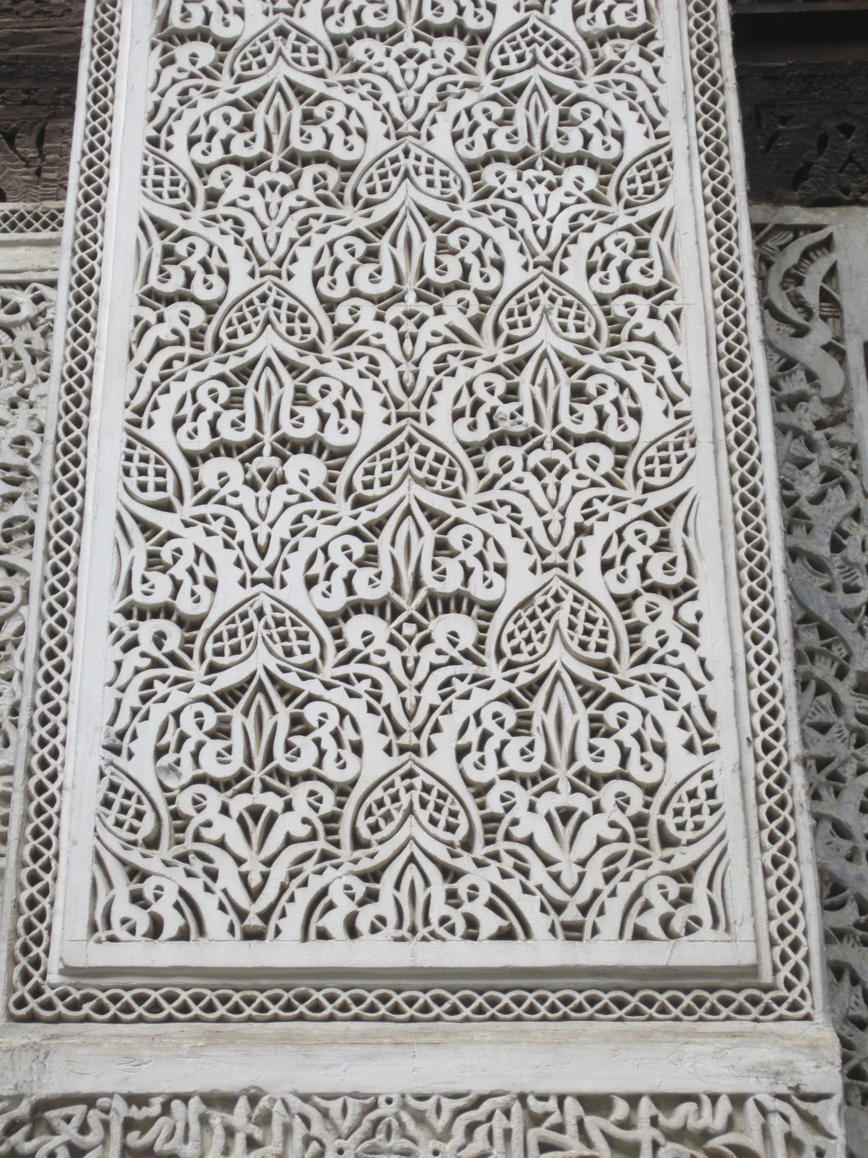
I like the integration of calligraphy and biomorphism here:
IMG_1479

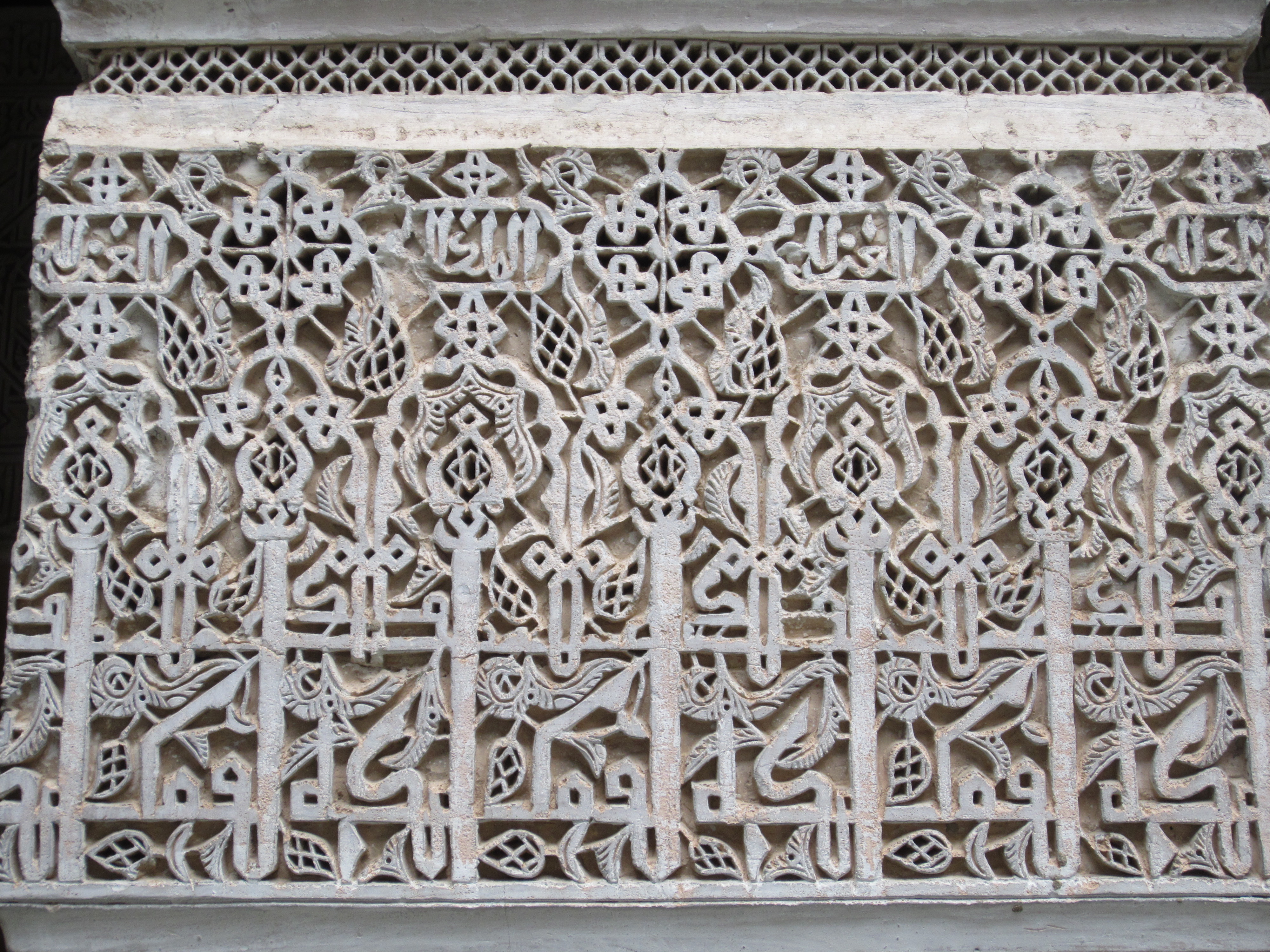
And the stark geometry of the medallion, surrounded by biomorphic design here:
IMG_1489

And what about rosettes intersecting with other rosettes here?
IMG_1487

John tells us a little about the work of the medersas, an intermediate level of Islamic schooling.  Students would have begun their educations in kuttabs or msids, schools often attached to a mosque or a zawiya.  Such schools would teach the beginning elements of Arabic speaking and writing, along with memorization of early (shorter) surahs.  More talented and motivated students would arrive at medersas, and their goal would be mastery of the Qur’an in its entirety.  Students would also study astrology, astronomy, and law.  Astrology was linked to the human body and its health; astronomy was important for Islamic practices, ranging from certainty about when to perform the five daily prayers to advance warning about the timing of holy days.

In studying law, the student’s job was to memorize not only the primary texts of the law or sharia, but also all subsequent discussions of the primary text within the tradition.  This education would conclude with an oral exam in which each student would be presented with a hypothetical legal case and asked to solve it by quoting from memory (word for word) both the main source of law in this area plus all subsequent texts on the subject, along with an account of how the student would apply these texts.  Students who passed this test would be awarded an Ijazah and given a robe and a turban–the origin of graduation robes and mortarboards in the West, where educational systems lagged behind this level of medieval Islamic development.

At Independence, 30% of the Moroccan population was educated (could read and write) and almost 100% of those educated people came from these medersas.  The medersas were closed in the 1960s, to be replaced by public schools.  The fact that the Bou Inania no longer functions as a school or a religious center means that we can climb the stairs to look at the student dormitories.

IMG_1490

This room might have housed two older boys: windows became available as you moved up in the hierarchy.  Larger rooms would have housed four boys.  There would never have been much space to spare.  Yet you would have been fed, and housed, given one new set of clothing each year, plus enough freedom from other tasks in order to dedicate yourself to mastering the Qur’an and its applications to law, life, and theology.  Medersas and their students were funded by wealthy merchants or craft guilds for the honor they brought to the city.  Still, everyone knew boys would be boys: the doors to these rooms lock from the outside, and there were common accounts of students slipping away from the medersa over the rooftops and trying to sneak back in again late at night.

IMG_1491

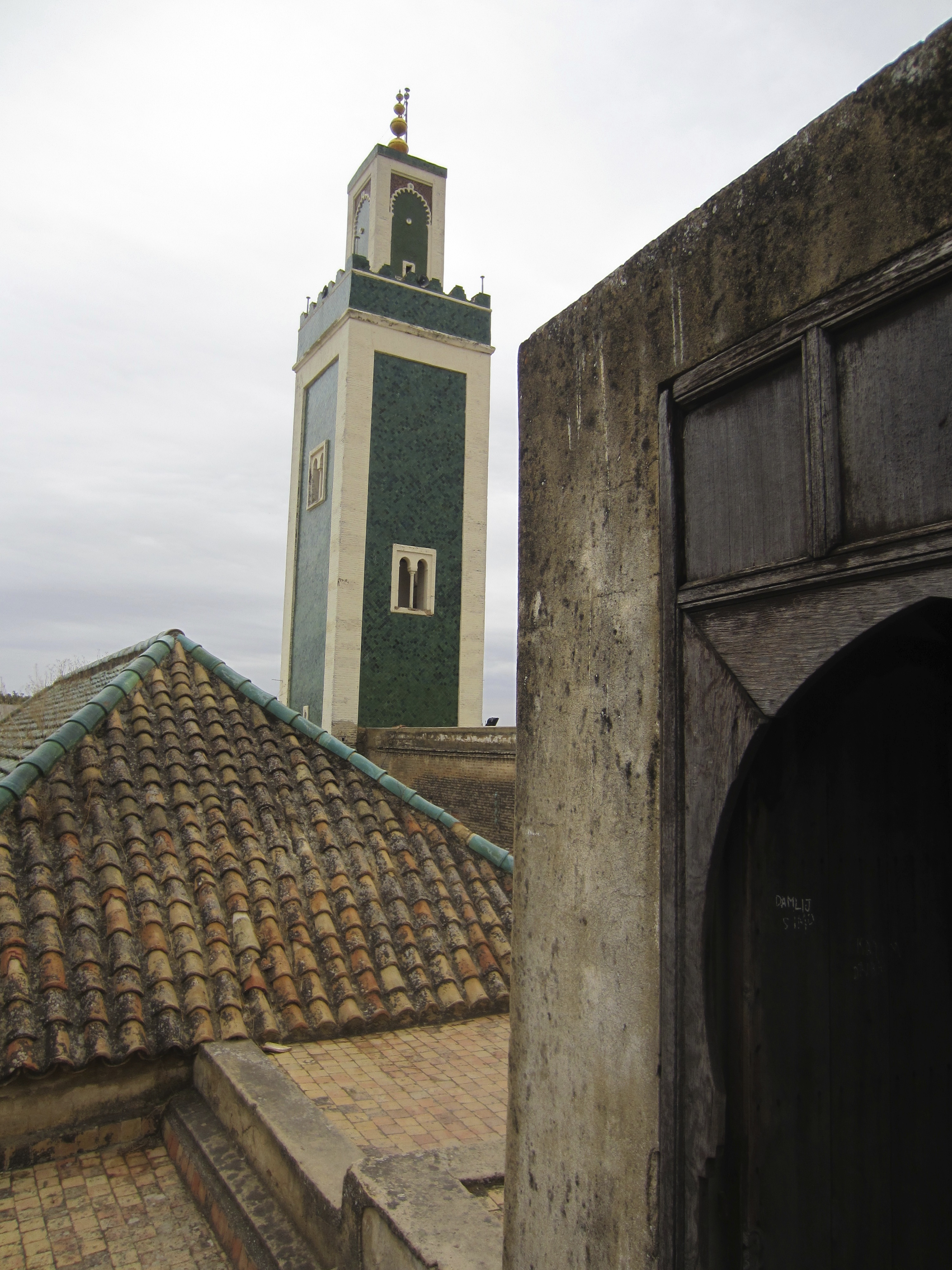
We climb up to the roof ourselves to look at the renovated minaret.  In 2010, the minaret of the nearby Bab Berdieyinne Mosque collapsed during Friday prayers, killing 41 people and injuring many others.   The king ordered that minaret rebuilt to historical specifications and other minarets inspected and renovated to prevent further damages.

IMG_1492
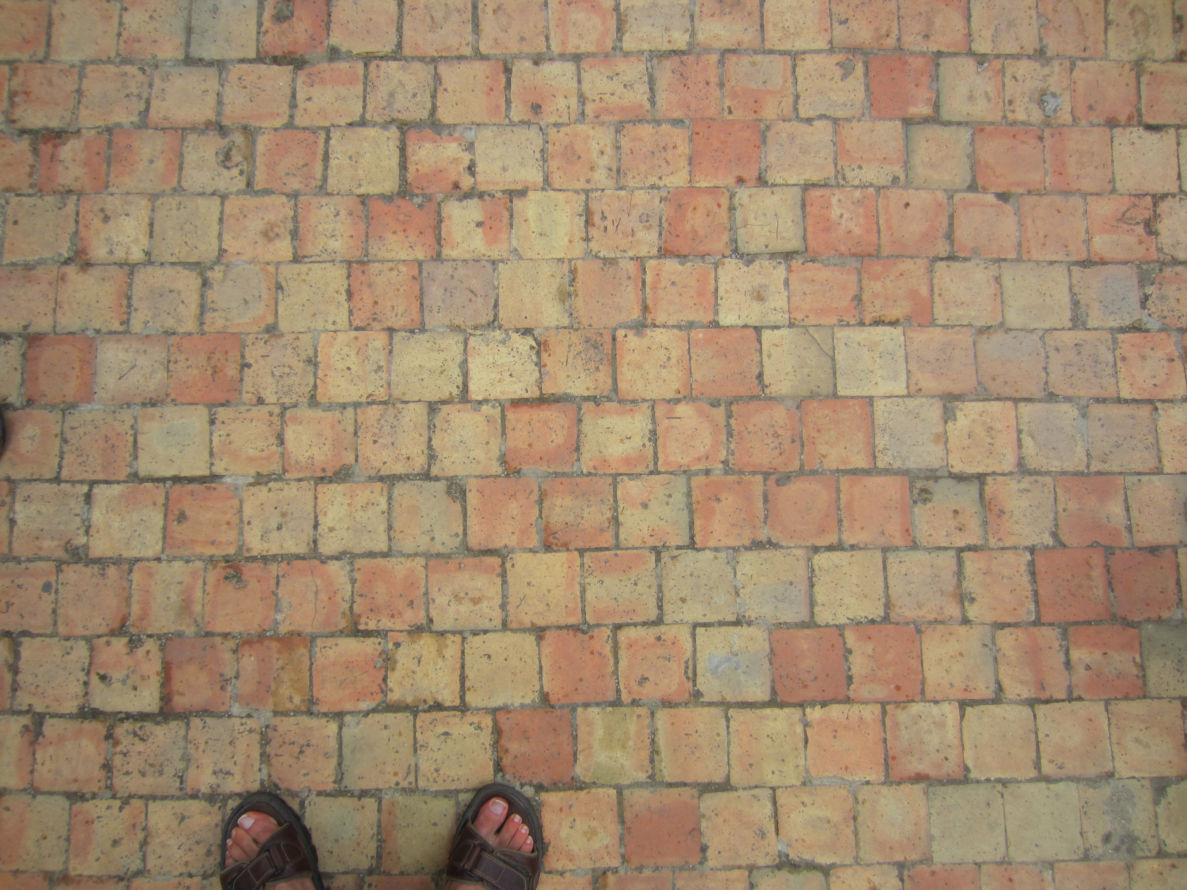
James likes the beldi (traditional) tile of the rooftop.

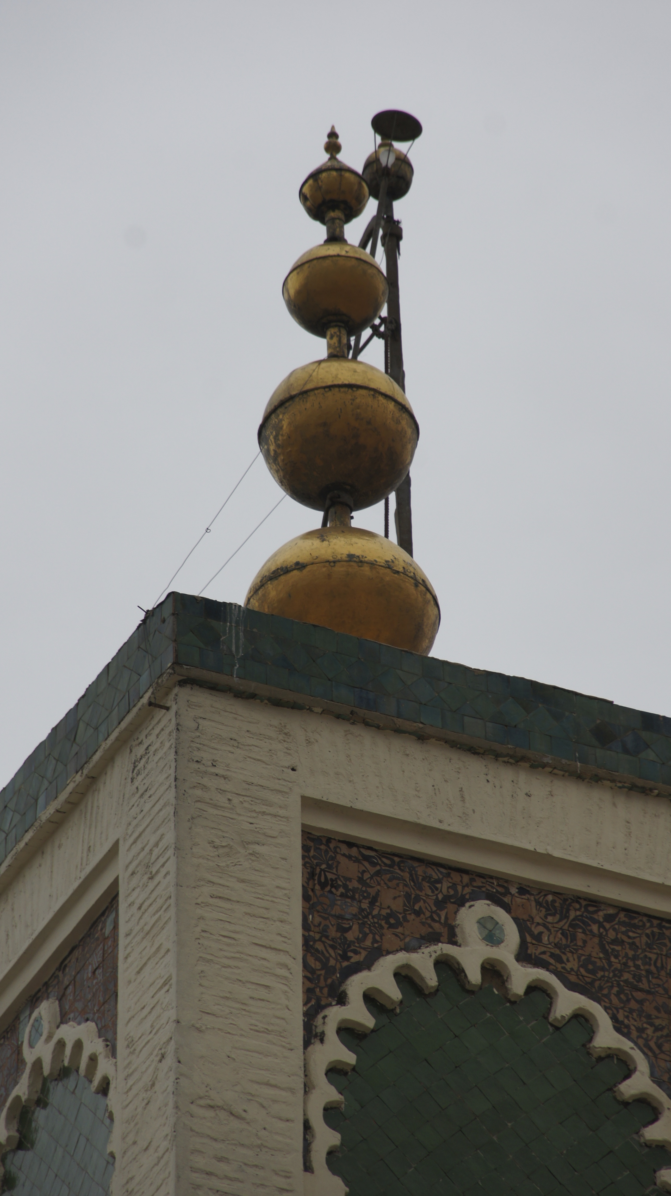
We ask John the meaning of the three golden balls mounted on the top of many minarets in Morocco.  He tells us the traditional story: the chief wife of a sultan in Marrakesh is supposed to have broken her Ramadan fast with 3 pomegranate seeds; in remorse, she had all her gold jewelry melted down and made into three “seeds” to be mounted on the Koutoubia minaret in Marrakesh, to the glory of Allah.
SONY DSC
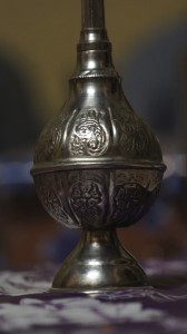
Time to leave and wander the medina for a while.  SONY DSC
Look familiar?  Think of the Attarine in Fez…

Zâwiyas: saints, economics, and politics

Still guided by John Shoup and Eric Ross, we are driving through a dramatic sunset to the zâwiya Sidi Al-Ghâzî to enjoy an evening of Sufi recitation.
SONY DSC SONY DSC

The evening will be focused on the religious aspects of the zâwiya or the Sufi brotherhood, but I’m also thinking about the political history of the zâwiya in this region.

In the century after the fall of Sijilmassa (1393), the lack of a strong central government meant that local conflicts proliferated and escalated.  In that power vacuum, saints (also called marabouts) and the zâwiyas they founded became an important source of stability: the zâwiyas often provided a physical space in which warring parties could meet to negotiate, and the saints or holy men running the zâwiyas had a powerful influence over local politics.  Religiously-motivated donations to the zâwiyas also made them powerful land- and slave-owning institutions.

In a land of uncertain production, spiritual power (baraka) carries a lot of influence.  Water is everything–but water comes from God. “Rain or no rain is the realm of God” (Tafilalt villager quoted by Ilahiane).

The Alawite, the royal dynasty that came to power in the seventeenth century and still rules today, rose out of the Tafilalt and derived their political and economic power from their spiritual force (baraka).  Back in the 1200s, the citizens of Sijilmassa invited some 1,200 descendents of Muhammed to settle in the city; tradition states that they brought with them the cloak of Muhammed.  The Alawite trace their descent from Muhammed through his daughter Fatima and son-in-law Ali: one of their mottos, visible in calligraphy throughout the country, is “Baraka Muhammed.”
119px-Meknes_Medersa_Bou_Inania_Calligraphy

Tradition also tells us that the Tafilalt region was plagued with a crippling drought and the inhabitants asked for help.  According to one version of the story, the oasis-dwellers sent a message to the governor of Mecca himself, who replied by sending one of his sons to break the drought and rule the oasis, launching the Alawite dynasty.  A different version of the story (quoted in Ilahiane) claims that the inhabitants asked the help of an Alawite Sharif or holy man who was headed to Mecca on pilgrimage.  He promised to pray for the recovery of the palms and the oasis in exchange for the best stem of dates from each palm.  When he returned, the drought was broken and the palms recovered, but the inhabitants refused to give him the agreed-upon reward.  The Sharif proclaimed the entire oasis promise-breakers.  He told them “tafi bi l’ahd” (honor your promise!) and they replied “la, la, la” (no, no, no): Tafilala or Tafilalet.  This version of the story provides a semi-mythical explanation for the difficulties of the region: as promise-breakers, the inhabitants of the oasis and their descendants have been cursed to live in hardship and misery.

The zâwiyas too have fallen on hard times–or perhaps times were always hard.  As we drive through the gathering dusk, John tells us that the particular zâwiya we are visiting is grounded in the baraka of the saint Sidi Al-Ghâzî.  But three separate villages, all at war with one another, all claimed the saint as their own.  The resolution was to divide the body of the saint: one third to each village.

Here, thanks again to Eric and John, are a photo (John) and satellite image (Eric) of the zâwiya Sidi Al-Ghâzî:
zawiyah-sidi-al-ghazi zc3a2wiya-sidi-al-ghc3a2zc3ae-sat
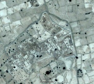
The photo is out of date: the minaret has since collapsed.  Of the satellite image, Eric notes “The actual shrine (mosque, mausolea, cemetery) in the north part of complex was destroyed by a flood in the late 1960s and is now completely ruined. Members of the Sufi order meet in the Guest House, next to the Shaykh’s house, in the complex’s eastern village. Half of this village too is ruined. The village at the west of the complex contains the shrine of Sidi al-’Arbi al-Ghâzî.”

We almost didn’t make it to the zâwiya: the piste was suddenly blocked by a pile of gravel, but the off-road edges were firm enough to take the busses.
SONY DSC
Once there, we were welcomed with cushioned seats, ritual hand-washing, cups of tea and peanuts.  Zoë sat in the place once occupied by Hassan II.

SONY DSC
As we spoke with Sidi Mustafa al-Ghâzî, the muqqadam or leader of the zâwiya, about Sufi practices, he (and later his son) came around sprinkling us with orange-blossom water from this container.  That felt an unmistakeable blessing: such a lovely scent!SONY DSC

“Can women be Sufis?” we wanted to know.   (John had told us that for the purposes of this evening, we would all be considered “honorary men.”  No women would appear though they would have cooked the dinner for us; if the women of the community wanted a look at us, they would peek in through the opening in the roof–and it would be rude to stare at any woman who was looking in at the roof.)
SONY DSC
“Oh, yes!  A very important early Sufi was a woman,” Sidi Mustafa replied.  (Rabi’a al-Adawiyya, 717-801 A.D.)  Eric confirms the existence of women Sufis: “In fact, I was once honored to be included as an honorary woman at a gathering of women Sufis in Senegal.”

I don’t quite have the chutzpah to ask how one would cross the gap between the invisible cooking women and these female Sufis.  If a daughter of this community wanted to follow the Sufi way, how would that desire be accomodated?  Or would it?

The best question of the night: “What’s the hardest thing about following the Sufi way?”
Reply: “Doing what the master tells you to do.  Accepting that guidance.”

IMG_1245

After several refills of tea and a dinner consisting of medfouna (a savory stuffed bread), bread and heaping platters of chicken for non-vegetarians, we move from discussion to recitation of the Qu’ran and of Sufi poetry.  After the recitation (which to uneducated ears sounds very musical) comes songs, accompanied by drumming.

Screen Shot 2014-01-13 at 11.03.11 PM Screen Shot 2014-01-13 at 11.05.57 PM

We loved the joy on the face of the muqaddam’s son, holding the hand drum in the photo above.  The young man below, a teacher in the local schools, did a soulful solo and eventually stood up to “dance”–this was a bouncing straight up and down, arms swinging out to the sides in a relaxed way, with some turning in a circular motion.
Screen Shot 2014-01-12 at 6.40.42 PM

As John had stressed before our arrival, the entire evening was carefully controlled by the muqaddam, whose drumming, voice, and non-verbal cues set the pace for every step of the evening.

Sufism in Morocco is sometimes associated with extreme ritual action, such as the self-mutilation of the Hamadsha, as detailed by Edith Wharton with a mix of gory fascination and cynicism:

At first these stripes and stains suggested only a gaudy ritual ornament like the pattern on the drums; then one saw that the paint, or whatever it was, kept dripping down from the whirling caftans and forming fresh pools among the stones; that as one of the pools dried up another formed, redder and more glistening, and that these pools were fed from great gashes which the dancers hacked in their own skulls and breasts with hatchets and sharpened stones.  […]  Gradually, however, it became evident that many of the dancers simply rocked and howled, without hacking themselves, and that most of the bleeding skulls and breasts belonged to negroes. […] Hamadch, it appears, had a faithful slave, who, when his master died, killed himself in despair, and the self-inflicted wounds of the brotherhood are supposed to symbolize the slave’s suicide. [… This account] enables the devotees to divide their ritual duties into two classes, the devotions of the free men being addressed to the saint who died in his bed, which the slaves belong to the slave, and must therefore simulate his horrid end.

Vincent Crapanzano offered a more nuanced psychological (or psychiatric) analysis of these rites of self-mutilation in the 1980s (The Hamadsha: a Study in Moroccan Ethnopsychiatry), but in any case, it’s hard to imagine anything further from the delightful devotions so graciously shared with us this evening.  We felt tremendously honored to be included in the evening, allowed a glimpse of faith in action.

Qsar defensive architecture, slaves, and colonial resistance

On the second day of our trip to the Tafilalt, John and Eric took us to visit a qsar that now houses a museum: Qsar al-Fidha.

First, we looked at some qsur (plural of qsar) from the outside, and talked about pisé or rammed earth construction.
SONY DSC
As we saw in the construction of the Fez medina, pisé or rammed earth architecture is both sustainable and locally appropriate.  The thermal mass of the thick walls offers insulation, keeping housing cool in summer and warm in winter.  Typically, construction uses subsoils low in clay, saving topsoils for agricultural use.  The mud can be shaped into bricks which are sun-dried; these are then stacked in a temporary frame and connected using a mud slurry.  Alternately, damp soil can be poured into the frame and directly tamped down using ramming poles, working up 4-10 inches at a time until the top of the frame is reached.

According to Wikipedia, rammed earth holds humidity “between 40% and 60%, the ideal range for asthma sufferers and for the storage of such susceptible items as books.” For an academic with an asthmatic child, this is of no small interest!  The width of rammed earth construction also offers significant sound-proofing, helpful when an entire village is living cheek-by-jowl.

The downside of pisé construction is the ongoing labor of its maintenance.  A new earth-based rendering needs to be applied almost every year in order to keep the walls from dissolving in the winter rains.  And the communal nature of the qsur means that if your neighbor lets her house disintegrate, your house is much more vulnerable to decay.  Here, external ramparts work to support a wall whose decay threatens its neighbor.
SONY DSCThe process of decay also makes visible the rammed earth bricks underlying the connective slurry.
SONY DSC SONY DSC
Another example of earthen bricks in the process of decay; water pipes working direct water far from the rammed-earth walls.

(John also mentioned a 20th century Egyptian architect, Hassan Fathy, who works with rammed earth.  Unfortunately, Fathy’s carefully designed rammed-earth village has suffered from salt-stone foundations; if you’re interested, the village is featured in this video: https://vimeo.com/15514401.  Rammed earth is becoming a hot topic on sustainable building sites: check it out.)

On to Qsar al-Fidha!  Eric describes the “onion” layering of this particular  qsar: a large outer courtyard, surrounded by walls; a smaller inner-walled compound, with additional buildings around the edges; a central compound which was occupied by the governor of the local province, “always a member of the royal family.”

The first courtyard or mashwar is big enough to allow the drilling and display of military force, though at the moment, it mostly makes for a long walk for women and girls collecting water.
Screen Shot 2014-01-14 at 9.23.15 AM

In the photo below, our host Abdullah, the head of the museum, proudly descended from the upper slaves of the royal family, crosses the mashwar to prepare for our visit.  Certainly, the size of the space has a psychological effect on a lonely visitor.
SONY DSC

When you pass through the gate pictured above, you find yourself facing a wall: this was an obvious architectural defense strategy, breaking the momentum of any possible enemy charge:
IMG_1096

A second “elbow” turn in the structure of the qsar served as a guardpost, where the guardian of the village could keep an eye on everyone coming in and out (and what they were carrying).  In this particular qsar–the qaidate, or the local center of government–the guard post would also have been the place where taxes were delivered and counted.  Taxes were paid in kind, so people would have brought bushels of wheat, quantities of dates, heads of sheep and so on.  This would also have been the courthouse, where unresolved conflicts across the oasis would have been brought to be decided by the governor, or more likely his deputy.  The finer stucco finish of this gate area speaks to its grander purposes (unfortunately, the photo doesn’t give much sense of the space included in the L-turning).
SONY DSC

Soon after the guard post, the corridor/street gives access to the mosque and the well.  Two things you could not refuse a traveler: water and a place to pray.  (But you could position those resources close to the guard post so that you could keep an eye on those dubious strangers.)
Screen Shot 2014-01-14 at 9.47.45 AM Screen Shot 2014-01-14 at 9.48.08 AM

The well only provides water for washing now–the water quality is too low for drinking or livestock or irrigation–hence the long walk out to the more modern water fountain.

The next layer of the onion brings us to the governor’s palace.  Here, we see classic white-and-blue plasterwork designed to rest the eyes from the glare of the sun as you enter a darker space.

SONY DSC

Before we get to that restful vision, however, we pause once again in the antechamber to hear John’s account of the qaidate under the French and earlier.
IMG_1102
Our host, Abdullah, is proud of his lineage, drawn from high-level palace slaves.  Here he holds  pictures of the Alawite dynasty his family has served through the generations.  As John explains it, Abdullah’s father would have been given as a slave to the son of the governor  when he was a boy.  The two boys would have grown up together, as intimates, closer than brothers, since the royal boy’s brothers would be competing with him for power.  Once grown, the governor’s slave would be the second most powerful man in the region, offering a separate channel of access to the governor.  People would approach the governor’s advisor (rather than the unapproachable governor) and pay him to put their case to the governor.  The advisor-slave would maintain his power by being absolutely honest with the governor, so he would have to choose the cases he accepted with care.
IMG_1103
Audiences held in the antechamber probably featured the governor sitting in front of a curtain, a curtain that could serve many purposes: decoration and demonstration of power, but also a hiding place for the governor’s advisor/slave.  The governor in thinking over an issue raised by an audience could lean back slightly to hear from behind the curtain the views of his slave advisor on the matter or the people at hand.  (Yes, yes, the wizard of Oz and the man behind the curtain definitely comes to mind here.)

But these kinds of governing structures also had a role to play under colonialism, also known as the French Protectorate.
Screen Shot 2014-01-14 at 1.41.32 PM

The Tafilalt was one of the last parts of Morocco to fall to the French.  The center of this region fell in 1930; the outskirts, down to Zagora, held out until 1933.  The battle around Jebel Sahro cost the French more officers per capita than were killed in World War I.  (Local people targeted the easily-recognizable officers, having realized that the rest of the soldiers didn’t know what to do if the officers were killed.) Force majeure concluded the struggle: the French brought over their long-range artillery from French-held Algeria and bombarded the town until concessions were finally made.

Screen Shot 2014-01-14 at 2.13.01 PMArea of heavy resistance to the French

Victory was relative.  Our host remembers his father answering the phone, setting the receiver down, and walking away.  An hour later, he might return, pick up the receiver and say, “Oh! you’re still there!  I forgot about you!”  The message? “The qaid rules here, not the French.  You will have access to the qaid when I feel like granting you that access, not before.”

So the French would have to get in a jeep and drive from Erfoud to this qsar in Rissani, just above Merzouga–only to find that they were kept waiting at the gate until someone could be bothered to let them in.  Same basic message.  This kind of passive resistance persisted for some 20 years.  Only in the 1950s did the French decide to move the administrative center to Rissani, shifting the caid’s office to the same building, in order to acquire ease of access.  Until independence in 1957.


Sijilmassa’s rise and fall

Sijilmassa might have been founded by Kharijites and their supporters, but the rich city, repeatedly conquered by reforming dynasties such as the Almoravids (1055-1146 in Sijilmassa) and the Almohads (1146-1269), soon had the heterodoxy beaten out of it.  The Almoravids smashed musical instruments and closed down wine shops throughout the city; Almohads massacred many of the Jews of Sijilmassa.  Yet the city as a whole expanded after the Almoravid conquest (1054) and “retained its enlarged importance through the Almohad period” as a result of improved water resources: the redirection of Ziz to the center of the Tafilalt. [Lightfoot & Miller]

So what did Sijilmassa look like, back in the day?

Here’s Lightfoot and Miller’s conceptual map of the city, drawn from oral histories of the area as recorded in the mid-1990s:Screen Shot 2014-01-14 at 2.33.43 PM

A long, thin city, bordered by a canal on one side, surrounded by a walled oasis.

Medieval historian Al-Bakri, drawing on the chronicles of Ibn Hawqal, records that in 814-5, an early ruler of Sijilmassa, Al-Yasa’, built a wall surrounding the town: the wall had twelve gates, eight built out of iron.  Under Al-Yasa’, Sijilmassa also acquired a royal palace, an “excellent” mosque, “lofty” mansions, “splendid” buildings, and many gardens.  Field and photo reconnaissance confirms that both the city and the oasis were once walled. [Lightfoot and Miller]

The famous traveller Ibn Battuta came to Sijilmassa in 1352-3 on his way to the Mali empire. Comparing Sijilmassa to cities in China, Ibn Battuta described Sijilmassa as including “orchards and fields and their houses in the middle,” making the city as a whole very large.  These houses were undoubtedly different from the fortress-villages of the qsour, but this description shows an established pattern that the later qsur may have built on.
SONY DSC

Ibn Battuta spent four months in Sijilmassa, preparing for a two-month Saharan caravan crossing.  Camels were traditionally fattened for several months in the area around Sijilmassa to prepare them for the arduous journey.
SONY DSC
Ibn Battuta also noted that the average trans-Saharan caravan included 1000 camels; large caravans might include as many as 12,000 camels.  Miles and miles of camels.
IMG_1353
Mindboggling.  You wouldn’t want to be at the back of the queue.

According to medieval geographer Leo L’Africain, the city fell in 1393, when the inhabitants rebelled against the Marinid governor (renowned in oral tradition as the “Black Sultan,” as recorded by Lightfoot and Miller), broke down the walls of the city, quarreled among themselves, and distributed themselves amid the qsur (fortified villages) of the oasis.  Writing of his two visits between 1510 and 1515, L’Africain praised the ruins of the city:

The city was built in a plain, on the Ziz, and was encircled by a high wall of which one can still see some parts…. Sijilmassa had fine temples and colleges supplied with numerous fountains whose water came from the river.  Great wheels took this water from the Ziz and projected it into conduits bringing it into the city.

Mostly, though, L’Africain saw the fate of Sijilmassa as something like an object lesson in the importance of cooperation:

Back when the people were all agreed, they built…walls to stop the incursion of Arab horsemen.  While the people were united, with a common will, they remained free.  But factions arose, and they demolished these walls and each [group] called upon the Arabs to protect them.  So it is that these people have become the subjects and almost the slaves of the Arabs… always fighting each other, doing as much harm as they can, which is to say damaging the irrigation canals which come from the river, [or even cutting] off palm trees at their trunk and steal[ing] from each other, which the Arabs abet.

You could almost say that when, in the early twentieth century, the French and their Moroccan collaborators destroyed irrigation canals and sabotaged water resources, “manufacturing a fifteen-year-long drought, followed by the 1944-5 famine” (Ilahiane), they were following something of a time-honored tradition.

Now, the al-bayud fungus is one of the greatest threats to the palmerie.  Kind of a relief–or maybe not, depending on how seriously your palm tree is infected.

SONY DSC
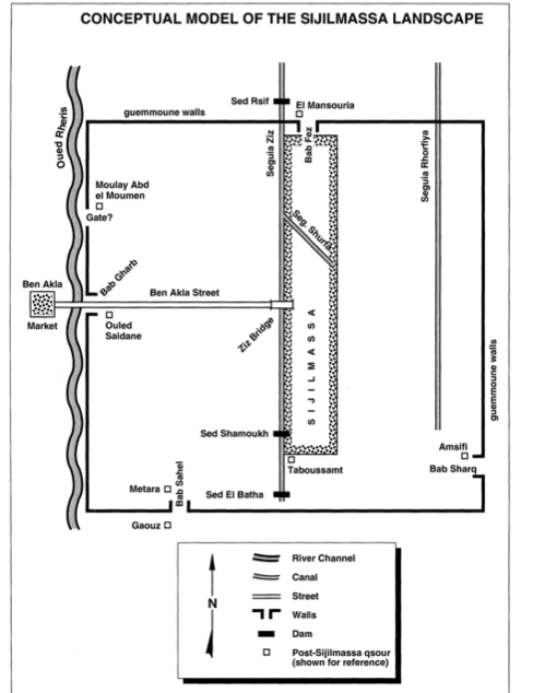
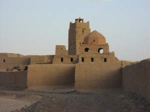
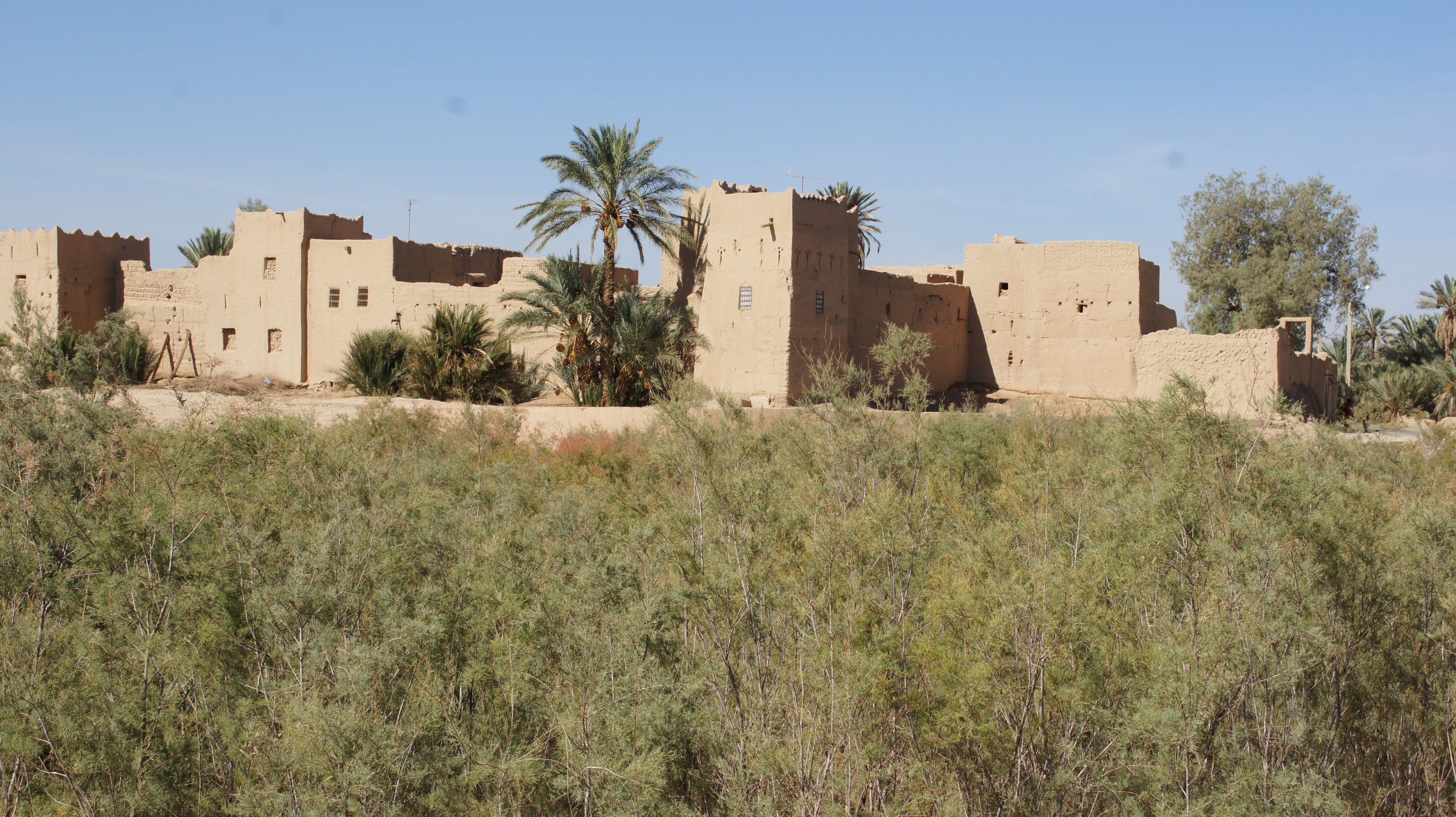
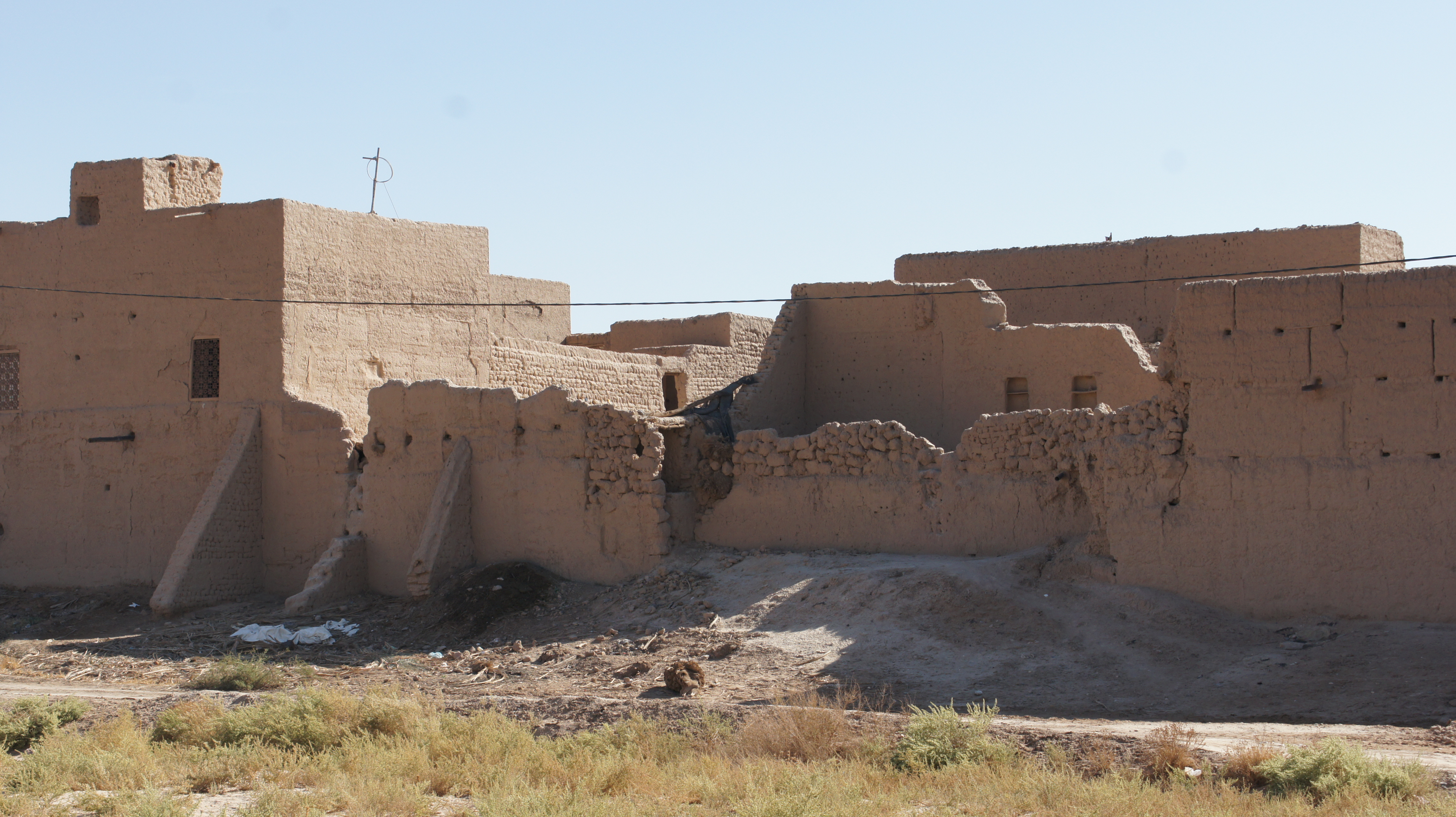
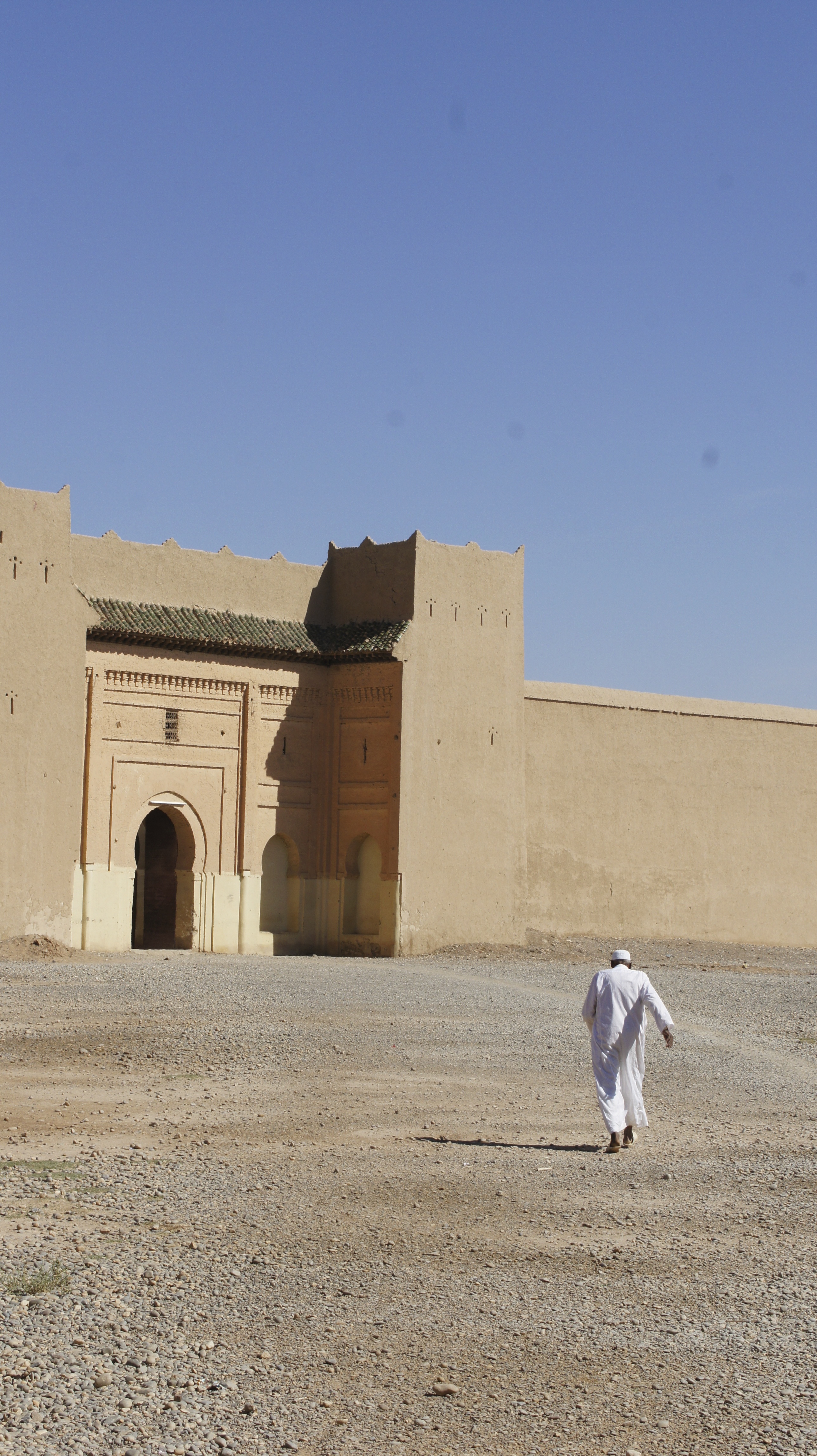
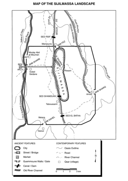
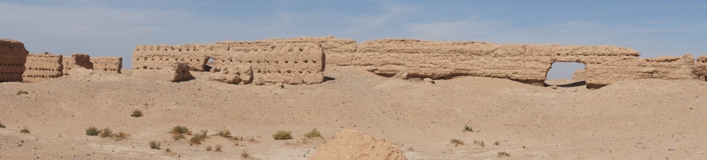
What remains of Sijilmassa today are actually the ruins of a mosque built in the 1600s and 1700s by the Alawite dynasty.  These are atmospheric if somewhat misleading: I spent ages imagining (incorrectly) thousands of camels parading through these walls.
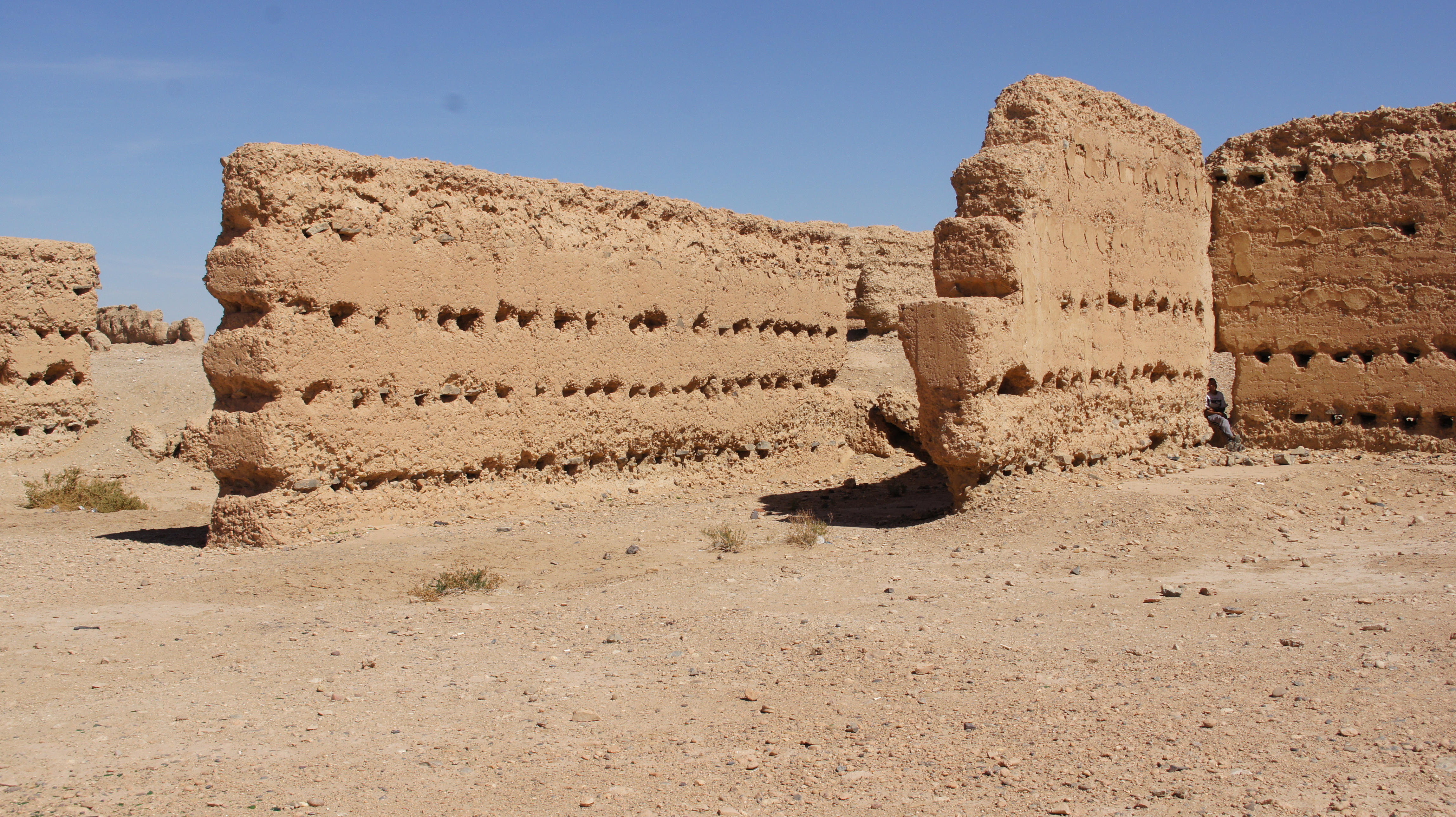
SONY DSC

For a Romanticist, of course, it’s also easy to think of Shelley’s “Ozymandias:”

“Look on my works, ye mighty, and despair!”

*****Quotes drawn from from Dale Lightfoot and James Miller, “Sijilmassa: The Rise and Fall of a Walled Oasis in Southern Morocco.”  Photos from Tafilalt visit with John Shoup and Eric Ross.

Sijilmassa, ethnic complexity, and the Haratine

Sijilmassas was founded by Kharijites and their followers in 757: so the story goes.  Sometimes I wonder about these founding claims, though.  Wasn’t there anyone living on the fertile banks of the Ziz river in 757?

1376693810_arabsudan99gi

“Sedentary peoples may have settled the oasis as early as fourth century BC, depending on irrigated agriculture and herding for a living.”[1]  Those sedentary people might (still speculatively) have been the ancestors of the Haratine: dark-skinned, African-featured inhabitants of the Tafilalt, hereditarily constrained to the status of indentured servants, tied to the land and working for Arab, Berber, or Jewish inhabitants of the oasis.

images
(both images–“Haratine girl in Morocco” and “Haratine” above–web caught)

Huh?  So the Haratine, potentially the “original” inhabitants of the Ziz region, lost control over the land to newer arrivals, and were themselves compelled to labor for their oppressors?  Doesn’t that all seem depressingly familiar and predictable?

Let’s try a different recap:

Arabs (the Kharijites) and Amazigh [Berbers] (Zenata) settle Sijilmassa on the labor of the Haratine; Jews and other merchants (like the Genoese in the 1300s) settle in Sijilmassa, both financing the salt trade and, at least in the case of the Jews, working as artisans.  Slaves, moving through Sijilmassa to the north, also constituted a significant portion of the population.

According  to Dumper and Stanley, Jewish networks “along the major North African and trans-Saharan routes [were] a crucial facilitator in building Sijilmassa’s monopoly.  They [Jews] were also important artisans, providing specialist skills as metalworkers, jewelers, tailors, cobblers, and carpenters.  Their community prospered, and the Tafilalt Abuhatzira family in particular became regionally known for their piety and rabbinic influence.”
Jewish-Women Jewish women in Tinghir

But only Arabs and the Berbers could own property–so the system was rigged to make race into a class issue.  Arabs and Berbers could own land; Jews could not, but they could amass wealth; Haratine were limited to sharecropping, subordinated to specific families; slaves lived with Arab, Berber, or Jewish families.  Comparisons are invidious, we know, but some would say that slaves–mostly domestic servants and concubines–were better off than the Haratine, who held a role not unlike that of a field slave in the antebellum American South.

The French attempted to leave tribal relations more or less intact (once the area was “pacified”), but their intervention in the region opened new possibilities.  Jews were the first Moroccans to adopt the French language; the large Moroccan-Jewish community emigrated to Israel en masse in the years after independence.  During the Protectorate, large numbers of Haratine migrated to southern Algeria or Morocco (later, to Europe) in search of work.  Unlike Arabs and Berbers, the Haratine had nothing to lose at home–and the money they sent back to the Tafilalt enabled Haratine families to purchase land and trees, acquire cultural capital, and earn at least a few places on village councils, much to the displeasure of prior power-holders.

(By contrast, the Haratine in Mauritania continue to suffer state-based discrimination.  Slavery was criminalized in 2007, but anti-slavery court cases are backlogged and slow to progress.  And in 2011, a new census, designed to systematize national identity documents, recognized only four ethnic groups (Moorish, Soninké, Fulani, Wolof), and failed to mention the Haratine, often considered “Black Moors,” who by some counts constitute roughly 40% of the population.  See http://www.minorityrights.org/5179/mauritania/haratin.html.)

But if power relations in the Tafilalt and other Moroccan oases have shifted somewhat, ethnicities remain distinct, much as they do in the American “melting pot” where melding is more obvious in social claims than in reality.  And the oases themselves are threatened by ecological challenges, particularly the ever-deepening demand for irrigation.

1.  Michael Dumper and Bruce E. Stanley, eds., Cities of the Middle East and North Africa: A Historical Introduction, ABC-CLIO, 2007.

See also Hsain Ilahiane, Ethnicities, Community Making, and Agrarian Change: The Political Ecology of a Moroccan Oasis (University Press of America, 2004), and Anna Natividad Martinez, “Intertribal Conflicts and Customary Law Regimes in North Africa: A Comparison of Haratin and Ait ‘Atta Indigenous Legal Systems” (http://tlj.unm.edu/tribal-law-journal/articles/volume_5/intertribal_con…omparison_of_haratin_and_ait_atta_indigenous_legal_systems/content.php).

The road to Sijilmassa

The road south from Ifrane to the Tafilalt oasis is marked by a beautiful stream that always lifts my heart,
IMG_1017
more commonly by dry river washes,
SONY DSC
(where water remains, somewhat surprisingly, just a foot or so below the surface), and perhaps most consistently by the evidence of remarkable geological forces at work:
SONY DSC.
If you’re six, however, the road is punctuated primarily by sandwiches and animated videos:
SONY DSC
Thank heavens for well-equipped friends!  It’s a long road.

We’re tagging along on a trip with Worcester Polytechnic Institute (WPI), the culmination of their 7-week sojourn in Morocco, doing an integrated field study project.  John Shoup, anthropologist, and Eric Ross, geographer, both of Al Akhawayn University (AUI) are leading the trip. (Both photos lifted from the internet: apologies.)
pic_1386671815  eric-driving-home

We’re headed to the Tafilalt oasis and to the site of a powerful medieval city, Sijilmassa.

Screen Shot 2014-01-09 at 2.41.32 PM
Lightfoot and Miller, 2006.

Sijilmassa was once one of the most powerful urban centers of the Maghreb; one medieval chronicler [Mas`udi] claimed it took half a day to walk Sijilmassa’s long main street.  The eleventh-century writer Edrissi described it this way:

As for Sijilmassa, it is a big and populated city, visited by travelers, surrounded by beautiful gardens and fields inside and outside [the ramparts]; it does not have a citadel, but it consists of a series of palaces [ksur], houses and fields, cultivated along the banks of a river coming from the Western side of the Sahara; the floods of this river, during summer, resemble those of the Nile, and its waters are used for agriculture in the same manner as those of the Nile are exploited by the Egyptians. [qtd in Iliahane (2004), 40]

I’m a little obsessed with Sijilmassa.  It seems to me that the vicissitudes of this vanished city are somehow central to the aspects of Morocco I find most baffling: the nearly miraculous creation of a nation on the edge of a desert; the (disputed) segmentation of Maghrebi society, with Arabs, Berbers, Jews, “blacks” and other foreigners remaining quite distinct despite general insistence on social pluralism; the perhaps-related silence around race; the reverence accorded the king; the role of Islam in public understanding of the nation.
SONY DSC

Bear with me, if you will, as I look into the history of the region and the city in a series of related posts, focusing (albeit not in any particular order) on (1) irrigation technologies (for building or maintaining oases in the desert), (2) Sijilmassa’s founding and social history, (3) agriculture or permaculture: the growing patterns of the palmeries, (4) the religious institution of the zawiya, (5) the architecture of a royal qsar in relation to local resistance to French colonialism.

References:
Dale R Lightfoot & James Miller, “Sijilmassa: The Rise and Fall of a Walled Oasis in Medieval Morocco” in Annals of the Association of American Geographers 86:1 (Mar 1996), 78-101.

Hsain Ilahiane, “Ethnicities, Community-making, and Agrarian Change: the Political Ecology of A Moroccan Oasis” (University of America Press, 2004).


Aazerf: the law underneath the law

At the start of our tour of Telouet schools, we stop for a breakfast break.  We three visitors (and later, the teacher Lahcen) traipse across the road to have some tea with a man I take to be the director of the school; Ahmed describes him as the chief of the village.
IMG_1099
Tea turns out to be more elaborate than I had anticipated. The house is traditional pisé architecture (“Take a photo of the roof,” Ahmed and Hassan urge me: the traditional beams are palm trunks).
IMG_1100
Our host, El Basheer, vanishes briefly; a woman greets us shyly then vanishes as well. When El Basheer returns, he brings with him traditional hand-washing equipment: Ahmed picks up the soap and washes his hands over the basin while El Basheer pours the warm water. We all take turns. Once you’ve washed and dried your hands, you pour for the person next to you in line; soap waits on the edge of the container catching the water.
SONY DSC
Then comes the sweet tea, along with four loaves of fresh, hot bread, with honey and butter and olive oil and olives. The bread is particularly good—warm, thick, light, and crusty—but it’s all delicious, and we give it our full attention. I worry briefly that if each school visit is going to include this kind of food, I may not be able to keep up.

The Tamazight-and-Darija conversation washes over me, with periodic breaks for translation into French, mostly by Ahmed. We canvass my appearance as an American, and the three men discuss previous American NGOs active in the area, along with the much greater French activity at present. The obligatory family inquiries turn up an interesting detail: El Basheer’s nephew is going to university for Islamic studies, something of a scandal because El Basheer himself is an old lefty, a member of the Istiqlal (the nationalist party). El Basheer smiles at me: “I just can’t understand it!” That younger generation…” By process of association, conversation shifts to the city of Kelaa-M’Gouna, where Hassan is now inspector of schools. Kelaa-M’Gouna is known for its political polarization: it sends half of its graduates to university in Islamic studies, the other half to university for Amazigh or Berber studies. How do these opposites co-exist in one city?

Screen Shot 2013-12-23 at 9.55.56 PMThen the conversation turns to a recent announcement from the local minister of education: all female teachers will be assigned to schools in Ouarzazate itself; all male teachers will be sent out to the small villages. It’s a potentially gallant gesture, saving young women from harsh living conditions: no electricity or running water in some places. But no one thinks the announcement is a good idea. What happened to equality? “Il est fou!” El Basheer sums up for my benefit. The minister of education is crazy! “It would have been simple to achieve the same effect without making such a stupid announcement. Now he’s got everyone’s back up.”

As we walk back out to the car, I thank El Basheer for his hospitality and mention in passing Ahmed’s remark that El Basheer is the chief of the village. I mean only to extend the compliment. But El Basheer takes issue—serious issue—with this statement: “I am not the chief! I am an elected official—un élué. A chief is something from the past. I am elected, elected! I am no different from any other member of the village.”

OK, I get it: I’ve made a post-colonial blunder. I seem politically naïve. “You want me to know you’re not like the Glaoui.”

“No! I’m an elected official. Elected. A chief is for life.”

I try to shift the focus a little by asking about the size and composition of the village. There are five families in the village—founding families, some of whom live further out now—and each of these five families sends a representative to a kind of village council. Total population: roughly 475 people. (Those are big families, I think to myself: multiple generations.)
IMG_1101
There are disputes about land and sometimes about other resources, but most of these are easily resolved. As we drill down into the details, El Basheer tries to clarify for me: this is l’aazerf, the ancient, oral tradition of governance. It underlies the rule of law, and it rests a little uneasily under the government and the structure of modern law. The government accepts it, because it serves the interests of the government in resolving local conflicts and issues, but l’aazerf is neither the modern government nor the law.

Hassan and Ahmed are waiting for me by the car; we all say our goodbyes and then the three of us drive off.

“He didn’t like it when I called him the chief,” I say, partly to explain the length of the conversation I’d been having.

Ahmed smiles. “Nonetheless, El Basheer is the chief.” I look back at him in surprise. “Absolutely. Every person in that village would move the entire village a mile up or downriver at a gesture from his little finger.”

“He wanted me to know he was an elected official, not a chief.”

Ahmed’s smile deepens. “Oh, yes, he’s elected. He didn’t want to run for office, so each of the families in the village sent a representative to ask—or really to insist—that he accept the role. The elected chief.”

We turn a sharp corner to find a large truck barreling at us and conversation halts as Hassan slams on the breaks. The car stalls. We take a communal breath.

“I was protecting the car,” Hassan explains with a grin, starting up again.

“Thank you!”

“He was scared,” teases Ahmed from the backseat.

“I was scared too!”

“But not me,” says Ahmed, “because I’m further back.”

Women’s weaving collective at Tarmilat

On the southern back road out of Ifrane, heading toward Azrou, there’s a kind of squatter’s community on the open ground to the right of the road.  This town is known as Tarmilat; it’s  home to a group of shepherds.  The original families came to this area some 50-60 years ago, right around independence.  Probably they looked after sheep for the French, or perhaps for wealthy Moroccans collaborating with the French.

Now there are some 50 families living here, in houses built from stone, roofed with large tin cans that have been cut open and flattened.
IMG_0882
The contrast with the royal palace, whose entrance is across the road, a little ways back, is striking.
IMG_0883
Karen Smith, Christian pastor at Al Akhawayn University (AUI), has brought a group of AUI affiliated folks–mostly students, a few faculty–out to Tarmilat to purchase rugs and bags and share a meal with the women weavers.

IMG_0887
Half a dozen years ago, a group of high school students, working with an AUI-affiliated organization called Hand in Hand wanted to raise money to help the people of Tarmilat.  Karen, a member of Hand in Hand, insisted that they begin by meeting the women and finding out what the women themselves needed and wanted.  What they wanted most was to form themselves into a weaving cooperative, even though only a few had weaving skills.

Karen remembers driving one of the women and her baby up to Tangier to learn from a successful cooperative there about how to form such an organization.  Imazighen women don’t diaper their babies–something Karen hadn’t yet learned–so she had no sheets or towels to protect or clean the car or the mother.  “It was an experience!”

IMG_0888
The Tarmilat weaving cooperative has been very successful, leading to other changes in the community.  To begin with, none of the women could read or keep track of numbers, so there was one man serving as treasurer for the collective.  “One man and twenty eight women: that was never going to last!” says Karen.  (Someone else told me later that the treasurer was accused of stealing the women’s money.)  Perhaps as a result of this experience, the women were very concerned that their children go to school.  But the nearest school was in Ifrane itself, some five kilometres away down a road not safe for pedestrians.
SONY DSC

The community started trying to build more permanent structures, claiming Karen had told them this was necessary for their cooperative (not true).  These structures were impermissible and had to be taken down.  But when it came to a school, the women pulled every string they had access to: the biggest string was Hand in Hand, with the governor’s wife on board.  Wala! (Voilà!) The community now has a cement school and even a mosque–but the homes remain stone-and-recycled-can structures.

SONY DSC IMG_0907Inside most of the buildings, it’s dark and a little smokey–but the home-made bread, butter, and tea is delicious.  In the right-hand photo above, the blue-and-white thing in the upper right corner is a “churn” for making butter: it’s a kind of swing in which the cream is pushed back and forth to make it slosh around until it solidifies.  This cooking hut is warm with the fire, so many of us crowd in briefly to get out of the chilly wind.  To our right is one of the community’s looms, with a rug in process:
IMG_0906

Our family buys two “lap rugs” (thick and small) against the coming winter, plus one small rug for the kitchen.  Each piece has a tag describing the weaver, in English geared toward the AUI community:
SONY DSC SONY DSCIto, pictured here, was one of the founders of the cooperative, and a major force in pushing for the school.  One day, a Moroccan friend came to tell Karen that Ito had died, since everyone knows that Karen has been closely involved in the Tarmilat community.  Karen and Fatima drove out to Tarmilat to attend something like a funeral.  They sat around with a group of women mourning Ito and they all told stories about her, describing how they had known her.  The next day, someone from Tarmilat came to town to tell Karen that in fact Ito was alive and well–it was a different Ito, from the same family, who had died.  Now there are jokes about Karen having attended Ito’s funeral prematurely.

SONY DSC SONY DSC
Aisha is one of the wealthier members of the Tarmilat community, as this tag notes: her husband has a hired hand; her grown son works for the city and owns a truck.

SONY DSC SONY DSC
Fatima, by contrast, is the second wife of a elderly deaf man whose first wife is disabled.  I can’t help but wonder about the internal dynamics of this family structure–or what Fatima’s earlier circumstances were, that made it sufficiently appealing to accept a marriage that seems mostly a formalization of caregiving responsibilities.  I love the simplicity of her rug.

As it gets dark, we gather inside Ito’s house, with a dim bulb powered by a solar panel bought with proceeds from the cooperative, and the community serves us a f’tur-style dinner: bread and msemmen and hard-boiled eggs and harira soup.  There’s a new baby in the community: a baby born to two 15-year-olds who were married last year.  Julie Reimer tells of attending the wedding and becoming the official photographer because she was the only one with a camera.  When she came back to the community to share the photographs later, the mother of the bride was (mildly) offended because Julie had not taken any pictures of her.  “She was wearing a bathrobe,” Julie explains, “so I thought maybe I shouldn’t take a picture.  Turns out, it was her very best bathrobe.”

I asked Karen if we could arrange for Zoe and me to have weaving lessons.  “Probably.  There was a student from Haverford who came and stayed at Tarmilat for three months a few years back (part of an anthropology thesis) and she learned to weave.  The gendarmes were not at all happy about it, though.”  Maybe once our Darija improves…

The mothers are not the only entrepreneurs here: the boys of the community build sleds out of old wooden pallets and (sometimes broken) skis.  When it snows, the boys stick their sleds in the drifts by the side of the road and hire them out to tourists who have come to see the snow.
IMG_0920
James makes friends with some of the boys by video-taping their play and then showing them the results:
IMG_7963

These hills are full of small communities like Tarmilat, though Tarmilat with its school and its mosque and its solar panels now ranks among the most prosperous.  What would extend the (relative) success of Tarmilat to other communities in the Middle Atlas?IMG_7930
(photo by AUI student)


Zellij

It’s a little hard to believe that something like this:
fj4WAjGD-M5AtA37jkX3Y_VWdtNE1AgjMjoqiIwS4xwstarts out something like this:
SONY DSC

Or, to be more accurate, it starts as a bit of mud, which is shaped into a tile and glazed; those glazed tiles then have patterns sketched upon them and a maalem or master craftsman cuts the tiles precisely into tiny khatams, safts, and related shapes. 
SONY DSC

The last day of the Art of Islamic Pattern study tour, we visit a zellij workshop.  The maalem or zellij master sits cross-legged on the floor all day, chipping the tiles into shape.
SONY DSC

He set up a chair for us neophytes, though, insisting that it was too difficult for us even to attempt to chip a tile from a cross-legged position.SONY DSC

The chisel is heavier than you might think, and some coaching is in order:SONY DSC

It turns out that the crucial factor is the angle between the chisel, the tile, and the thin metal surface on which the tile rests.
SONY DSC

Adam, a sculptor, says that this is a little like splitting stone: get the angle right, and a single blow on a huge block of stone will split it down to the floor.

Pages from a long-ago magazine article are posted on the walls of the workshop, showing various steps of the process:
SONY DSC
SONY DSC

Once everyone who’s interested has had a chance to try cutting the zellij, we go downstairs to the room where the zellij are actually assembled.

Sometimes, a frame is used…
SONY DSC

But clearly, some of the designs are created freehand:
SONY DSC

Notice that the patterns are constructed face down, with the colors obscured.  Imagine getting a color wrong in a split-second of distraction and discovering the mistake only at a much later moment of truth.

James arrives with Zoe and Jeremy just as we are about to make our own little tiles, so I let the children take over my piece:
SONY DSC

Once the pieces are arranged in the appropriate order, a temporary wooden frame is placed around them to hold them close together.  Then some grouting powder is sprinkled over them…
SONY DSC

and water is flicked onto that grouting powder with a paintbrush.  What fun!
SONY DSC

Then comes the plaster, rapidly applied by one of the apprentices of the workshop:
SONY DSC

While the plaster is drying, Jeremy tries out other patterns as the maalem (master) rapidly creates a few additional shapes for other people’s patterns.
K5F-pqO1z8fiP1UgX3UXWM23BU61r77Dvhs-sKbrS3o,GepcE4rqp82pJzyVgNNZkGhv8wJrkKQWXfWB5h-i5Bs

Finally, voila: the finished tile.
SONY DSC

Now we just have to extend that pattern a hundred-fold or so to arrive at a small fountain design…

Replicating and generating patterns of Islamic art…

is a whole lot harder than you might think–but also kind of obsessively compelling.bV90jY4TdgxKR9EQ32sl5tPrKBkHQk9MdCQS8rgczvM
Here, Adam is trying to teach me how to see the patterns, the grids, underlying biomorphic designs in the Al-Attarine, but really, it’s a bit of a hopeless task.  Take this panel, for instance:
SONY DSC
I thought this little creature with eyes should be the repeating motif.  So adorable!
SONY DSC
Oops.  Probably that’s not meant to be a creature at all.  The double loop at the center of the image below (and placed in the four corners of the design as well) is a better unit to focus on for tracking the extension and tessellation of the image.  See the grid that comes into focus around that repeated double loop?  You’re looking for a rhomb, a dynamic (or diagonal) square shape that repeats both vertically and horizontally.
SONY DSC
And now can you see why some of us might find this process challenging?

The plaster carvers would have created a cardboard (in medieval times, stiff paper or vellum) template to draw the design grid on the fresh, damp plaster.  Then they would have “pumiced” the shape through the template, leaving black pigment on the plaster–and then they would have used fine, sharp tools to carve out the plaster into these shapes.

Adam has carefully parsed pattern after pattern for us.  Here’s just one example: the stunning door and knocker at the Al-Attarine.  The knocker itself is a khatam (static square plus diagonal square extended out from it), extended further into an eight-pointed star…P1000939
What about the door behind the knocker?  It’s almost like a variation on my beloved “breath of the compassionate” pattern: khatams, some surrounded by four dynamic squares, diagonal crosses, plus safts (or petals) to fill out the pattern.
P1000940

Adam takes the analysis one step further, drawing out the incredibly fine (and faint) biomorphic design traced within each of those large safts:P1000941
Isn’t this amazing?  First, the painstaking detail of the design–and then the painstaking, even meditative recreation of that design.
j6BIb4UsPuxGleynG8_DWMILE285tbReBZhvaHKUZi4
Not to mention the painstaking correction of student errors in attempts to further replicate those designs…

Geometry and generation:
SONY DSC
On the geometrical side, meanwhile, Richard (having walked us through the many stages of creating a 12-fold rosette among other patterns), asks us to think about the shapes that can be generated from a khatam.  Some of us understand the question well enough to sketch some possible shapes.  (Tip: think about cutting pieces out of a khatam or possibly extending corners out to make a new shape.)

Richard chooses the most useful propositions and has us cut out templates for creating watercolor zellij–paper versions of the cut tiles used in Maghrebi mosaics.
SONY DSC
We paint and cut out the shapes, and then we play with different arrangements, from small to large:
CY1zwAqhmw_G1YkuvYv8ml4c2eEhCagJ6e76rsLvTuY   SONY DSC

Some principles for productive play: 1) think about the white space; 2) join shapes point to point, not side to side; 3) follow straight lines to extend patterns; 4) be intentional about color patterns; 5) share your pieces; 6) have fun!
SONY DSC