Category Archives: Geography and environment

How does the remarkable geographical diversity of this country shape its culture? What are Morocco’s environmental challenges, strengths, and strategies?

Zâwiyas: saints, economics, and politics

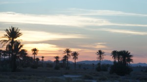
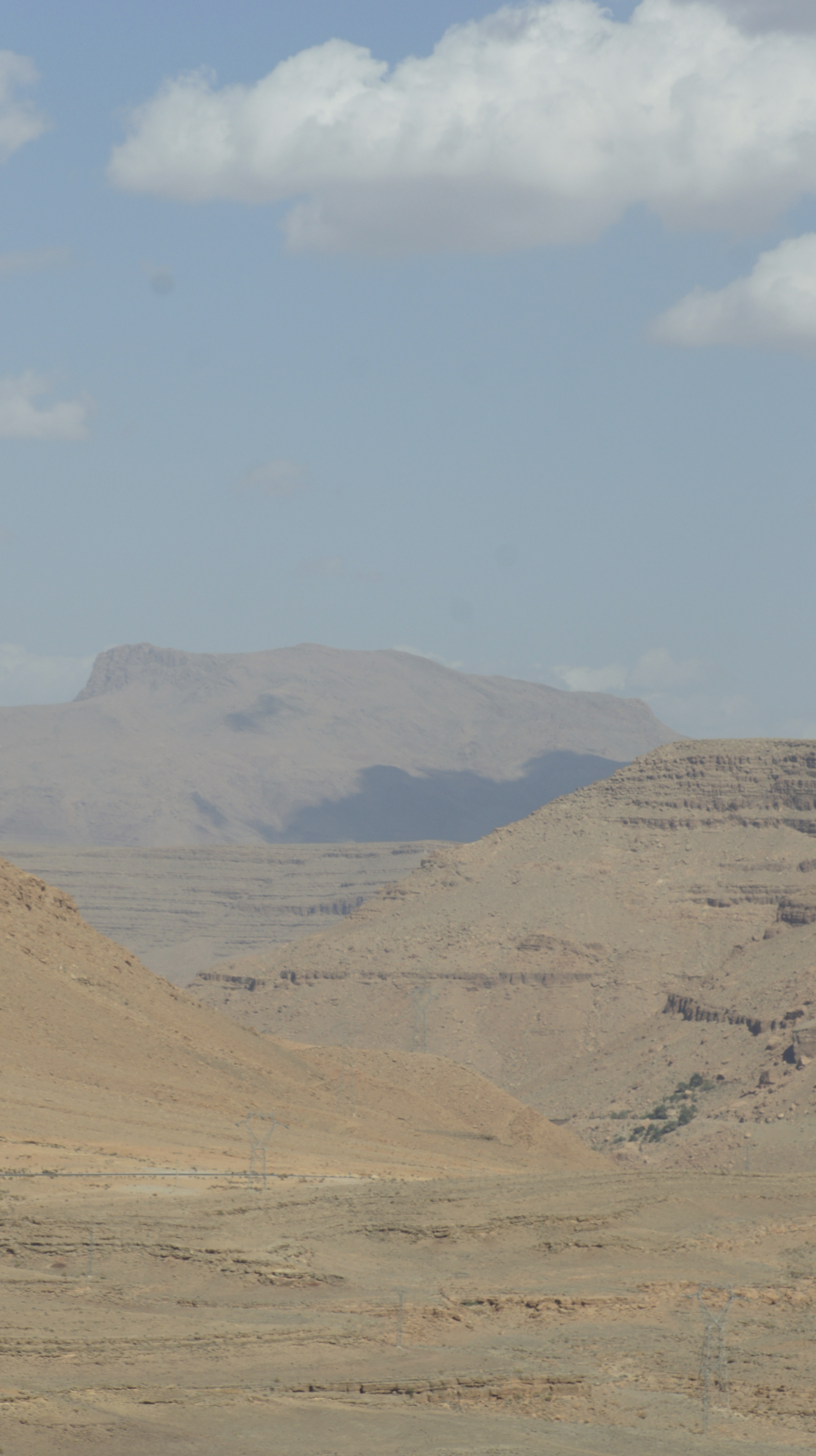
Still guided by John Shoup and Eric Ross, we are driving through a dramatic sunset to the zâwiya Sidi Al-Ghâzî to enjoy an evening of Sufi recitation.
SONY DSC SONY DSC

The evening will be focused on the religious aspects of the zâwiya or the Sufi brotherhood, but I’m also thinking about the political history of the zâwiya in this region.

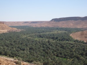
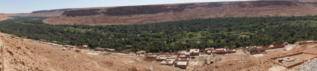
In the century after the fall of Sijilmassa (1393), the lack of a strong central government meant that local conflicts proliferated and escalated.  In that power vacuum, saints (also called marabouts) and the zâwiyas they founded became an important source of stability: the zâwiyas often provided a physical space in which warring parties could meet to negotiate, and the saints or holy men running the zâwiyas had a powerful influence over local politics.  Religiously-motivated donations to the zâwiyas also made them powerful land- and slave-owning institutions.

In a land of uncertain production, spiritual power (baraka) carries a lot of influence.  Water is everything–but water comes from God. “Rain or no rain is the realm of God” (Tafilalt villager quoted by Ilahiane).

The Alawite, the royal dynasty that came to power in the seventeenth century and still rules today, rose out of the Tafilalt and derived their political and economic power from their spiritual force (baraka).  Back in the 1200s, the citizens of Sijilmassa invited some 1,200 descendents of Muhammed to settle in the city; tradition states that they brought with them the cloak of Muhammed.  The Alawite trace their descent from Muhammed through his daughter Fatima and son-in-law Ali: one of their mottos, visible in calligraphy throughout the country, is “Baraka Muhammed.”
119px-Meknes_Medersa_Bou_Inania_Calligraphy

Tradition also tells us that the Tafilalt region was plagued with a crippling drought and the inhabitants asked for help.  According to one version of the story, the oasis-dwellers sent a message to the governor of Mecca himself, who replied by sending one of his sons to break the drought and rule the oasis, launching the Alawite dynasty.  A different version of the story (quoted in Ilahiane) claims that the inhabitants asked the help of an Alawite Sharif or holy man who was headed to Mecca on pilgrimage.  He promised to pray for the recovery of the palms and the oasis in exchange for the best stem of dates from each palm.  When he returned, the drought was broken and the palms recovered, but the inhabitants refused to give him the agreed-upon reward.  The Sharif proclaimed the entire oasis promise-breakers.  He told them “tafi bi l’ahd” (honor your promise!) and they replied “la, la, la” (no, no, no): Tafilala or Tafilalet.  This version of the story provides a semi-mythical explanation for the difficulties of the region: as promise-breakers, the inhabitants of the oasis and their descendants have been cursed to live in hardship and misery.

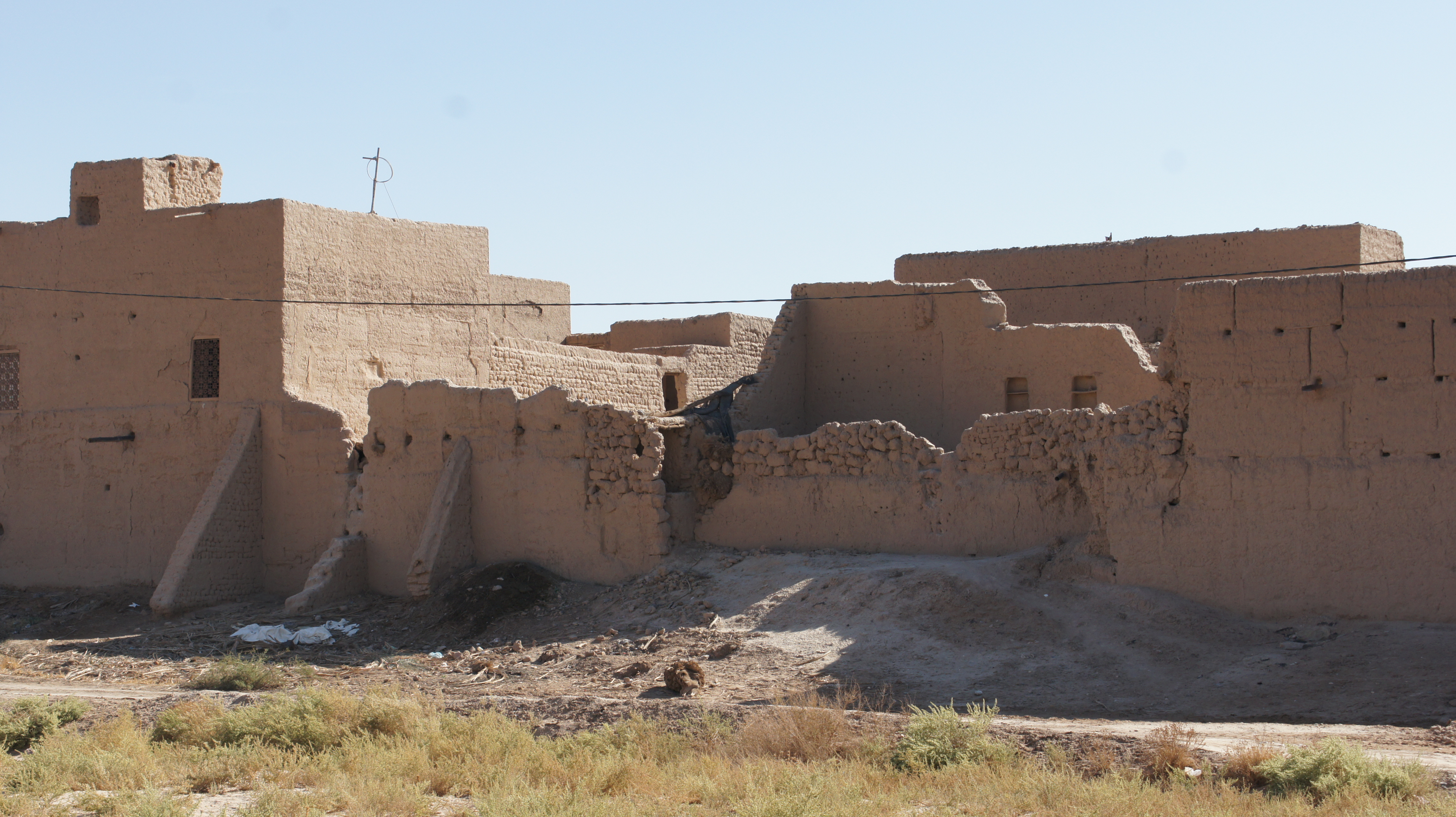
The zâwiyas too have fallen on hard times–or perhaps times were always hard.  As we drive through the gathering dusk, John tells us that the particular zâwiya we are visiting is grounded in the baraka of the saint Sidi Al-Ghâzî.  But three separate villages, all at war with one another, all claimed the saint as their own.  The resolution was to divide the body of the saint: one third to each village.

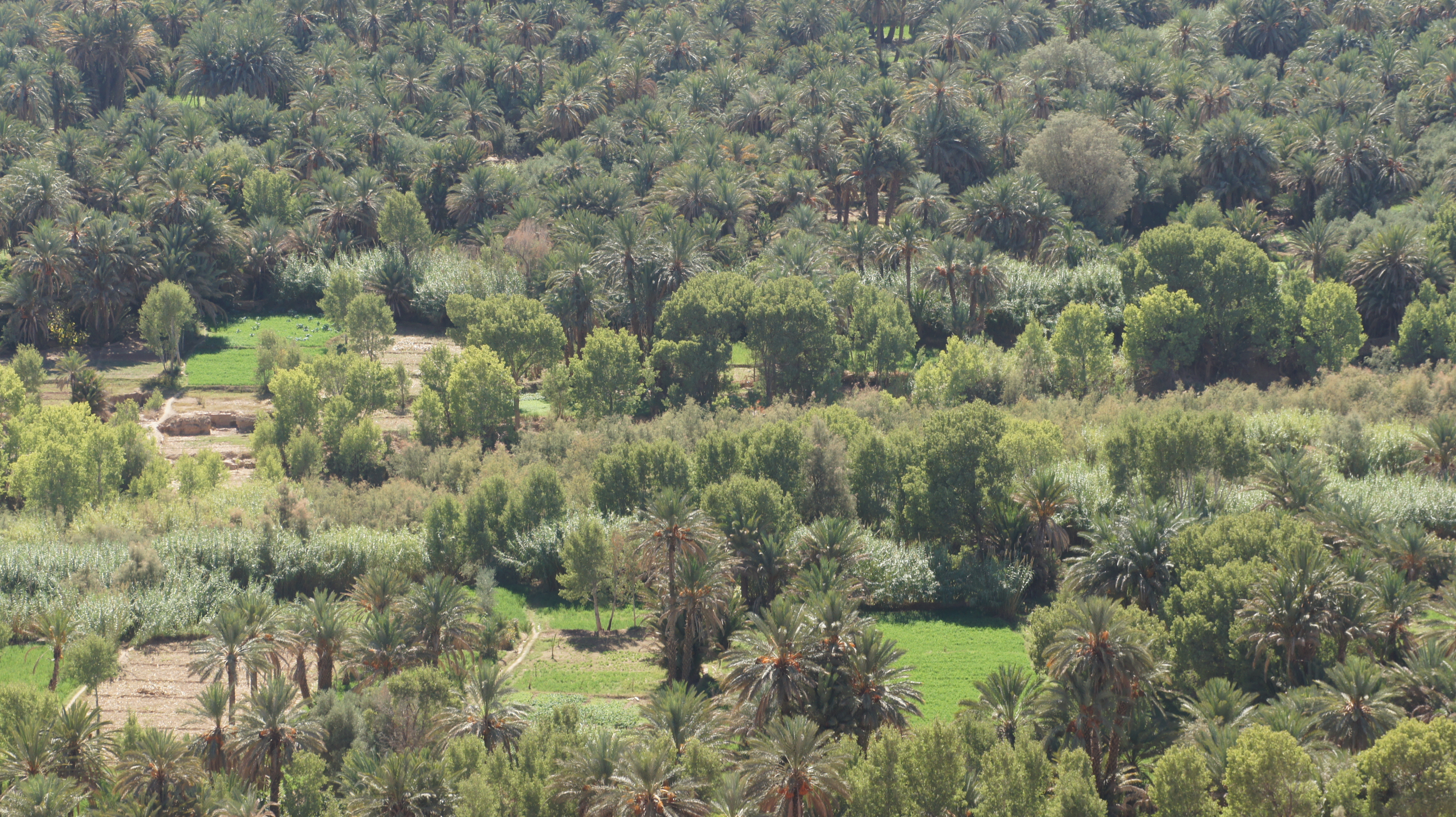
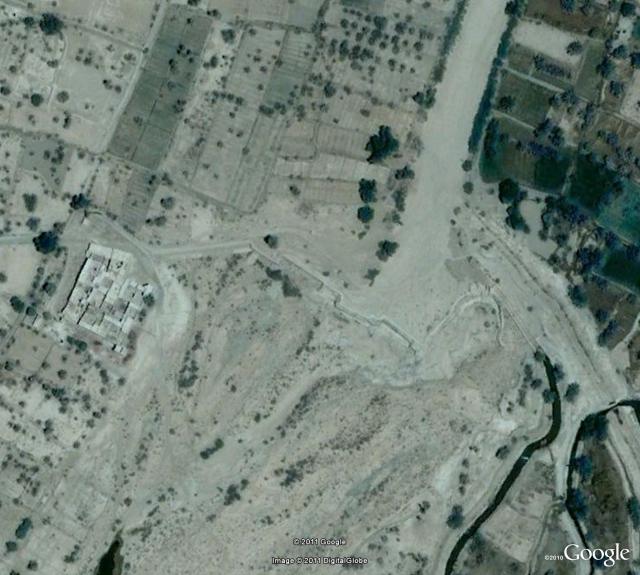
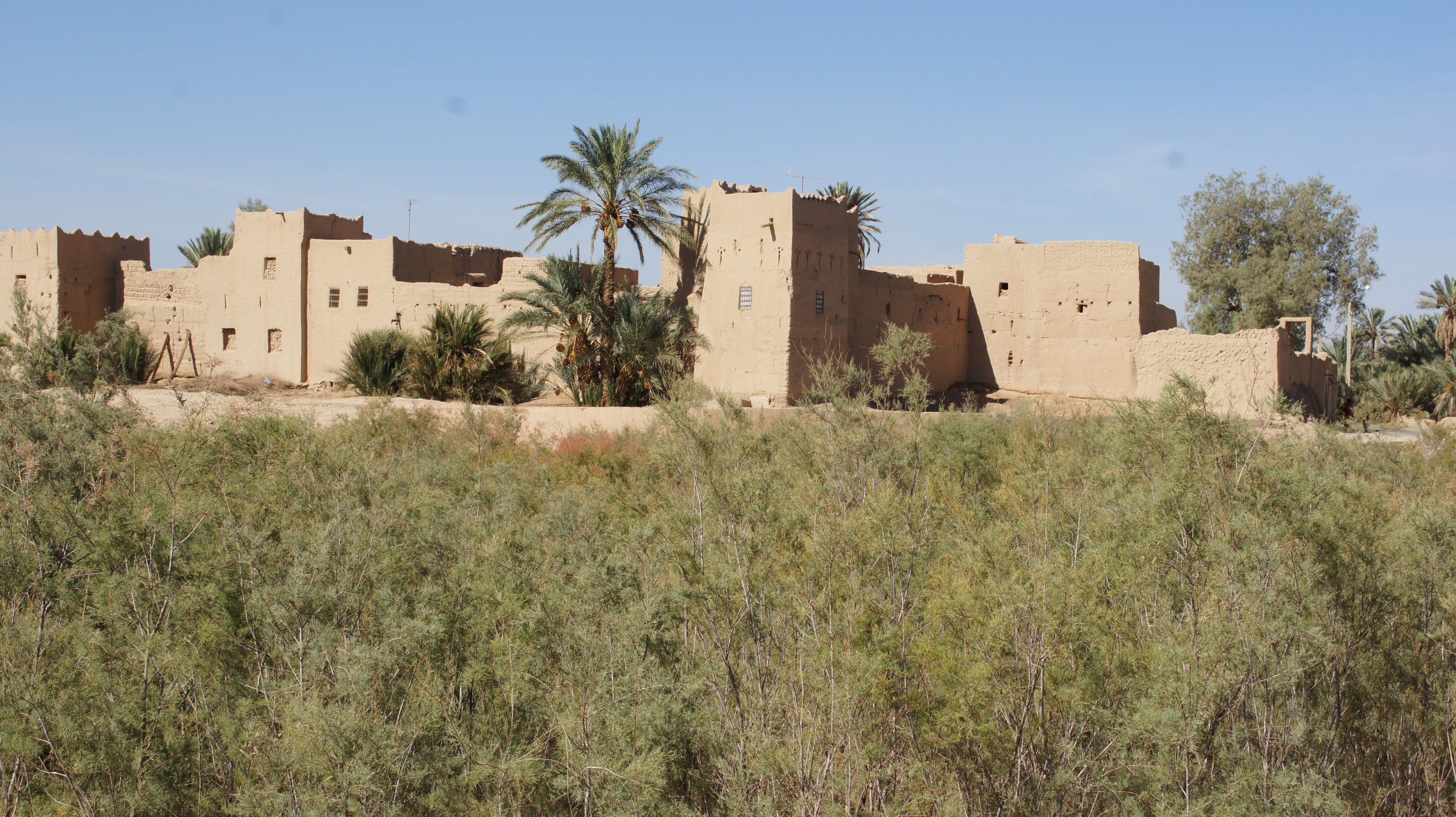
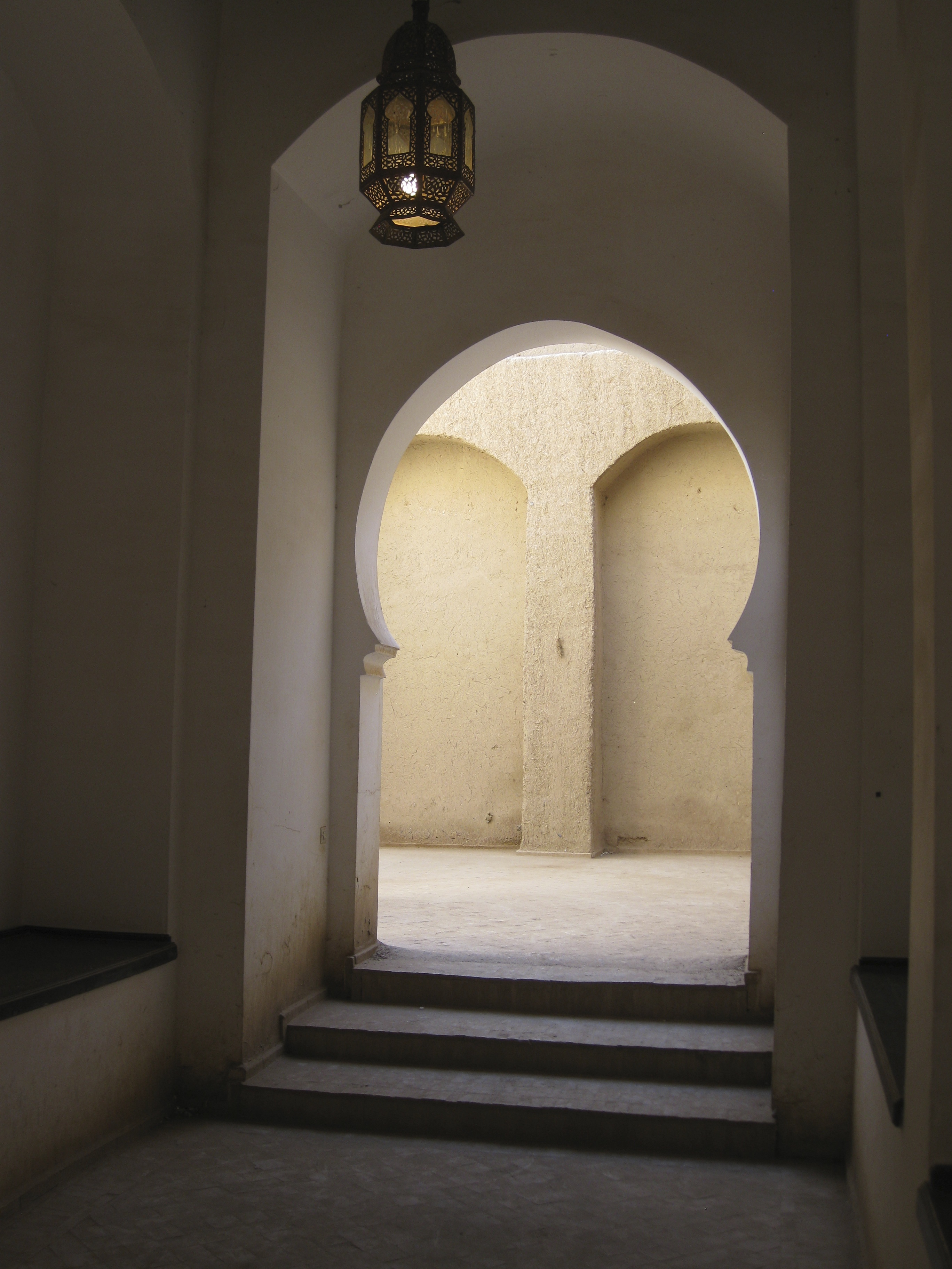
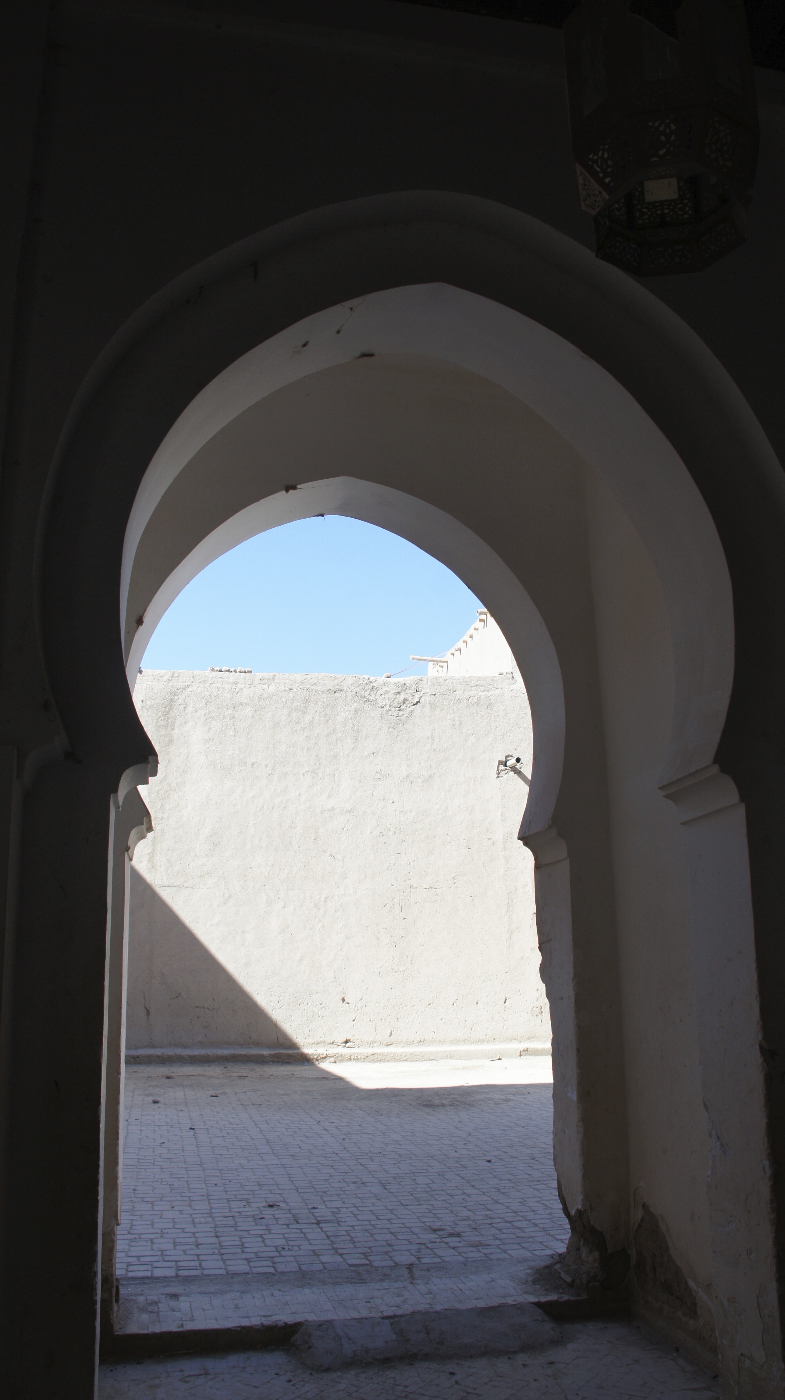
Here, thanks again to Eric and John, are a photo (John) and satellite image (Eric) of the zâwiya Sidi Al-Ghâzî:
zawiyah-sidi-al-ghazi zc3a2wiya-sidi-al-ghc3a2zc3ae-sat
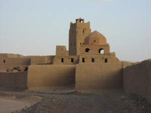
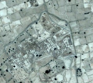
The photo is out of date: the minaret has since collapsed.  Of the satellite image, Eric notes “The actual shrine (mosque, mausolea, cemetery) in the north part of complex was destroyed by a flood in the late 1960s and is now completely ruined. Members of the Sufi order meet in the Guest House, next to the Shaykh’s house, in the complex’s eastern village. Half of this village too is ruined. The village at the west of the complex contains the shrine of Sidi al-’Arbi al-Ghâzî.”

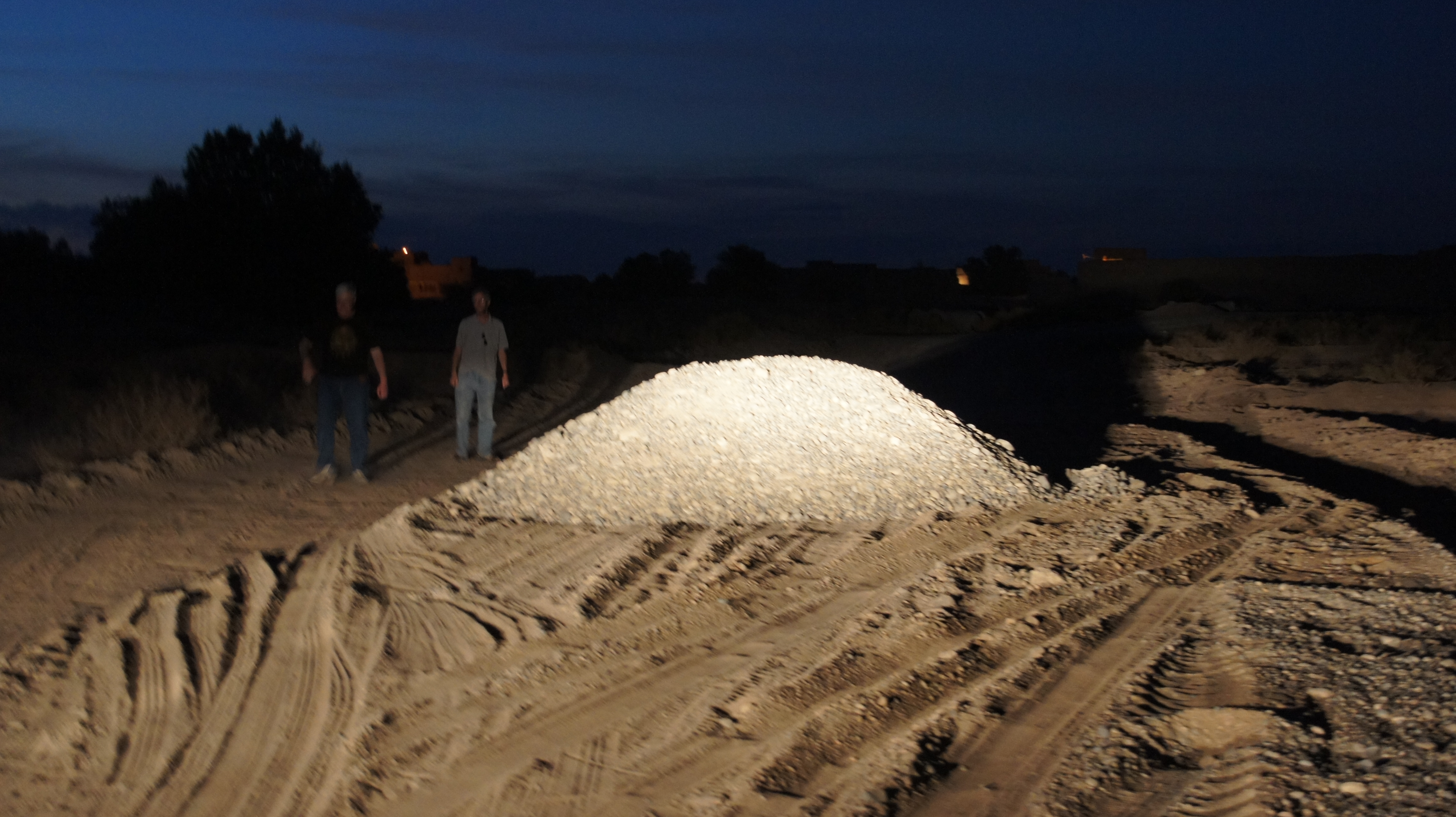
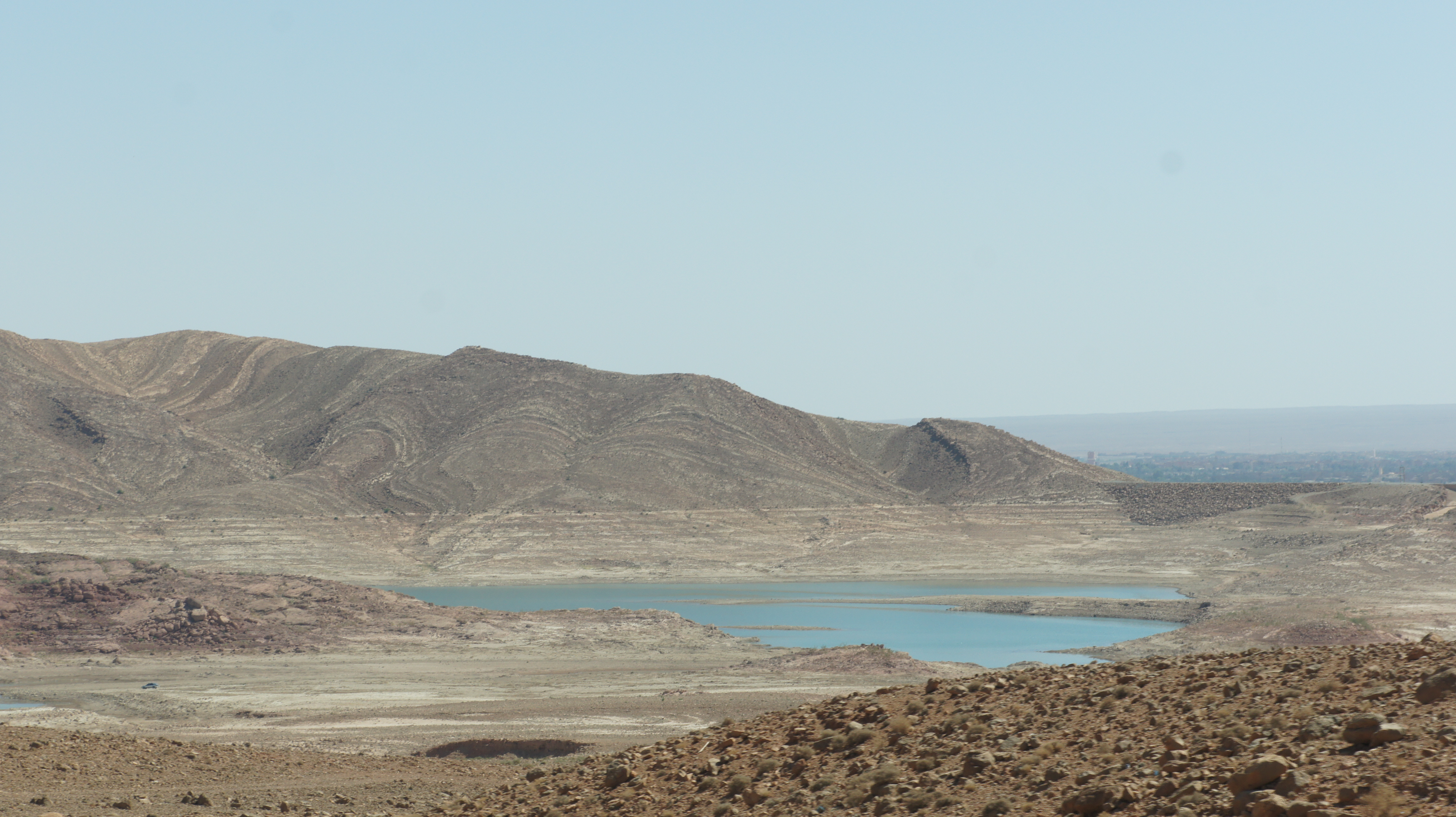
We almost didn’t make it to the zâwiya: the piste was suddenly blocked by a pile of gravel, but the off-road edges were firm enough to take the busses.
SONY DSC
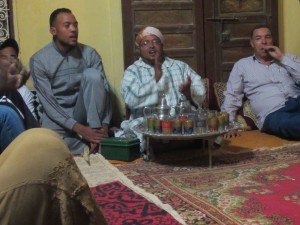
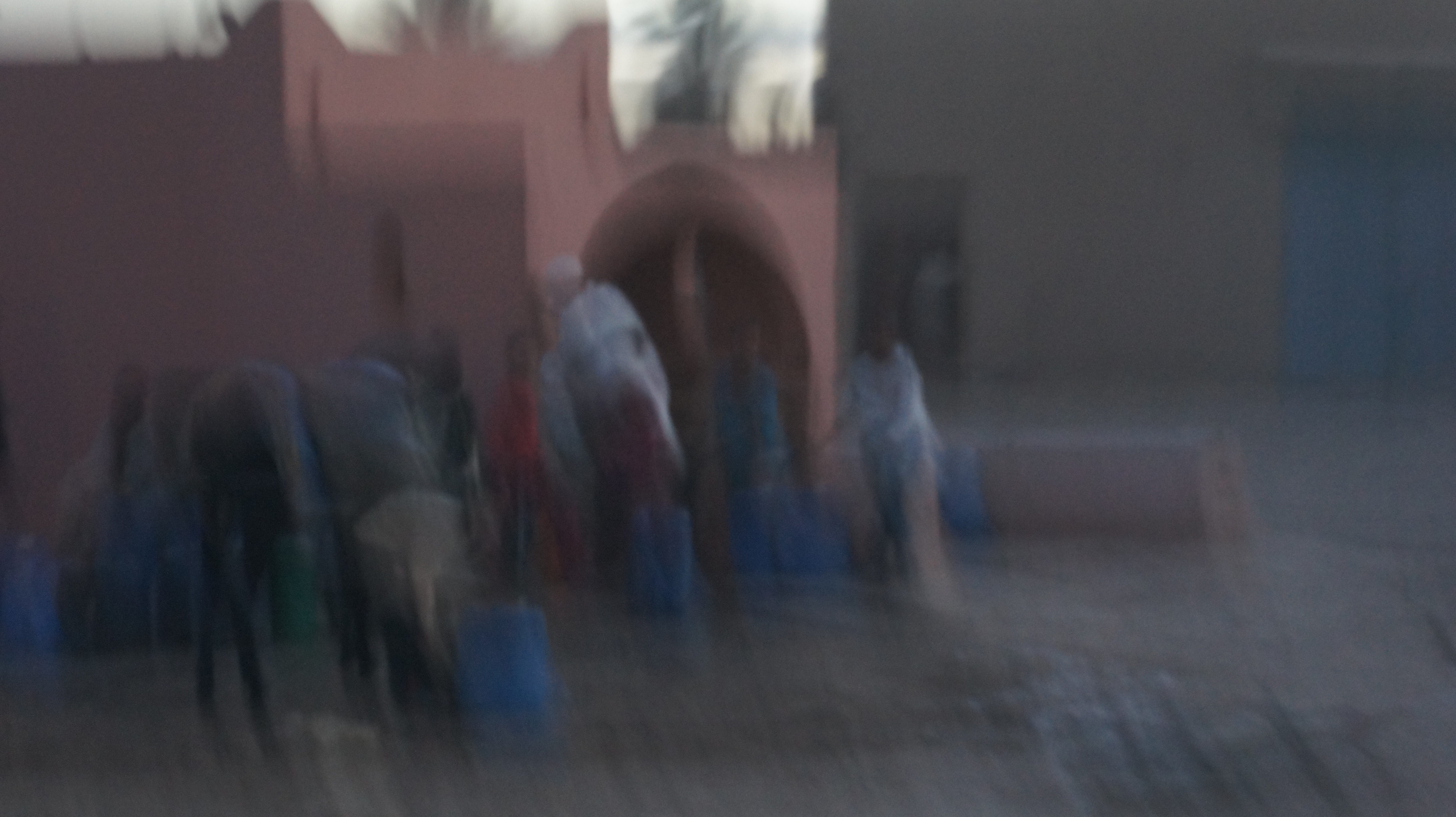
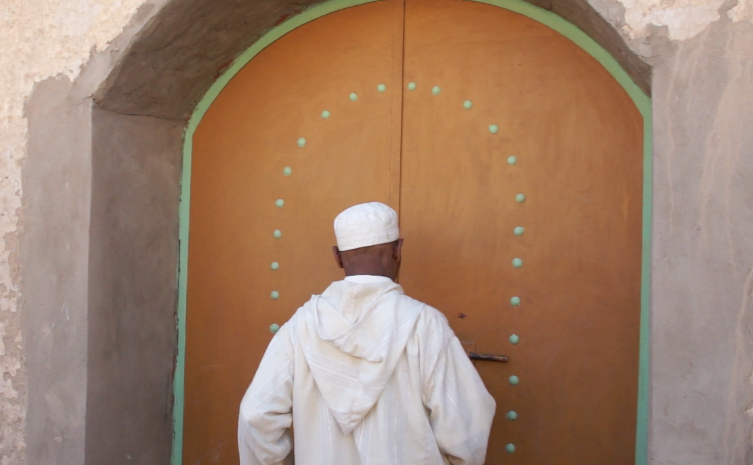
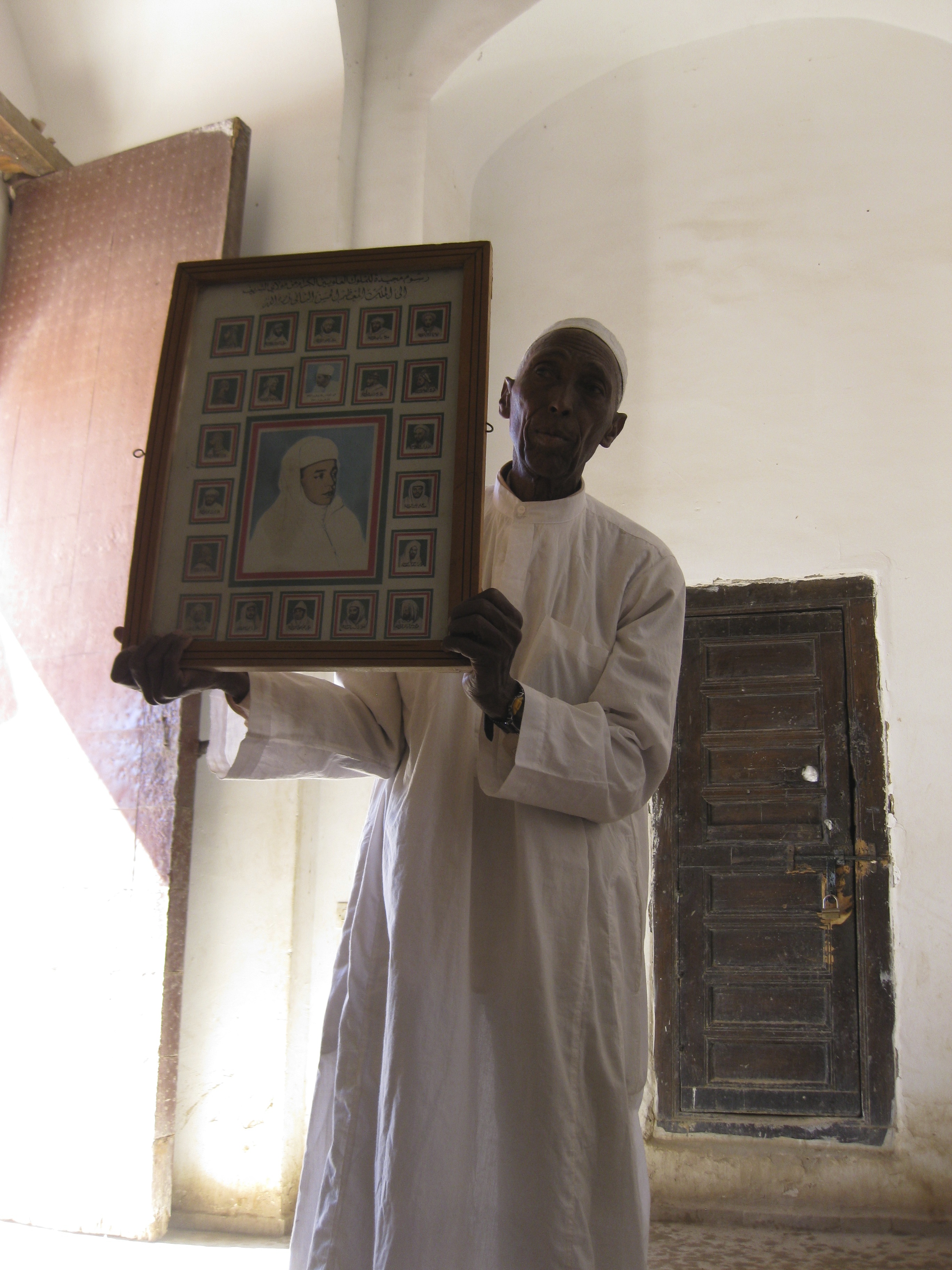
Once there, we were welcomed with cushioned seats, ritual hand-washing, cups of tea and peanuts.  Zoë sat in the place once occupied by Hassan II.

SONY DSC
As we spoke with Sidi Mustafa al-Ghâzî, the muqqadam or leader of the zâwiya, about Sufi practices, he (and later his son) came around sprinkling us with orange-blossom water from this container.  That felt an unmistakeable blessing: such a lovely scent!SONY DSC

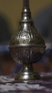
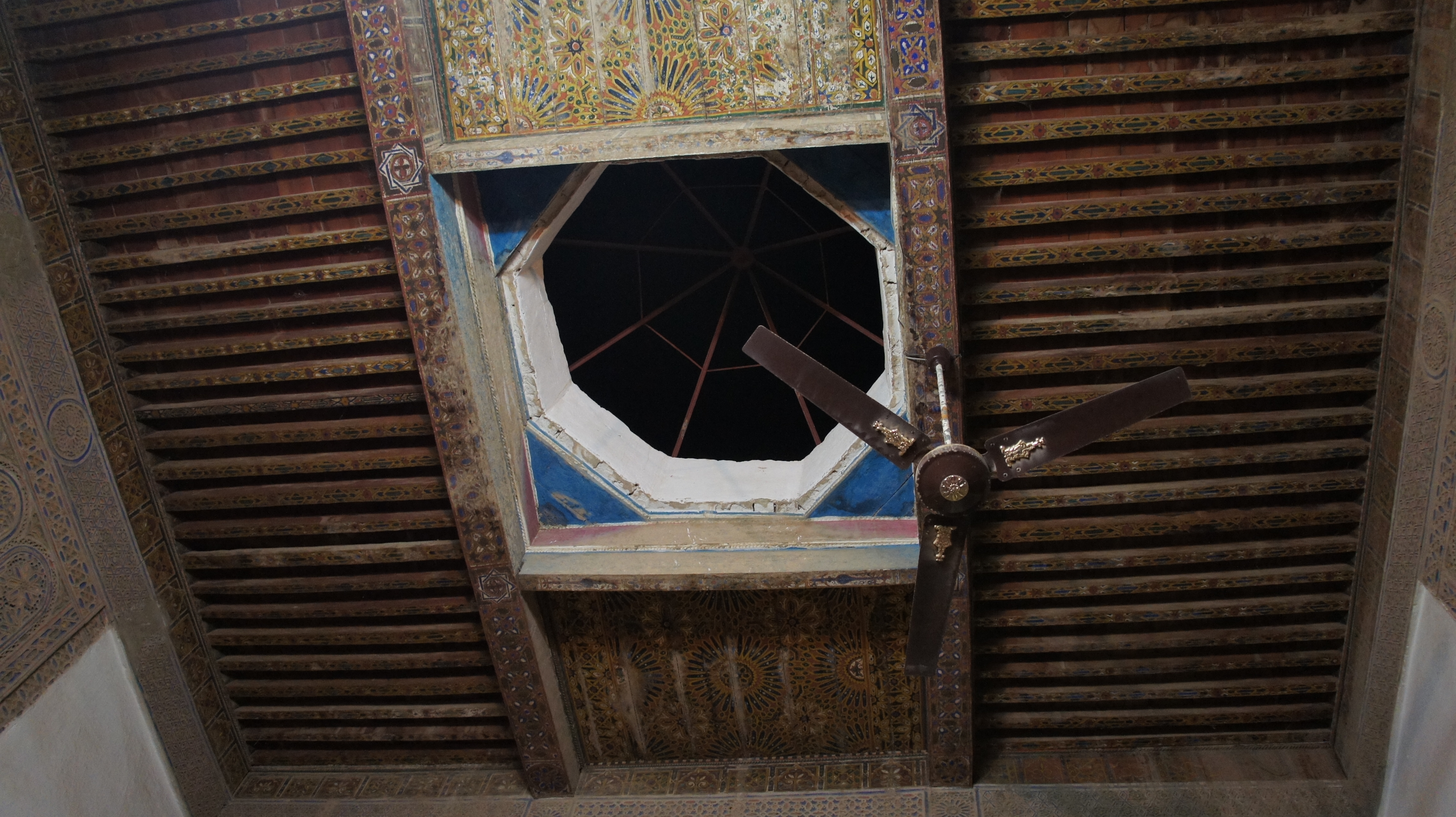
“Can women be Sufis?” we wanted to know.   (John had told us that for the purposes of this evening, we would all be considered “honorary men.”  No women would appear though they would have cooked the dinner for us; if the women of the community wanted a look at us, they would peek in through the opening in the roof–and it would be rude to stare at any woman who was looking in at the roof.)
SONY DSC
“Oh, yes!  A very important early Sufi was a woman,” Sidi Mustafa replied.  (Rabi’a al-Adawiyya, 717-801 A.D.)  Eric confirms the existence of women Sufis: “In fact, I was once honored to be included as an honorary woman at a gathering of women Sufis in Senegal.”

I don’t quite have the chutzpah to ask how one would cross the gap between the invisible cooking women and these female Sufis.  If a daughter of this community wanted to follow the Sufi way, how would that desire be accomodated?  Or would it?

The best question of the night: “What’s the hardest thing about following the Sufi way?”
Reply: “Doing what the master tells you to do.  Accepting that guidance.”

IMG_1245

After several refills of tea and a dinner consisting of medfouna (a savory stuffed bread), bread and heaping platters of chicken for non-vegetarians, we move from discussion to recitation of the Qu’ran and of Sufi poetry.  After the recitation (which to uneducated ears sounds very musical) comes songs, accompanied by drumming.

Screen Shot 2014-01-13 at 11.03.11 PM Screen Shot 2014-01-13 at 11.05.57 PM

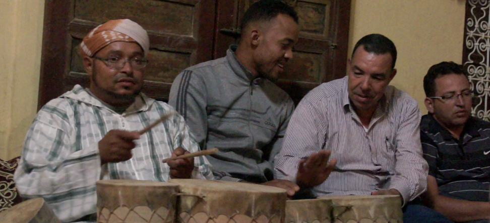
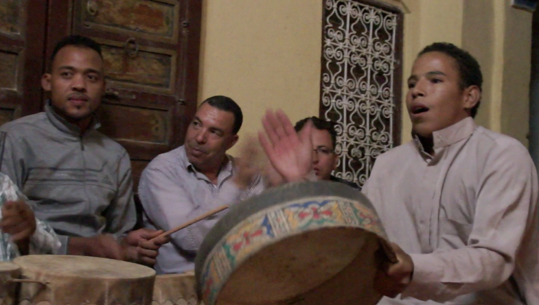
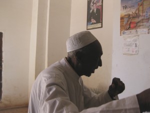
We loved the joy on the face of the muqaddam’s son, holding the hand drum in the photo above.  The young man below, a teacher in the local schools, did a soulful solo and eventually stood up to “dance”–this was a bouncing straight up and down, arms swinging out to the sides in a relaxed way, with some turning in a circular motion.
Screen Shot 2014-01-12 at 6.40.42 PM

As John had stressed before our arrival, the entire evening was carefully controlled by the muqaddam, whose drumming, voice, and non-verbal cues set the pace for every step of the evening.

Sufism in Morocco is sometimes associated with extreme ritual action, such as the self-mutilation of the Hamadsha, as detailed by Edith Wharton with a mix of gory fascination and cynicism:

At first these stripes and stains suggested only a gaudy ritual ornament like the pattern on the drums; then one saw that the paint, or whatever it was, kept dripping down from the whirling caftans and forming fresh pools among the stones; that as one of the pools dried up another formed, redder and more glistening, and that these pools were fed from great gashes which the dancers hacked in their own skulls and breasts with hatchets and sharpened stones.  […]  Gradually, however, it became evident that many of the dancers simply rocked and howled, without hacking themselves, and that most of the bleeding skulls and breasts belonged to negroes. […] Hamadch, it appears, had a faithful slave, who, when his master died, killed himself in despair, and the self-inflicted wounds of the brotherhood are supposed to symbolize the slave’s suicide. [… This account] enables the devotees to divide their ritual duties into two classes, the devotions of the free men being addressed to the saint who died in his bed, which the slaves belong to the slave, and must therefore simulate his horrid end.

Vincent Crapanzano offered a more nuanced psychological (or psychiatric) analysis of these rites of self-mutilation in the 1980s (The Hamadsha: a Study in Moroccan Ethnopsychiatry), but in any case, it’s hard to imagine anything further from the delightful devotions so graciously shared with us this evening.  We felt tremendously honored to be included in the evening, allowed a glimpse of faith in action.

Dams old and new

Driving south from Ifrane, through Azrou and Midelt, you see a lot of barren landscape.
SONY DSC SONY DSC
The first time I made this drive (on the way to Ouarzazate), I gasped when I saw the blue waters of the Hassan Addakhil dam.  It felt as if those waters were easing an intense visual or mental thirst:
SONY DSC
But even in a sideways glance (or in a small photo), you can see the high-water mark on the hillside, defining the drastic loss of water to evaporation.  (Note the small buildings in the foreground, constructed by the US Army Corps of Engineers, who helped build the dam in 1971.)

And as you come closer to the dam, certain angles of vision let you see how little water it actually holds:
SONY DSC

Let’s remember that in southern Morocco, irrigation is everything:

In the Sahara the oasis–which is to say, the forest of date palms–is primarily a man-made affair and can continue its existence only if the work of irrigating its terrain is kept up unrelentingly…. It was never the practice or the intention of the sons of God to live there.  They have a saying which goes, “No one lives in the Sahara if he is able to live elsewhere.” …. The oases, those magnificent palm groves, are the blood and bone of the desert: life in the Sahara would be unthinkable without them….

(Paul Bowles, Their Heads are Green and their Hands are Blue: Scenes from the Non-Christian World, 1957)

The most obvious forms of irrigation in the Tafilalt are the rivers, the canals, and the khettara.  Archeological reconstruction, for instance, shows that the builders of Sijilmassa diverted the Oued Ziz into a channel that ran along the side of the city.  [Lightfoot & Miller]

But traditional irrigation also relied upon periodic flooding, and on a series of low-lying, traditional dams across the Ziz, to divert waters when in flow.  Here’s a photo of Rasif dam, one of these traditional dams:
SONY DSC SONY DSC
And here’s what that dam looks like from the air:
rasif-dam-sat
Eric Ross notes of this satellite image (on his blog): “The masonry structure zigzags across the dry valley of the Ziz River. The dam’s reservoir (light grey area north of the masonry) is completely silted up. Occasionally, after heavy rains, water will still rush down the Ziz and flow over the dam.”

The Hassan Addakhil dam was built in 1971 after a catastrophic flood in 1965.  The dam was designed both to stop such massive floods, and to hold water for farmers.  It has been only partially successful.  On the plus side, the dam moderated the severe flooding of 1989 (greater flow than the 1965 flood that prompted dam construction), and it provides clean drinking water throughout the Tafilalt, with water piped from the reservoir directly to community fountains outside each qsar.
SONY DSC
(Blurry night photo of large blue buckets being filled at a community fountain and mounted on mules and donkeys.)

On the downside of the equation…
the dam stops most of the periodic floods that used to recharge the water table, so the water table is sinking dangerously low;
not all flooding is contained by the dam;
rissani-flood (photo Tachfine Baida, Eric Ross’s blog)
farmers complain that the cold water sent downstream with each timed dam release “burns” their plants;
fertilizer use and irrigation have both increased dramatically since the dam’s construction, with accompanying soil depletion;
cement irrigation channels increase evaporation dramatically over the khettara or traditional mud channels;
SONY DSC
community fountains are placed outside the qsars, making it more laborious to gather water (and contributing to the local tendency to keep girls out of school). SONY DSC SONY DSC
An old community well, now dried up and useless; girls and women preparing to carry water.

John Shoup reports that one of the engineers overseeing the dam told him the best thing to do with the dam would be to blow it up.  Hsain Ilahiane suggests there may be political benefits to the dam’s introduction of “a bureaucratic structure of water management, a social welfare institution whose motives coincide with anchoring the state’s presence in a border area not far from a defiant Algeria.” (Dissertation, 1998)

Water is wealth; water is power.


Khettaras: ingenious irrigation

The sheer labor required to maintain an oasis might be part of the answer to the slavery question–the puzzle of Sijilmassa’s path from radical equality (the Kharijites) to promoter of the salt/gold/slave trade.

And some of the most invisible labor of the oasis is hidden underground.

SONY DSC
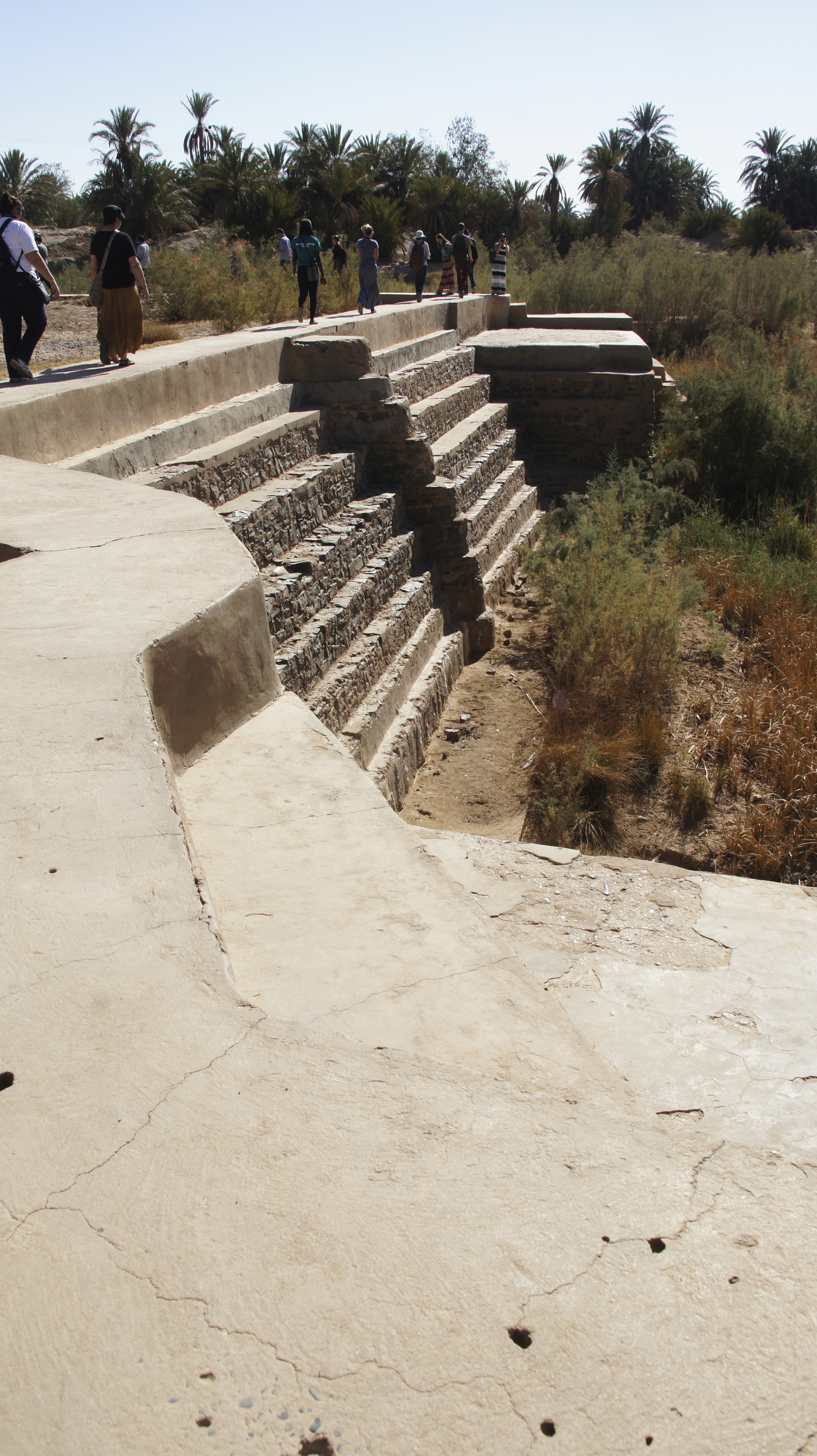
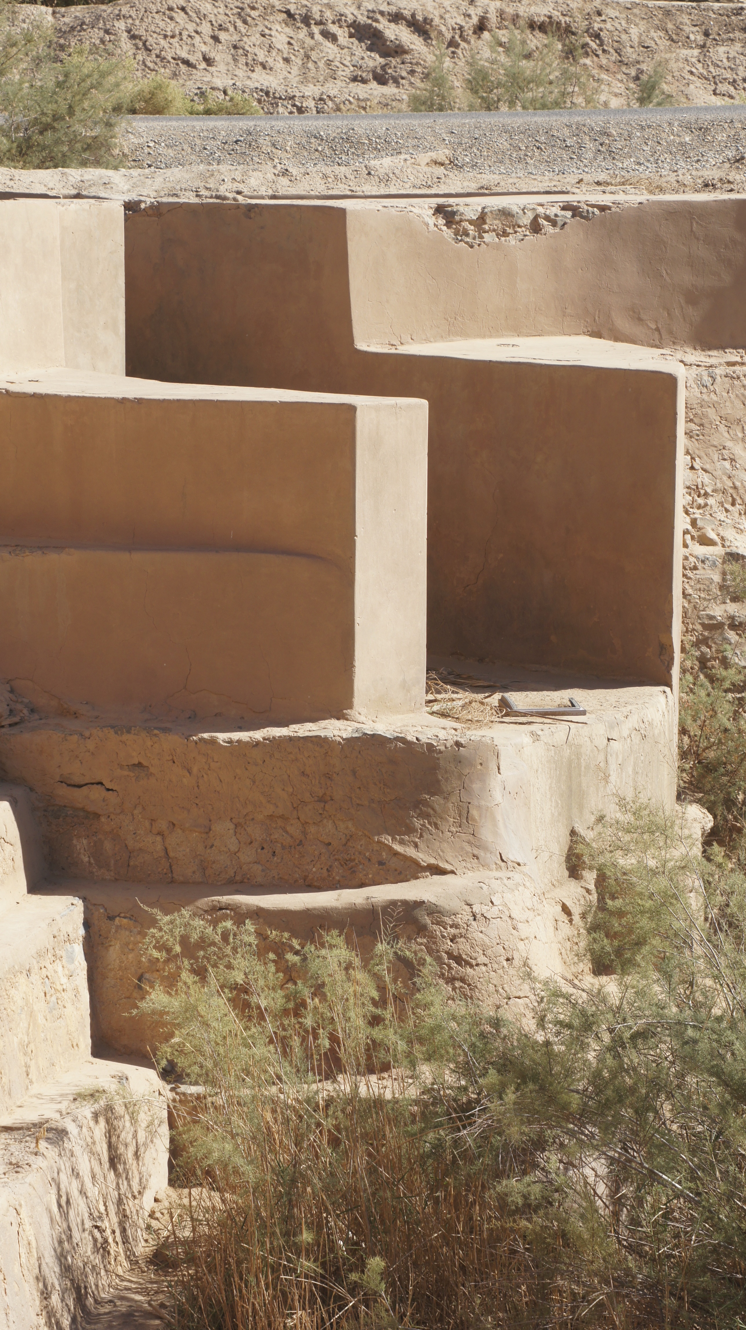
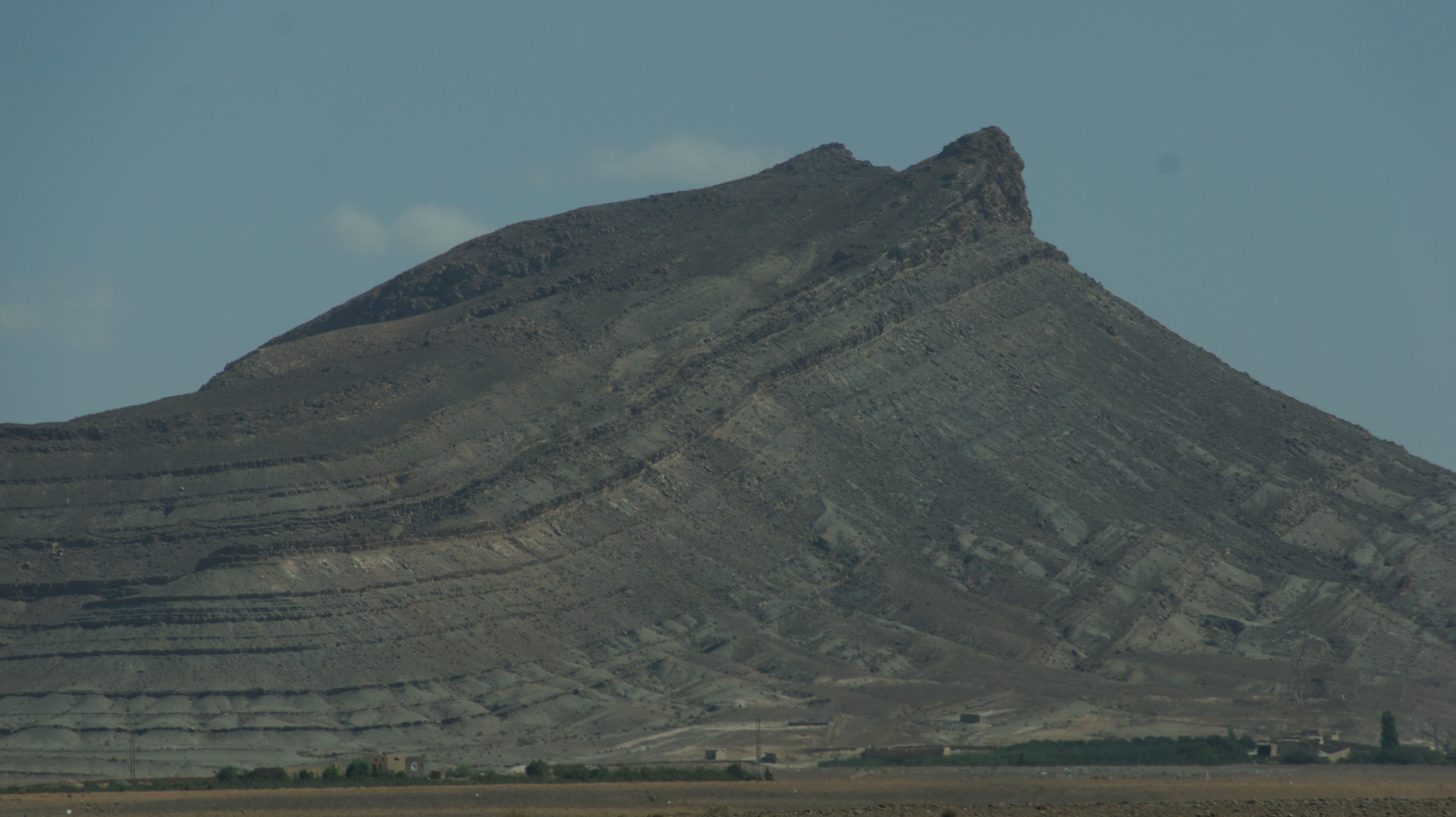
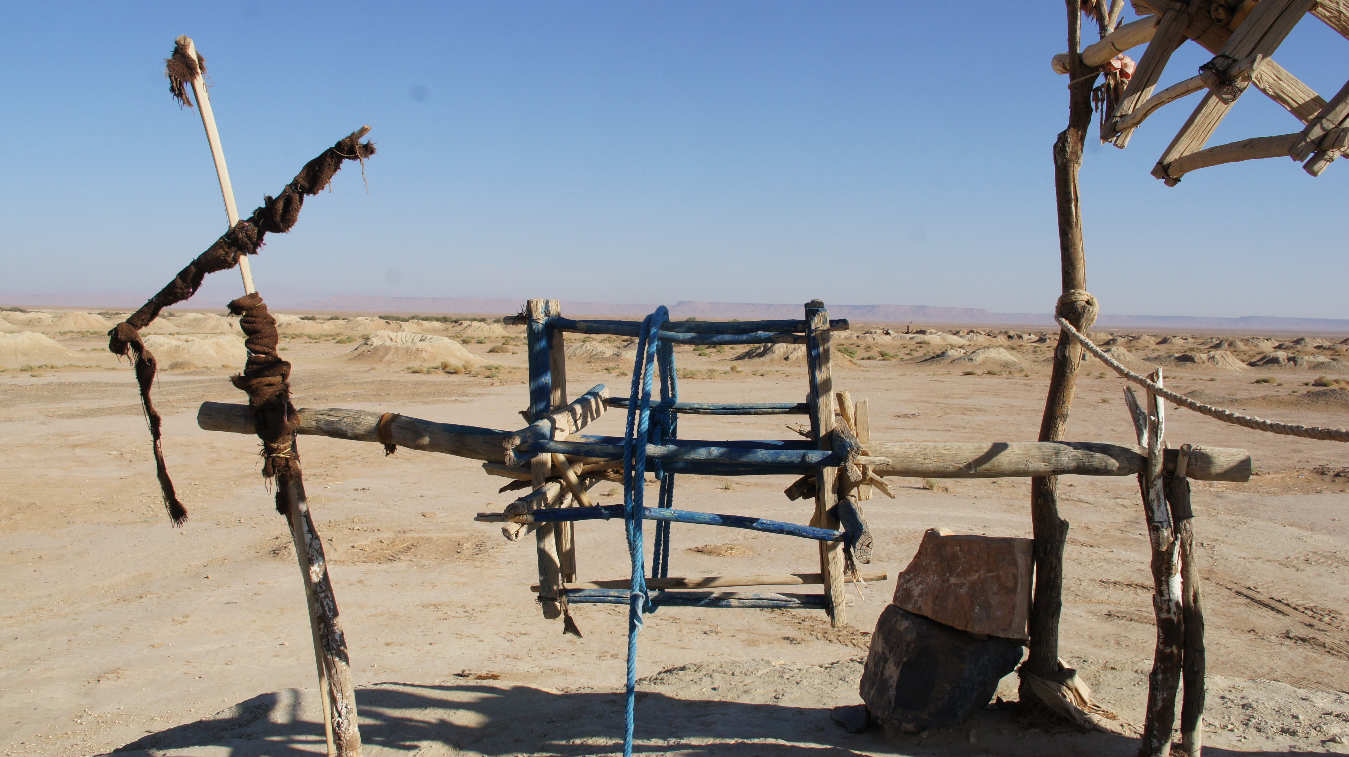
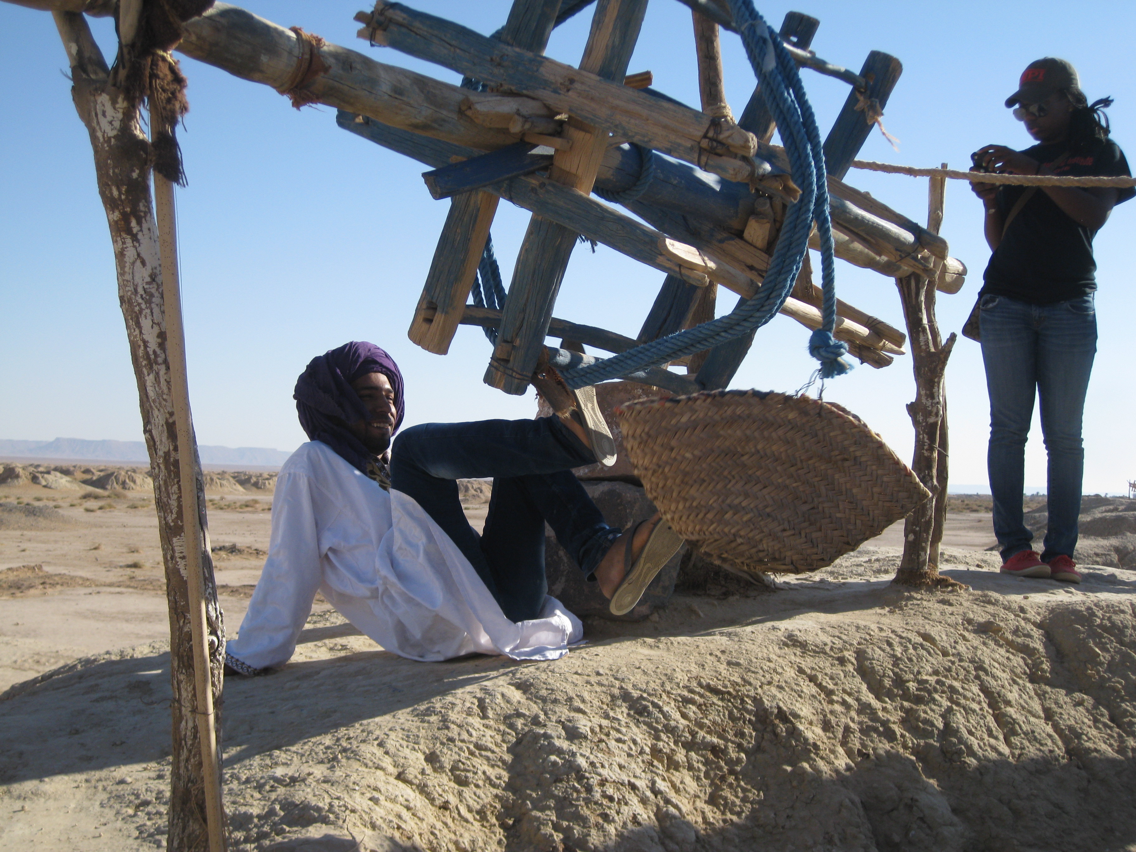
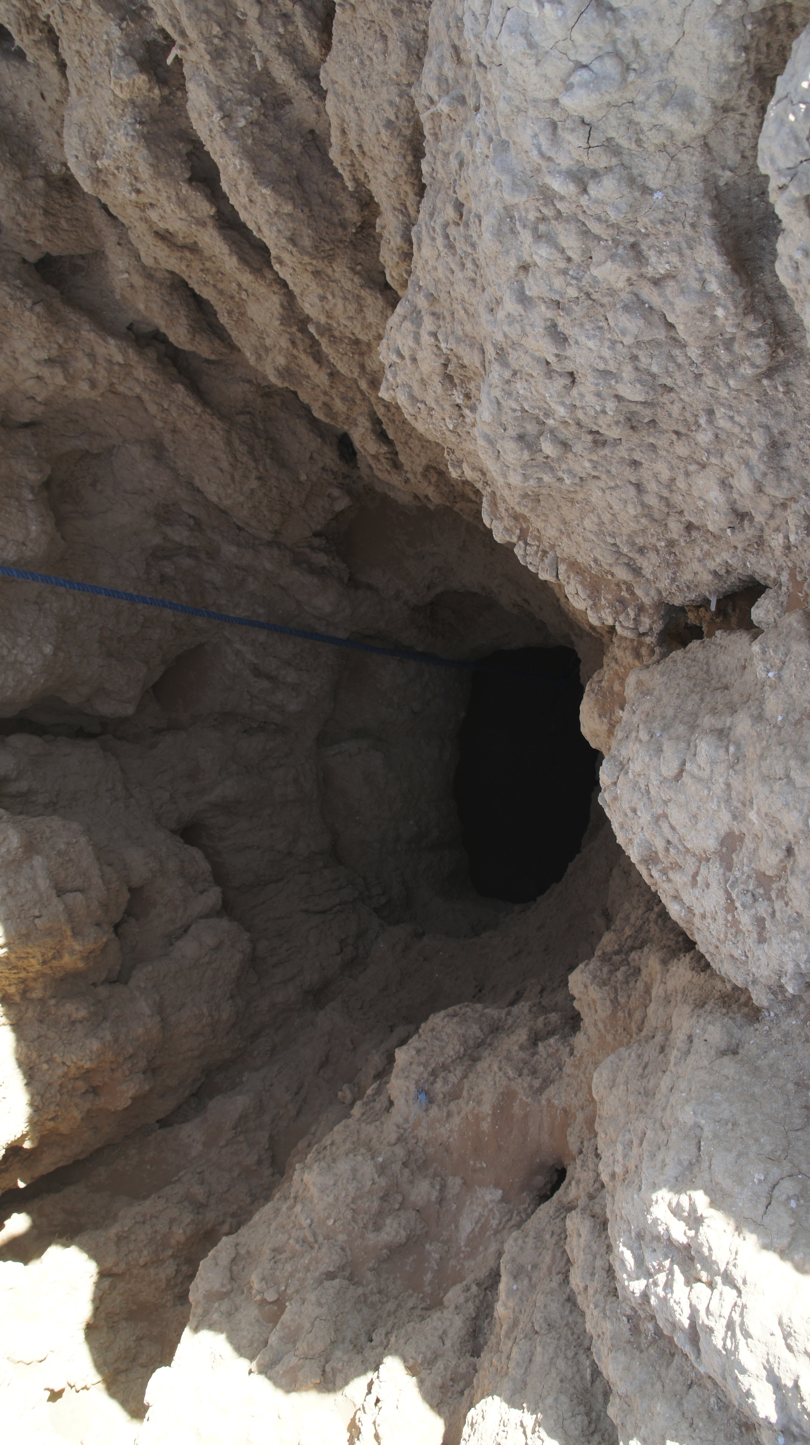
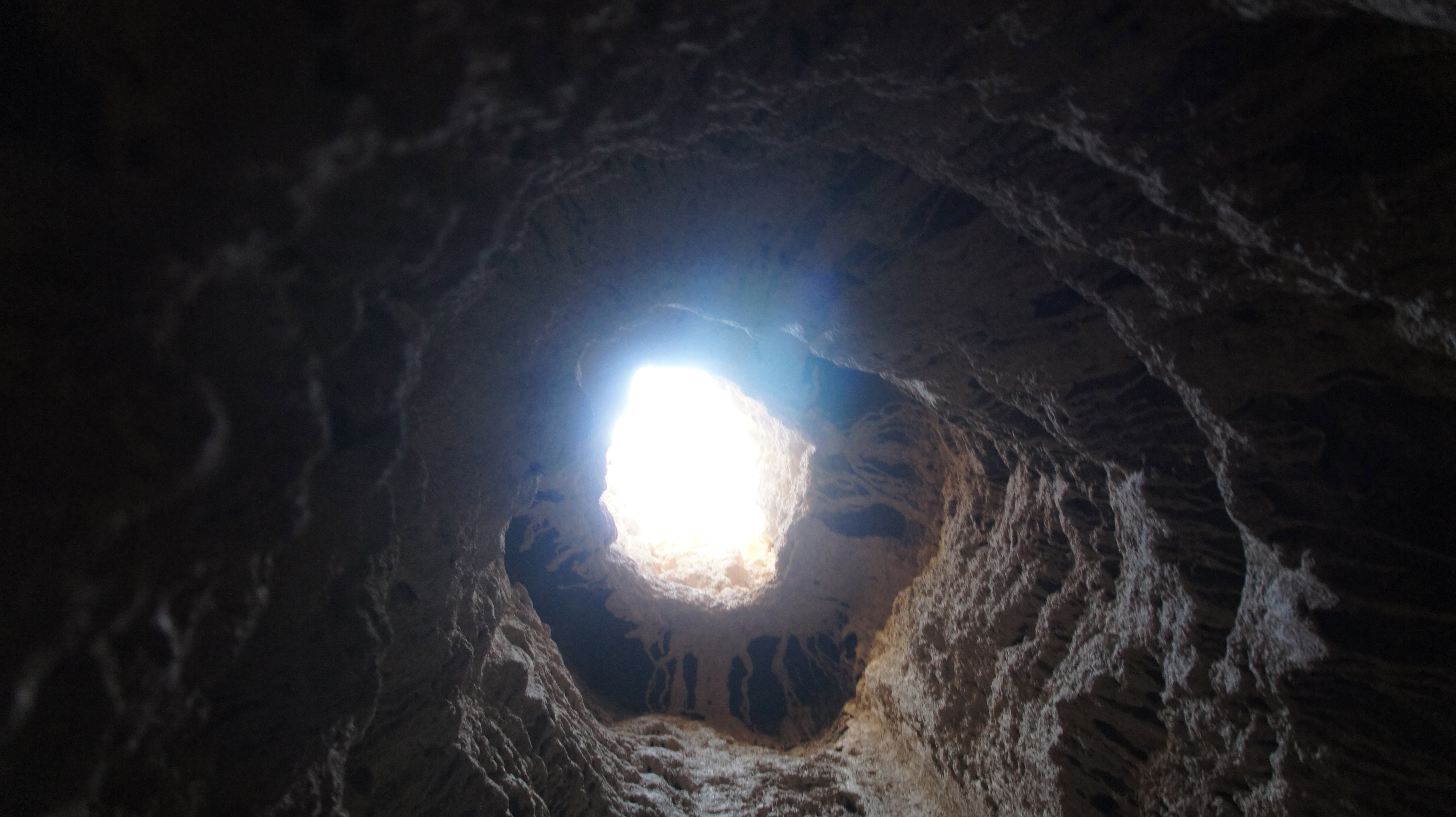
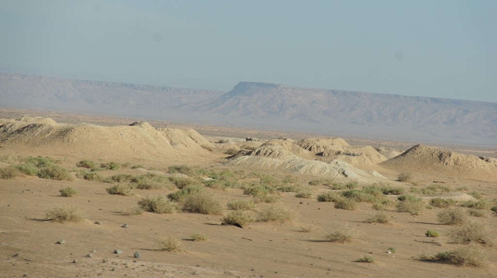
There you are, driving through the desert, and you see a bunch of enormous anthills.  Really?  Ant-hills?  Maybe mole hills? How big are those moles?  The size of camels?

What are those things?

Those are khettara, “an ingenius technology to harvest hidden groundwater and deliver it to the surface by means of gravity alone.”*  Who knew?
SONY DSC
The khettara is essentially a tunnel or gallery, large enough to walk in (though perhaps only in a bent over or crouching position), and often several kilometres long.  Khettaras (called qanat in Iran and other countries) serve to move water from a higher place to a lower place–in this particular case, the khettaras are moving water from the piedmont (the foothills) of the High Atlas to the extended oasis of the Tafilalt: a total of 48 kilometers.  Mind-boggling!

SONY DSC
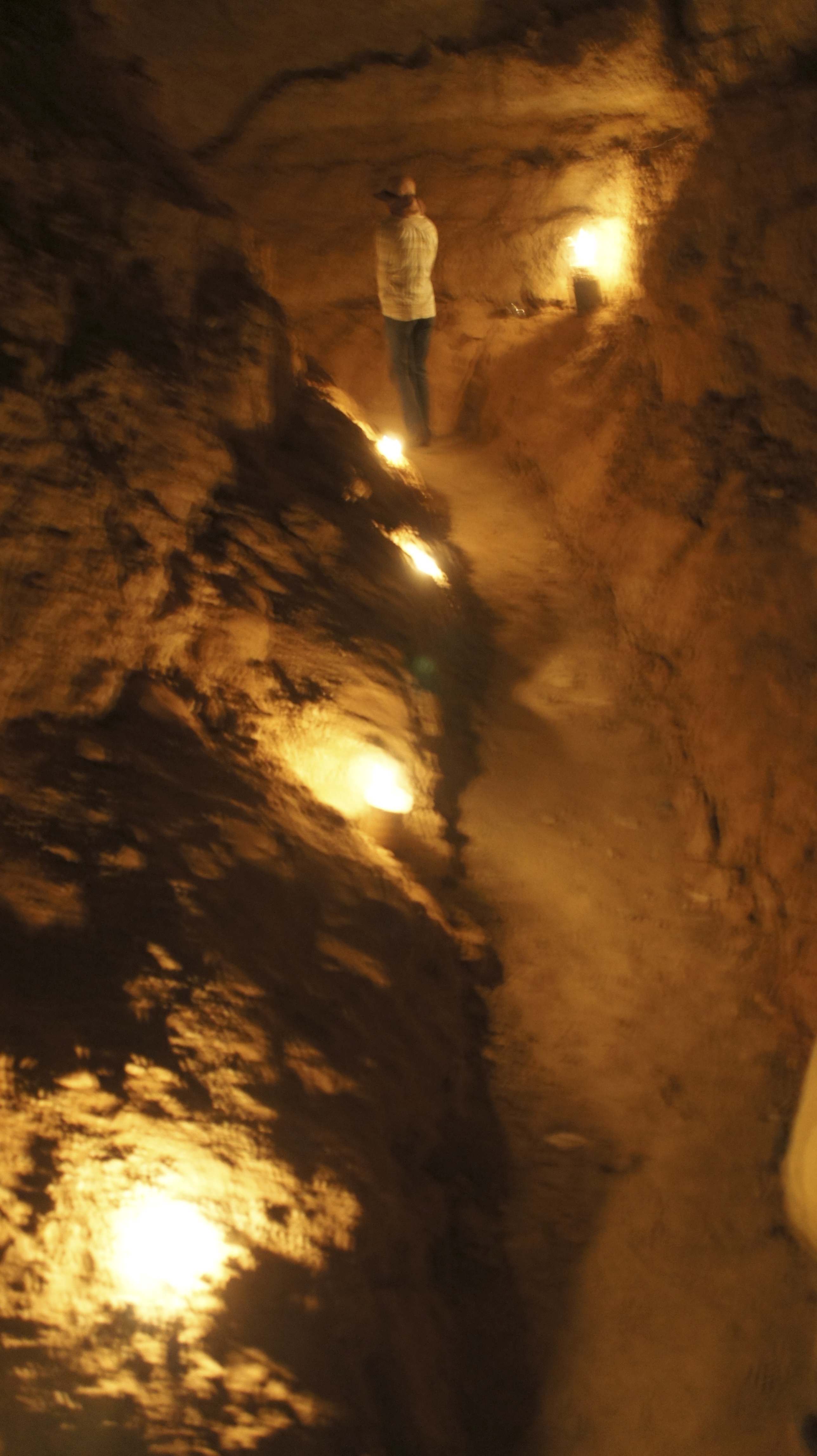
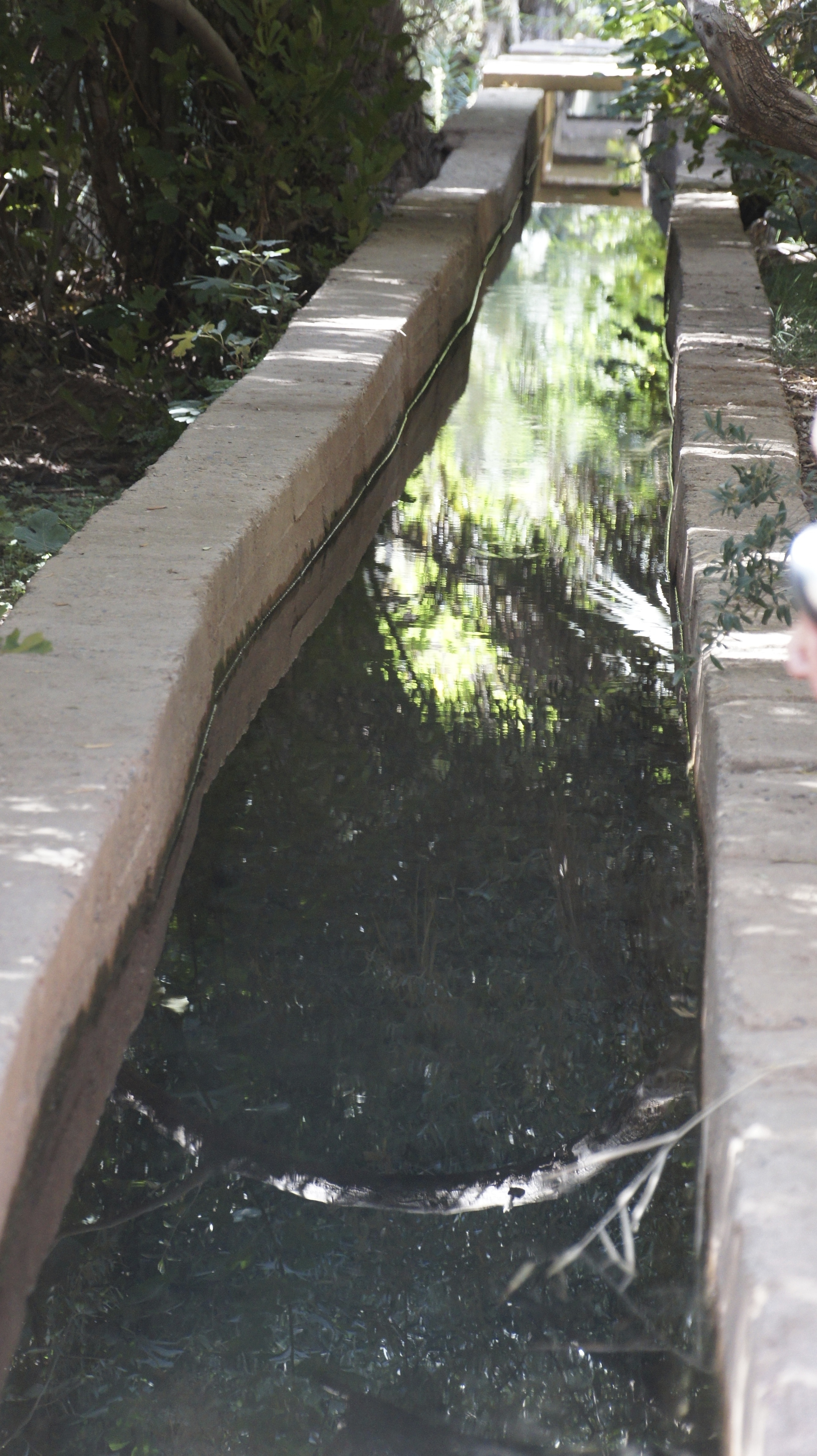
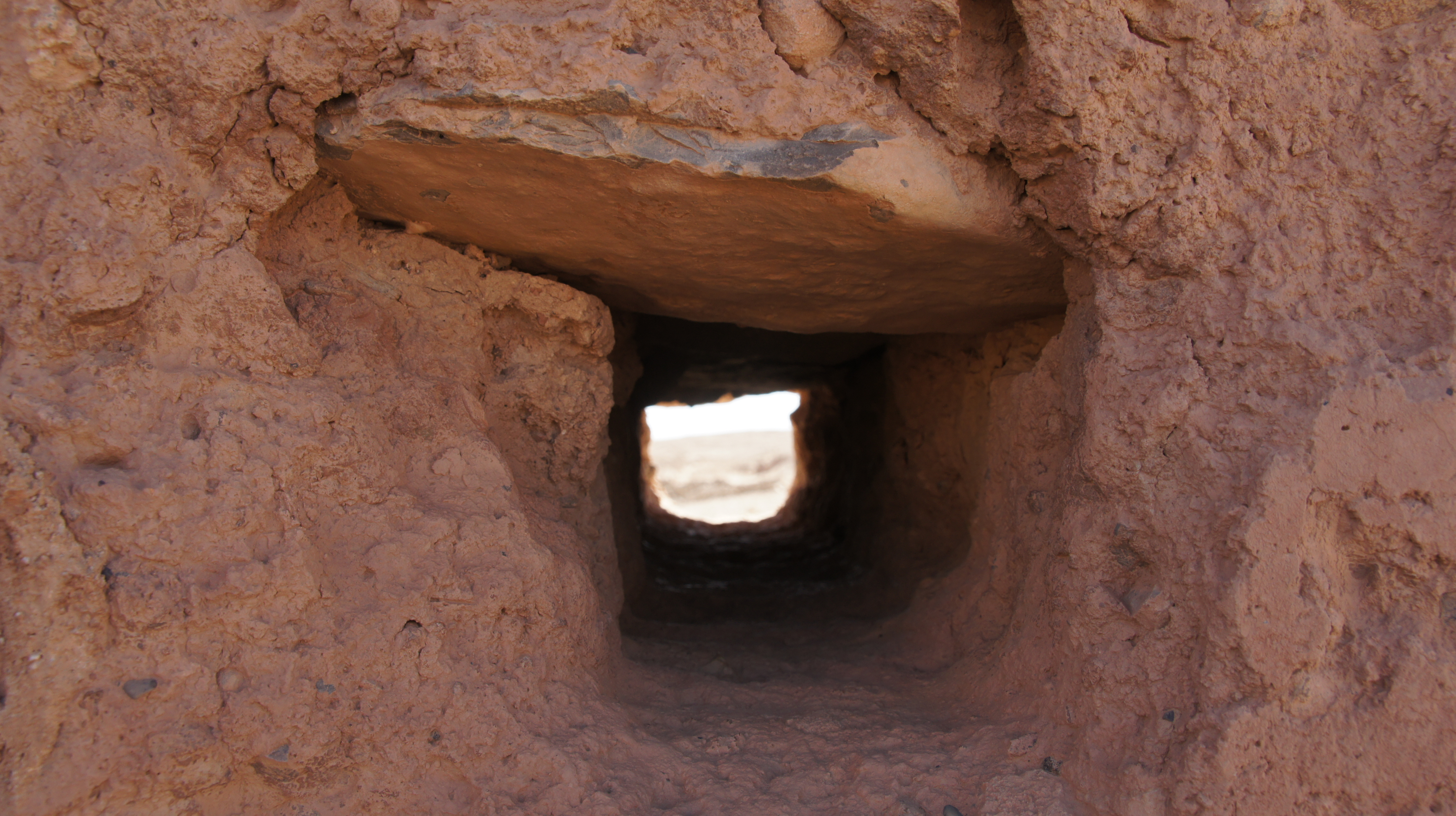
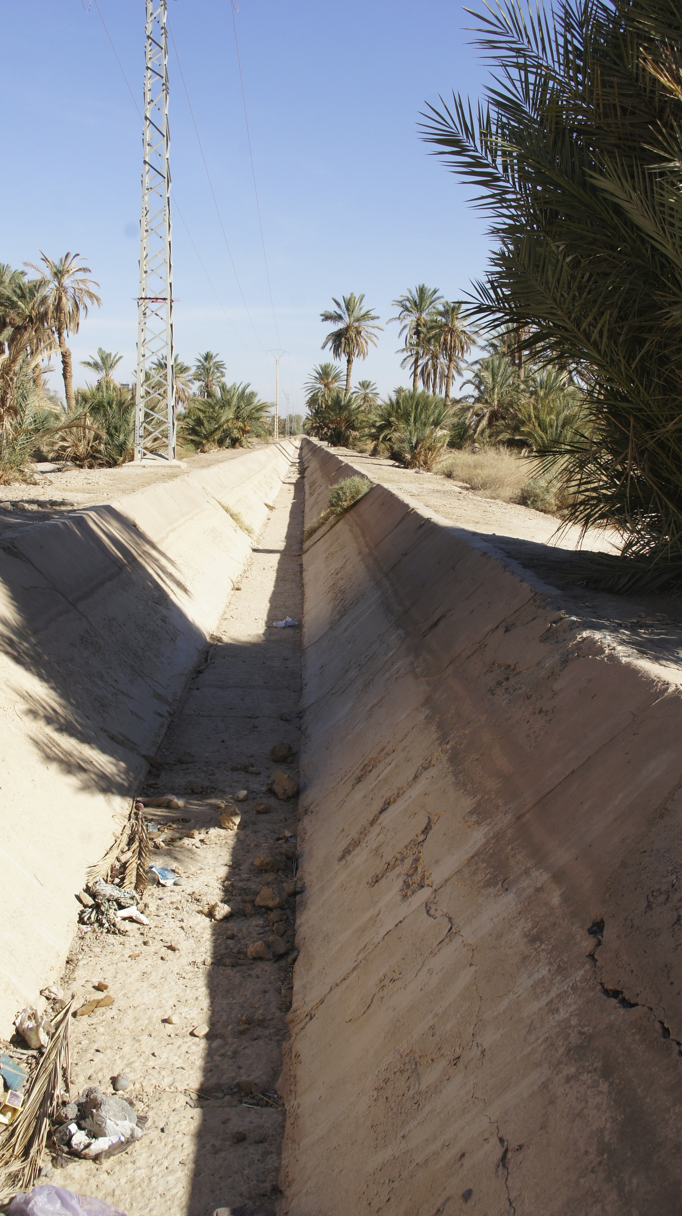
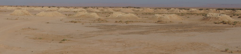
What’s visible on the surface are merely the waste piles: the heaps of sand and scree dug out of the water channel and removed to the surface of the earth.

The brilliance of this irrigation system is hard to overstate: these khettaras can move water up to 48 kilometers while keeping it underground, minimizing evaporation and maximizing irrigation potential.
khettara-sat
Satellite image of a single khettara (made visible through the line of access shafts) crossing under the national road–taken from Eric Ross’s blog: http://ericrossacademic.wordpress.com.

Without the khettara, Fitzwilliam-Hall suggests, the date palm oases of southern and central Morocco might never have existed.  (Lightfoot and Miller suggest, conversely, that khettara only came into use in the Tafilalt region after the fall of Sijilmassa: the city’s central government could maintain the network of canals watering the city, but khettara were more suited to the dispersed, decentralized labor available to the individual qsar.  In this case, the role of the Haratine in Sijilmassa must have been more related to field work than to khettara irrigation.)

There’s a rest stop along the road between Erfoud and Tinerhir where you can see a model of how the khettara might have worked: under the ground, a man would be filling up buckets or baskets with sand and sludge; above ground, another man would lie on his back and use his feet to turn a kind of wooden pulley to raise the baskets of sand up to where they could be emptied.
SONY DSC SONY DSC
IMG_1124
Multiply this labor by a factor of thousands.  Remember that each khettara includes many many access shafts (hassi in Arabic; tasfalt in Tashelhit).  Simon Fitzwilliam-Hall inventoried 1600 khettaras in Morocco in 2009, though he counted only 350 still functioning.  Let’s randomly imagine an average of 30 hassi per khettara for a total of 48,000 hassi.

SONY DSC SONY DSC

So who did all that work?  Some scholars estimate that creating the Almoravid-era khettaras near Marrakesh would have required 12 specialists and 200-300 laborers working for 30 years; 20,000 Christian prisoners-of-war were allegedly sent from Moorish Spain to Marrakesh to provide unpaid labor.  More commonly, the Haratine (see earlier post) are on record as khettara diggers.

This roadside rest stop is historical tourism: a delightfully dry tunnel, hollowed out deeply enough that it’s easy to walk in; atmospheric darkness, punctuated by the light of the access shafts.  
SONY DSC
 SONY DSC
But imagine this instead: slogging barefoot through a stream of water, crab-hopping Golum-like  down the channel but still scraping your back or your head on the roof of the tunnel; struggling to shovel sludge into a woven basket that is undoubtedly broken and leaky; dragging that broken and breaking basket to your next access shaft.  Imagine having no choice about this labor, no ownership in the products that depend upon the irrigation you so laboriously provide.

Both survival and the means of production seem complicated here.

*Simon Fitzwilliam-Hall, “The Living Khettaras of Southern Morocco: A Traditional Water Harvesting Technology on the Brink”

Dale Lightfoot and James Miller, “Sijilmassa: The Rise and Fall of a Walled Oasis in Southern Morocco”

Qsar defensive architecture, slaves, and colonial resistance

On the second day of our trip to the Tafilalt, John and Eric took us to visit a qsar that now houses a museum: Qsar al-Fidha.

First, we looked at some qsur (plural of qsar) from the outside, and talked about pisé or rammed earth construction.
SONY DSC
As we saw in the construction of the Fez medina, pisé or rammed earth architecture is both sustainable and locally appropriate.  The thermal mass of the thick walls offers insulation, keeping housing cool in summer and warm in winter.  Typically, construction uses subsoils low in clay, saving topsoils for agricultural use.  The mud can be shaped into bricks which are sun-dried; these are then stacked in a temporary frame and connected using a mud slurry.  Alternately, damp soil can be poured into the frame and directly tamped down using ramming poles, working up 4-10 inches at a time until the top of the frame is reached.

According to Wikipedia, rammed earth holds humidity “between 40% and 60%, the ideal range for asthma sufferers and for the storage of such susceptible items as books.” For an academic with an asthmatic child, this is of no small interest!  The width of rammed earth construction also offers significant sound-proofing, helpful when an entire village is living cheek-by-jowl.

The downside of pisé construction is the ongoing labor of its maintenance.  A new earth-based rendering needs to be applied almost every year in order to keep the walls from dissolving in the winter rains.  And the communal nature of the qsur means that if your neighbor lets her house disintegrate, your house is much more vulnerable to decay.  Here, external ramparts work to support a wall whose decay threatens its neighbor.
SONY DSCThe process of decay also makes visible the rammed earth bricks underlying the connective slurry.
SONY DSC SONY DSC
Another example of earthen bricks in the process of decay; water pipes working direct water far from the rammed-earth walls.

(John also mentioned a 20th century Egyptian architect, Hassan Fathy, who works with rammed earth.  Unfortunately, Fathy’s carefully designed rammed-earth village has suffered from salt-stone foundations; if you’re interested, the village is featured in this video: https://vimeo.com/15514401.  Rammed earth is becoming a hot topic on sustainable building sites: check it out.)

On to Qsar al-Fidha!  Eric describes the “onion” layering of this particular  qsar: a large outer courtyard, surrounded by walls; a smaller inner-walled compound, with additional buildings around the edges; a central compound which was occupied by the governor of the local province, “always a member of the royal family.”

The first courtyard or mashwar is big enough to allow the drilling and display of military force, though at the moment, it mostly makes for a long walk for women and girls collecting water.
Screen Shot 2014-01-14 at 9.23.15 AM

In the photo below, our host Abdullah, the head of the museum, proudly descended from the upper slaves of the royal family, crosses the mashwar to prepare for our visit.  Certainly, the size of the space has a psychological effect on a lonely visitor.
SONY DSC

When you pass through the gate pictured above, you find yourself facing a wall: this was an obvious architectural defense strategy, breaking the momentum of any possible enemy charge:
IMG_1096

A second “elbow” turn in the structure of the qsar served as a guardpost, where the guardian of the village could keep an eye on everyone coming in and out (and what they were carrying).  In this particular qsar–the qaidate, or the local center of government–the guard post would also have been the place where taxes were delivered and counted.  Taxes were paid in kind, so people would have brought bushels of wheat, quantities of dates, heads of sheep and so on.  This would also have been the courthouse, where unresolved conflicts across the oasis would have been brought to be decided by the governor, or more likely his deputy.  The finer stucco finish of this gate area speaks to its grander purposes (unfortunately, the photo doesn’t give much sense of the space included in the L-turning).
SONY DSC

Soon after the guard post, the corridor/street gives access to the mosque and the well.  Two things you could not refuse a traveler: water and a place to pray.  (But you could position those resources close to the guard post so that you could keep an eye on those dubious strangers.)
Screen Shot 2014-01-14 at 9.47.45 AM Screen Shot 2014-01-14 at 9.48.08 AM

The well only provides water for washing now–the water quality is too low for drinking or livestock or irrigation–hence the long walk out to the more modern water fountain.

The next layer of the onion brings us to the governor’s palace.  Here, we see classic white-and-blue plasterwork designed to rest the eyes from the glare of the sun as you enter a darker space.

SONY DSC

Before we get to that restful vision, however, we pause once again in the antechamber to hear John’s account of the qaidate under the French and earlier.
IMG_1102
Our host, Abdullah, is proud of his lineage, drawn from high-level palace slaves.  Here he holds  pictures of the Alawite dynasty his family has served through the generations.  As John explains it, Abdullah’s father would have been given as a slave to the son of the governor  when he was a boy.  The two boys would have grown up together, as intimates, closer than brothers, since the royal boy’s brothers would be competing with him for power.  Once grown, the governor’s slave would be the second most powerful man in the region, offering a separate channel of access to the governor.  People would approach the governor’s advisor (rather than the unapproachable governor) and pay him to put their case to the governor.  The advisor-slave would maintain his power by being absolutely honest with the governor, so he would have to choose the cases he accepted with care.
IMG_1103
Audiences held in the antechamber probably featured the governor sitting in front of a curtain, a curtain that could serve many purposes: decoration and demonstration of power, but also a hiding place for the governor’s advisor/slave.  The governor in thinking over an issue raised by an audience could lean back slightly to hear from behind the curtain the views of his slave advisor on the matter or the people at hand.  (Yes, yes, the wizard of Oz and the man behind the curtain definitely comes to mind here.)

But these kinds of governing structures also had a role to play under colonialism, also known as the French Protectorate.
Screen Shot 2014-01-14 at 1.41.32 PM

The Tafilalt was one of the last parts of Morocco to fall to the French.  The center of this region fell in 1930; the outskirts, down to Zagora, held out until 1933.  The battle around Jebel Sahro cost the French more officers per capita than were killed in World War I.  (Local people targeted the easily-recognizable officers, having realized that the rest of the soldiers didn’t know what to do if the officers were killed.) Force majeure concluded the struggle: the French brought over their long-range artillery from French-held Algeria and bombarded the town until concessions were finally made.

Screen Shot 2014-01-14 at 2.13.01 PM
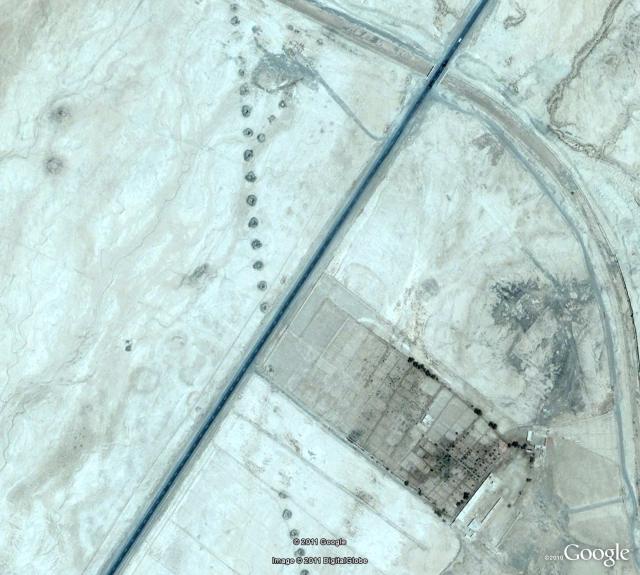
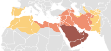
Area of heavy resistance to the French

Victory was relative.  Our host remembers his father answering the phone, setting the receiver down, and walking away.  An hour later, he might return, pick up the receiver and say, “Oh! you’re still there!  I forgot about you!”  The message? “The qaid rules here, not the French.  You will have access to the qaid when I feel like granting you that access, not before.”

So the French would have to get in a jeep and drive from Erfoud to this qsar in Rissani, just above Merzouga–only to find that they were kept waiting at the gate until someone could be bothered to let them in.  Same basic message.  This kind of passive resistance persisted for some 20 years.  Only in the 1950s did the French decide to move the administrative center to Rissani, shifting the caid’s office to the same building, in order to acquire ease of access.  Until independence in 1957.


Fossils!

Minerals and fossils are big business in Morocco: tourist stops across the country present them for sale.  The aridity of the landscape works to preserve specimens, I’m told, but I think the broad expanse of land not being used for other purposes plus the availability of labor also contributes to the concentration on fossils.  Online, I see many warnings about “fake Moroccan trilobites” being shipped abroad, but the Tahiri fossil museum in Rissani is, as too many other shopkeepers have (over-enthusiastically) promised, “a feast for the eyes.”

IMG_1055 SONY DSC
The mounted dinosaur skeletons are satisfyingly predatory: don’t let yourself be swallowed,  stomped, or spiked!
SONY DSC

Some of the fossils remind me a little to vividly that I’m looking at evidence of a world covered in bugs:
SONY DSC
SONY DSC

But other carefully prepared samples evoke a wonderful underwater world:
SONY DSCIMG_1051

And the highly polished tablets of ammonite and orthoceratoid fossils somehow make me think of planets and shooting stars:
SONY DSC

Or shoals of fish:
SONY DSC

Back in the workshop, we watch as samples are cleaned using dental equipment to polish away fragments of dirt and sand.
P1000429 P1000428

SONY DSC

Members of staff here have contributed to the relatively recent discovery that trilobites could curve themselves into extravagant shapes–and that they were among the first creatures to develop complex eyes, some of them on stalks.SONY DSC

P1000432 P1000434

P1000433 P1000431

It’s a weird and wonderful world.  Imagine having time enough to explore all these fossils, and the piles of geodes waiting on the tables out in the back, on the edge of the desert.

IMG_1064

Sijilmassa’s rise and fall

Sijilmassa might have been founded by Kharijites and their supporters, but the rich city, repeatedly conquered by reforming dynasties such as the Almoravids (1055-1146 in Sijilmassa) and the Almohads (1146-1269), soon had the heterodoxy beaten out of it.  The Almoravids smashed musical instruments and closed down wine shops throughout the city; Almohads massacred many of the Jews of Sijilmassa.  Yet the city as a whole expanded after the Almoravid conquest (1054) and “retained its enlarged importance through the Almohad period” as a result of improved water resources: the redirection of Ziz to the center of the Tafilalt. [Lightfoot & Miller]

So what did Sijilmassa look like, back in the day?

Here’s Lightfoot and Miller’s conceptual map of the city, drawn from oral histories of the area as recorded in the mid-1990s:Screen Shot 2014-01-14 at 2.33.43 PM

A long, thin city, bordered by a canal on one side, surrounded by a walled oasis.

Medieval historian Al-Bakri, drawing on the chronicles of Ibn Hawqal, records that in 814-5, an early ruler of Sijilmassa, Al-Yasa’, built a wall surrounding the town: the wall had twelve gates, eight built out of iron.  Under Al-Yasa’, Sijilmassa also acquired a royal palace, an “excellent” mosque, “lofty” mansions, “splendid” buildings, and many gardens.  Field and photo reconnaissance confirms that both the city and the oasis were once walled. [Lightfoot and Miller]

The famous traveller Ibn Battuta came to Sijilmassa in 1352-3 on his way to the Mali empire. Comparing Sijilmassa to cities in China, Ibn Battuta described Sijilmassa as including “orchards and fields and their houses in the middle,” making the city as a whole very large.  These houses were undoubtedly different from the fortress-villages of the qsour, but this description shows an established pattern that the later qsur may have built on.
SONY DSC

Ibn Battuta spent four months in Sijilmassa, preparing for a two-month Saharan caravan crossing.  Camels were traditionally fattened for several months in the area around Sijilmassa to prepare them for the arduous journey.
SONY DSC
Ibn Battuta also noted that the average trans-Saharan caravan included 1000 camels; large caravans might include as many as 12,000 camels.  Miles and miles of camels.
IMG_1353
Mindboggling.  You wouldn’t want to be at the back of the queue.

According to medieval geographer Leo L’Africain, the city fell in 1393, when the inhabitants rebelled against the Marinid governor (renowned in oral tradition as the “Black Sultan,” as recorded by Lightfoot and Miller), broke down the walls of the city, quarreled among themselves, and distributed themselves amid the qsur (fortified villages) of the oasis.  Writing of his two visits between 1510 and 1515, L’Africain praised the ruins of the city:

The city was built in a plain, on the Ziz, and was encircled by a high wall of which one can still see some parts…. Sijilmassa had fine temples and colleges supplied with numerous fountains whose water came from the river.  Great wheels took this water from the Ziz and projected it into conduits bringing it into the city.

Mostly, though, L’Africain saw the fate of Sijilmassa as something like an object lesson in the importance of cooperation:

Back when the people were all agreed, they built…walls to stop the incursion of Arab horsemen.  While the people were united, with a common will, they remained free.  But factions arose, and they demolished these walls and each [group] called upon the Arabs to protect them.  So it is that these people have become the subjects and almost the slaves of the Arabs… always fighting each other, doing as much harm as they can, which is to say damaging the irrigation canals which come from the river, [or even cutting] off palm trees at their trunk and steal[ing] from each other, which the Arabs abet.

You could almost say that when, in the early twentieth century, the French and their Moroccan collaborators destroyed irrigation canals and sabotaged water resources, “manufacturing a fifteen-year-long drought, followed by the 1944-5 famine” (Ilahiane), they were following something of a time-honored tradition.

Now, the al-bayud fungus is one of the greatest threats to the palmerie.  Kind of a relief–or maybe not, depending on how seriously your palm tree is infected.

SONY DSC
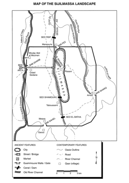
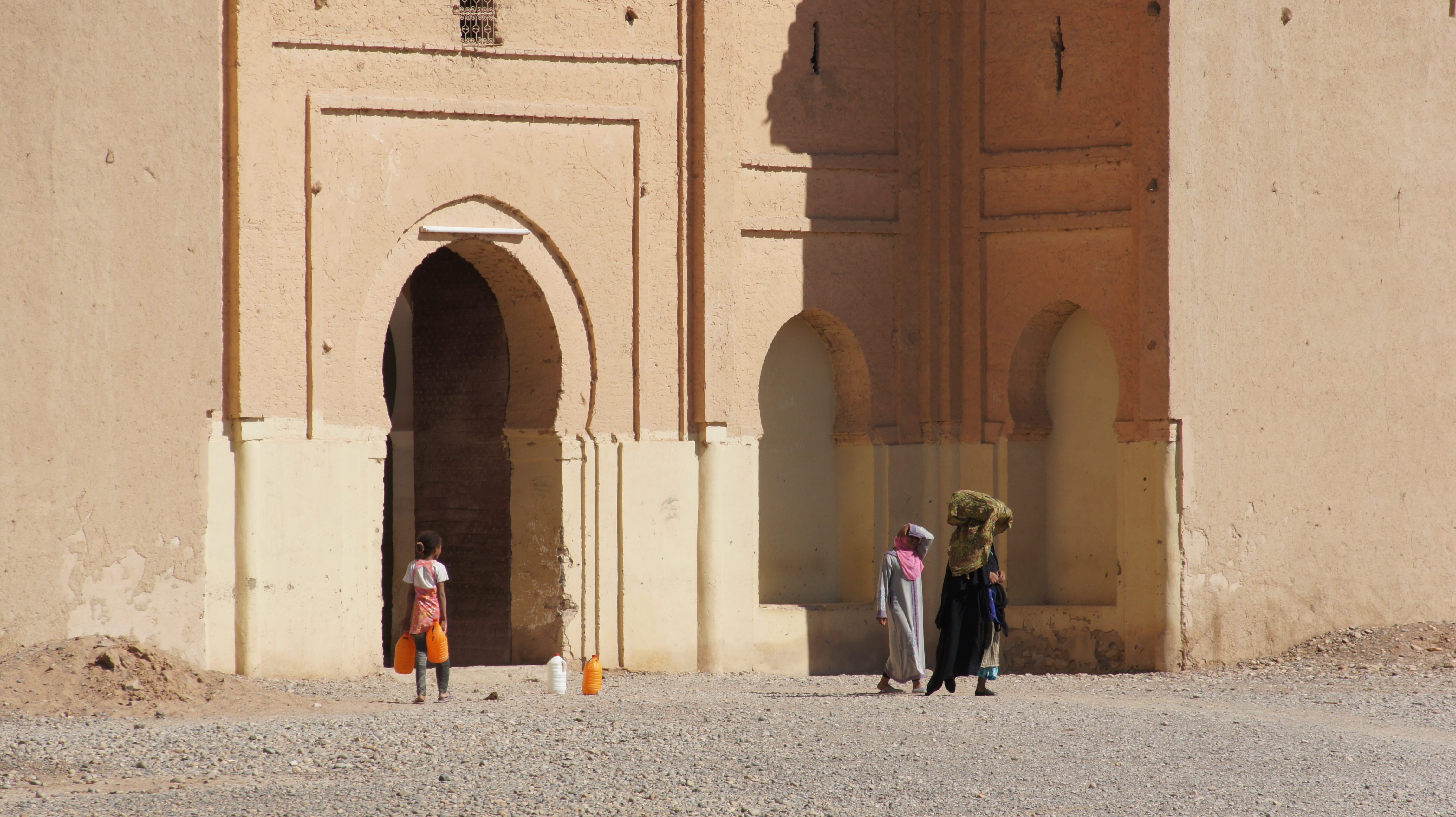
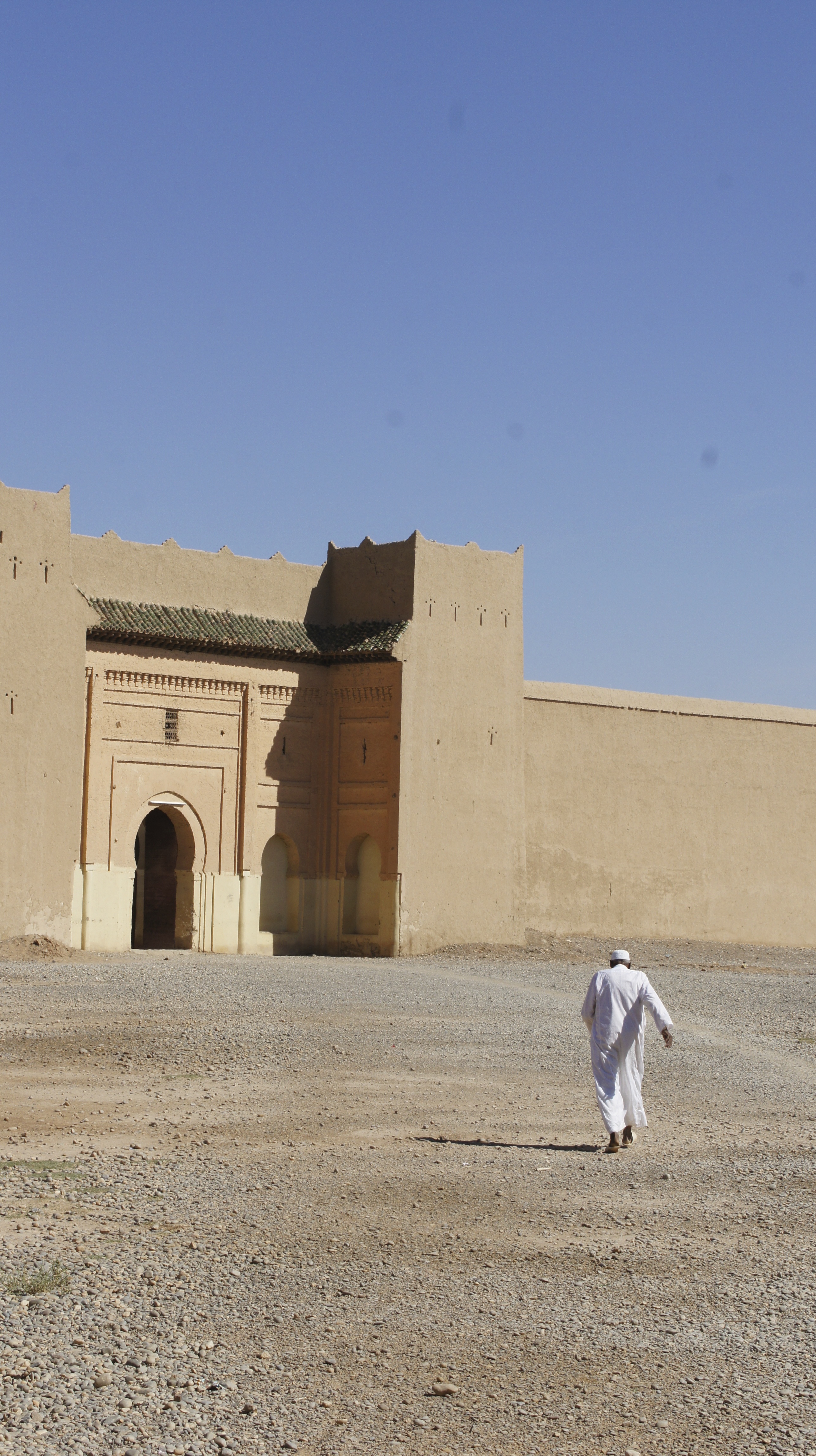
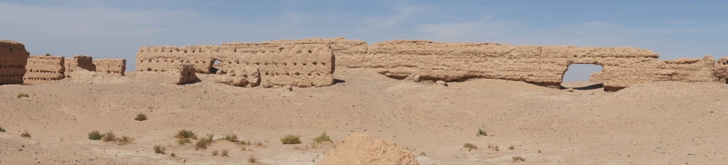
What remains of Sijilmassa today are actually the ruins of a mosque built in the 1600s and 1700s by the Alawite dynasty.  These are atmospheric if somewhat misleading: I spent ages imagining (incorrectly) thousands of camels parading through these walls.

SONY DSC

For a Romanticist, of course, it’s also easy to think of Shelley’s “Ozymandias:”

“Look on my works, ye mighty, and despair!”

*****Quotes drawn from from Dale Lightfoot and James Miller, “Sijilmassa: The Rise and Fall of a Walled Oasis in Southern Morocco.”  Photos from Tafilalt visit with John Shoup and Eric Ross.

Sijilmassa, ethnic complexity, and the Haratine

Sijilmassas was founded by Kharijites and their followers in 757: so the story goes.  Sometimes I wonder about these founding claims, though.  Wasn’t there anyone living on the fertile banks of the Ziz river in 757?

1376693810_arabsudan99gi

“Sedentary peoples may have settled the oasis as early as fourth century BC, depending on irrigated agriculture and herding for a living.”[1]  Those sedentary people might (still speculatively) have been the ancestors of the Haratine: dark-skinned, African-featured inhabitants of the Tafilalt, hereditarily constrained to the status of indentured servants, tied to the land and working for Arab, Berber, or Jewish inhabitants of the oasis.

images
(both images–“Haratine girl in Morocco” and “Haratine” above–web caught)

Huh?  So the Haratine, potentially the “original” inhabitants of the Ziz region, lost control over the land to newer arrivals, and were themselves compelled to labor for their oppressors?  Doesn’t that all seem depressingly familiar and predictable?

Let’s try a different recap:

Arabs (the Kharijites) and Amazigh [Berbers] (Zenata) settle Sijilmassa on the labor of the Haratine; Jews and other merchants (like the Genoese in the 1300s) settle in Sijilmassa, both financing the salt trade and, at least in the case of the Jews, working as artisans.  Slaves, moving through Sijilmassa to the north, also constituted a significant portion of the population.

According  to Dumper and Stanley, Jewish networks “along the major North African and trans-Saharan routes [were] a crucial facilitator in building Sijilmassa’s monopoly.  They [Jews] were also important artisans, providing specialist skills as metalworkers, jewelers, tailors, cobblers, and carpenters.  Their community prospered, and the Tafilalt Abuhatzira family in particular became regionally known for their piety and rabbinic influence.”
Jewish-Women Jewish women in Tinghir

But only Arabs and the Berbers could own property–so the system was rigged to make race into a class issue.  Arabs and Berbers could own land; Jews could not, but they could amass wealth; Haratine were limited to sharecropping, subordinated to specific families; slaves lived with Arab, Berber, or Jewish families.  Comparisons are invidious, we know, but some would say that slaves–mostly domestic servants and concubines–were better off than the Haratine, who held a role not unlike that of a field slave in the antebellum American South.

The French attempted to leave tribal relations more or less intact (once the area was “pacified”), but their intervention in the region opened new possibilities.  Jews were the first Moroccans to adopt the French language; the large Moroccan-Jewish community emigrated to Israel en masse in the years after independence.  During the Protectorate, large numbers of Haratine migrated to southern Algeria or Morocco (later, to Europe) in search of work.  Unlike Arabs and Berbers, the Haratine had nothing to lose at home–and the money they sent back to the Tafilalt enabled Haratine families to purchase land and trees, acquire cultural capital, and earn at least a few places on village councils, much to the displeasure of prior power-holders.

(By contrast, the Haratine in Mauritania continue to suffer state-based discrimination.  Slavery was criminalized in 2007, but anti-slavery court cases are backlogged and slow to progress.  And in 2011, a new census, designed to systematize national identity documents, recognized only four ethnic groups (Moorish, Soninké, Fulani, Wolof), and failed to mention the Haratine, often considered “Black Moors,” who by some counts constitute roughly 40% of the population.  See http://www.minorityrights.org/5179/mauritania/haratin.html.)

But if power relations in the Tafilalt and other Moroccan oases have shifted somewhat, ethnicities remain distinct, much as they do in the American “melting pot” where melding is more obvious in social claims than in reality.  And the oases themselves are threatened by ecological challenges, particularly the ever-deepening demand for irrigation.

1.  Michael Dumper and Bruce E. Stanley, eds., Cities of the Middle East and North Africa: A Historical Introduction, ABC-CLIO, 2007.

See also Hsain Ilahiane, Ethnicities, Community Making, and Agrarian Change: The Political Ecology of a Moroccan Oasis (University Press of America, 2004), and Anna Natividad Martinez, “Intertribal Conflicts and Customary Law Regimes in North Africa: A Comparison of Haratin and Ait ‘Atta Indigenous Legal Systems” (http://tlj.unm.edu/tribal-law-journal/articles/volume_5/intertribal_con…omparison_of_haratin_and_ait_atta_indigenous_legal_systems/content.php).

The Kharijites and the founding of Sijilmassa

Before the Tafilalt became known as the Tafilalt in something like its current configuration, the oasis was the  ground of a glorious medieval city: Sijilmassa.

Sijilmassa was founded in 757 by people following the Kharijite vision of Islam: a vision of radical egalitarianism, in which any devout person could become the leader of the community, and all Kharijites were called to fight against unjust leaders.  Yet by 956, Sijilmassa was the epicenter of the Trans-Saharan trade: a trade based on the exchange of salt for gold and slaves.  Surely this central irony ranks right up there with the life of American founding father Thomas Jefferson .

The roots of Sijilmassa–and thus a large portion of Moroccan history–lie in both the success of and the fractures within the early Islamic empire.  Here’s the shortish version of the story: in the ten years after Mohammed moved to Medina, the entire Arabian peninsula became part of the early Islamic empire (622-32; brown on the map below); in the subsequent 30 years, under the Caliphate (the early successors to Mohammed), it spread both east and west (632-661; orange territory); under the Ummayid dynasty, it expanded through Morocco, Spain and Portugal (661-750; tan on the map).  That is an impressively rapid imperial expansion:
220px-Map_of_expansion_of_Caliphate-1.svg (image from Wikipedia)

As you may remember, the fourth caliph (successor) was Ali, Mohammed’s son-in-law, and his rule was marked by a struggle over power.  Those backing Ali and refusing to recognize the first three caliphs became known as Shi’a (the party of Ali); those backing the other three caliphs became the majority Sunni power.

The less-known part of this story takes place on a battlefield during Ali’s rule, when the opposing army tied copies of the Qur’an to their lances.  A significant portion of Ali’s troops (traditionally 12,000) refused to fight on these terms; negotiations ensued, in which Ali’s negotiator somehow agreed that Ali should abandon his claim to the caliphate altogether (!).  The dissenting troops withdrew in disgust from the battlefield and from Ali’s army, rejecting both the negotiations and the negotiators: they came to be known as kharijites (those who left).

Kharijites believed that any pious Muslim could be a leader of the Muslim community (membership in Mohammed’s tribe or family was not required); kharijites were also quick to name as unbelievers any leaders who acted against the principles of the Qur’an–such fallen leaders should be deposed or even killed.  Kharijites insisted more emphatically than other Muslims on the radical egalitarianism enshrined in the Qur’an; the Haruriyya, an early kharijite group, even believed women as well as men could serve as imams.  (It was also a Haruriyya who assassinated Ali, five years into his reign.)

By the 720s, small groups of Kharijite refugees, persecuted by the Abbasid caliphate of Baghdad and Kairouan, had arrived in the western Atlas mountains.  Imazighen (Berber) inhabitants of the area were themselves in search of religious legitimation—a way to practice Islam without acceding to the Arab elites controlling more established urban centers of the Maghreb. Kharijite insistence on egalitarianism, an Islam open to non-Arabs, was popular in this context.

By 740, Kharijite agitators were associated with a massive “Berber revolt” across the Maghreb; in 757, Kharijite-inspired Zenata Berbers founded the city of Sijilmassa by the banks of the river Ziz.  Benefiting from the support provided by the oasis there, Sijilmassa was also perfectly placed to profit from the West African gold trade: by 956, some sources said that Sijilmassa minted all the gold coming north from the Sudan.
Screen Shot 2014-01-08 at 1.07.03 PM  
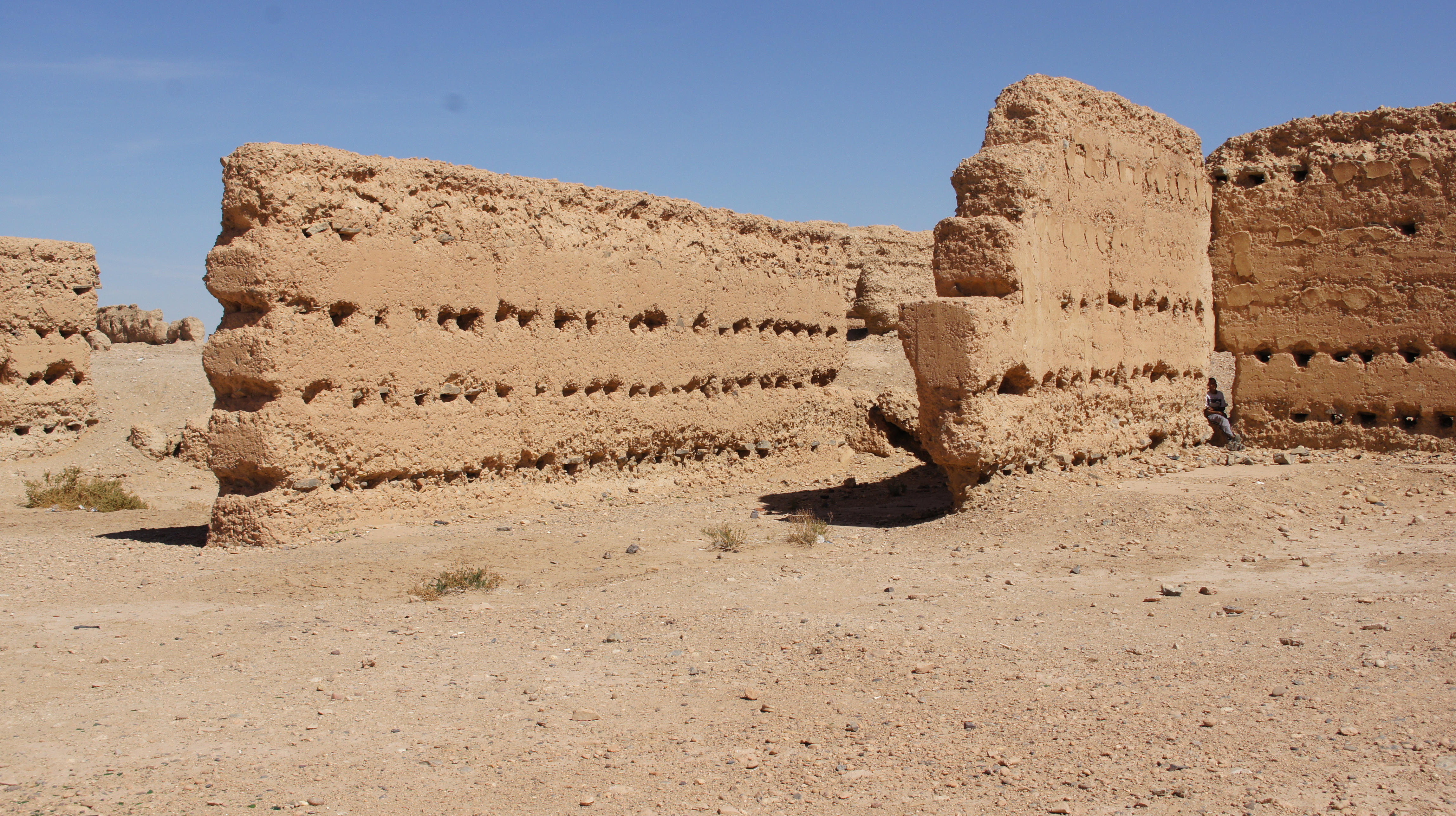
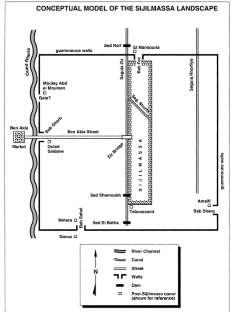
(Image from Lightfoot & Miller, 1996)

But of course the gold trade was never only a trade in gold and salt: according to some estimates, from the tenth century on, roughly 6000 slaves were sent north each year along the Trans-Saharan trade routes. So how did a city founded on a belief in radical egalitarianism come to be the center of a slave trade persisting for many centuries?

Introduction to an oasis (Tafilalt)

IMG_1046
This is our first clear view of the Tafilalt—a palmerie we have been following for the past 40 minutes from Errachidia.  We look down over a sprawling river of green, stretching for miles to the north and south. This roadside stop hangs over the top of the oasis, which seems to fill in an immense crevasse opening up the surface of the desert.  The heat is oppressive: Jeremy tries to stand in the shade I cast.  Down below, the palmerie looks cool and lush.
SONY DSC
Eric Ross, AUI geographer, is walking us through a brief introduction to the oasis. “First, I want you to forget everything you think you know about oases.  Forget Hollywood images of waving palm trees and limpid pools of water; forget the myth of effortless fertility.  An oasis is an agricultural system,” Eric announces, gesturing at the lush river of green below us.

“Water alone is not enough,” John Shoup adds.  “Add water to desert and you get a salt marsh, not an oasis.”
A student hand goes up.  “Why a salt marsh?  Is there salt in the sand?”
Eric shakes his head.  “Evaporation.”   John clarifies:  “There’s salt in the water.”

I’ve seen that salt, crusting on the red rocks, marking the dry riverbeds near Telouet.  There are salt mines in the area, too, so I’d guess the salt passes into the water from the rock in the mountains.
IMG_1127 IMG_1126

But Eric is speaking, repeating his point for emphasis.  “An oasis is a complex system of irrigation and husbandry: incredibly labor intensive, but also highly productive.  In fact, a thriving oasis is the most productive agricultural system in the world in terms of output per hectare—more productive than the often-cited rice paddies of southeast Asia.”

Eric continues his explanation.  “A healthy oasis has three productive levels.  Palms go in first, because their roots are bulbs, like tulips, and they help hold water in the soil.  Their fronds also provide some small measure of shade, which is important for the crops that follow.  The middle layer consists of fruit trees: pomegranates and figs, olives and citrus.  The bottom level produces vegetables, onions, and also forage crops like alfalfa to feed donkeys, sheep, etc., since there is no open grazing land.

SONY DSC
“This, unlike the oases we’ll see further south, is a thriving oasis, and it is the second largest oasis of the Sahara, second only to the Nile.  In the sites we’ll visit tomorrow, further downstream, the middle layer has vanished: fruit trees are no longer sustainable, given the greater scarcity of water.

“The oases in Morocco differ from those in western Egypt: in Egypt, the oases are produced through artesian wells, and the oasis is based on the distribution of water from the center to the periphery.  Moroccan oases are all based on surface water that flows down from the mountains: the sandstone of these mountains does not absorb water.

“The labor needed for an oasis to thrive is organized according to a complex social system.  There are four classes (not unlike the caste system of India), of which only two classes can own property.  All of the property in an oasis is privately owned, but the water rights are more commonly collective, and those rights are administered tribally.  The water rights of individual families are measured in terms of hours of irrigation per year, and those hours are defined in part by the amount of rain in a given year.  The man administering water rights has memorized the ancestry of each land-owner and the percentage of water from each irrigation channel that eventually leads to the calculation of irrigation hours due.

SONY DSC

“If someone outside the landowner classes of the village attempts to buy land, both the seller and the buyer are fined by the community, and upon the buyer’s death, the land reverts to the seller’s family.  Buyers from outside the landowning class cannot acquire land to pass on to their descendants.

“Conversely, everyone from a landowning family inherits, leaving the land to be ever more finely parsed.  Eventually, one might inherit a single tree, leaving one’s children to inherit a portion of a tree, while one’s grandchildren inherit a still smaller fraction of a tree.  An entire family can live for a year on the proceeds from a single tree’s fruit, so even a fraction of a tree is not an inconsiderable inheritance—as long as one has the water needed for that tree to thrive.”
SONY DSC
“The importance of water, along with its scarcity, means that oases have historically been sites of much social violence: raiding from one tribe to another, raiding herds, raiding grain reserves.  This can be seen in the architecture: each house is a little fortress, each village is a little fortress.  But we’ll see more of this tomorrow.”


The road to Sijilmassa

The road south from Ifrane to the Tafilalt oasis is marked by a beautiful stream that always lifts my heart,
IMG_1017
more commonly by dry river washes,
SONY DSC
(where water remains, somewhat surprisingly, just a foot or so below the surface), and perhaps most consistently by the evidence of remarkable geological forces at work:
SONY DSC.
If you’re six, however, the road is punctuated primarily by sandwiches and animated videos:
SONY DSC
Thank heavens for well-equipped friends!  It’s a long road.

We’re tagging along on a trip with Worcester Polytechnic Institute (WPI), the culmination of their 7-week sojourn in Morocco, doing an integrated field study project.  John Shoup, anthropologist, and Eric Ross, geographer, both of Al Akhawayn University (AUI) are leading the trip. (Both photos lifted from the internet: apologies.)
pic_1386671815  eric-driving-home

We’re headed to the Tafilalt oasis and to the site of a powerful medieval city, Sijilmassa.

Screen Shot 2014-01-09 at 2.41.32 PM
Lightfoot and Miller, 2006.

Sijilmassa was once one of the most powerful urban centers of the Maghreb; one medieval chronicler [Mas`udi] claimed it took half a day to walk Sijilmassa’s long main street.  The eleventh-century writer Edrissi described it this way:

As for Sijilmassa, it is a big and populated city, visited by travelers, surrounded by beautiful gardens and fields inside and outside [the ramparts]; it does not have a citadel, but it consists of a series of palaces [ksur], houses and fields, cultivated along the banks of a river coming from the Western side of the Sahara; the floods of this river, during summer, resemble those of the Nile, and its waters are used for agriculture in the same manner as those of the Nile are exploited by the Egyptians. [qtd in Iliahane (2004), 40]

I’m a little obsessed with Sijilmassa.  It seems to me that the vicissitudes of this vanished city are somehow central to the aspects of Morocco I find most baffling: the nearly miraculous creation of a nation on the edge of a desert; the (disputed) segmentation of Maghrebi society, with Arabs, Berbers, Jews, “blacks” and other foreigners remaining quite distinct despite general insistence on social pluralism; the perhaps-related silence around race; the reverence accorded the king; the role of Islam in public understanding of the nation.
SONY DSC

Bear with me, if you will, as I look into the history of the region and the city in a series of related posts, focusing (albeit not in any particular order) on (1) irrigation technologies (for building or maintaining oases in the desert), (2) Sijilmassa’s founding and social history, (3) agriculture or permaculture: the growing patterns of the palmeries, (4) the religious institution of the zawiya, (5) the architecture of a royal qsar in relation to local resistance to French colonialism.

References:
Dale R Lightfoot & James Miller, “Sijilmassa: The Rise and Fall of a Walled Oasis in Medieval Morocco” in Annals of the Association of American Geographers 86:1 (Mar 1996), 78-101.

Hsain Ilahiane, “Ethnicities, Community-making, and Agrarian Change: the Political Ecology of A Moroccan Oasis” (University of America Press, 2004).